
| Memorials | : | 1 |
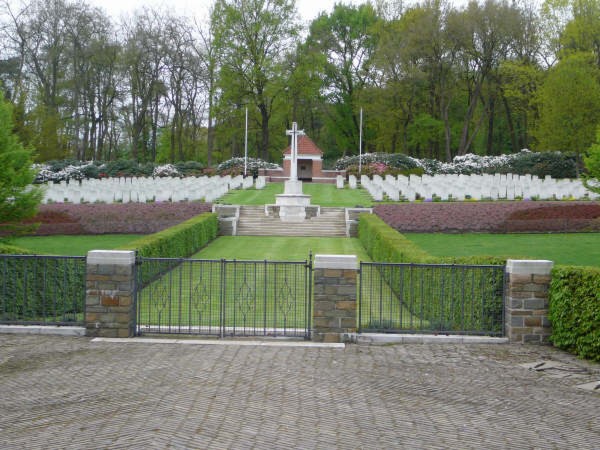
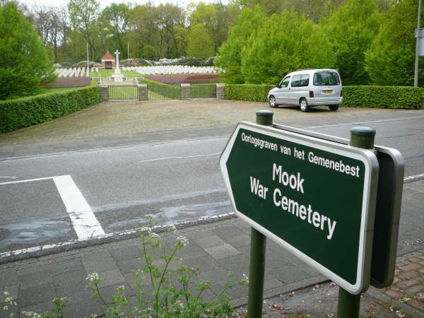
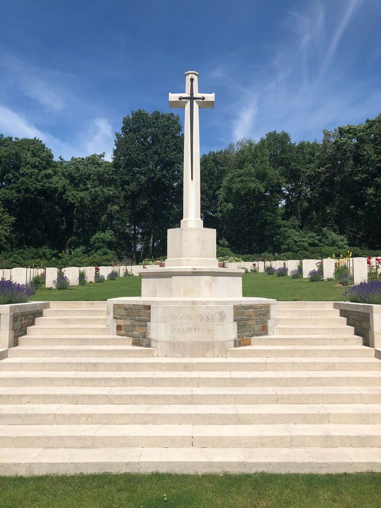
| Location | : | Mook, Mook en Middelaar Municipality, Netherlands |
| Coordinate | : | 51.7541200, 5.8854300 |
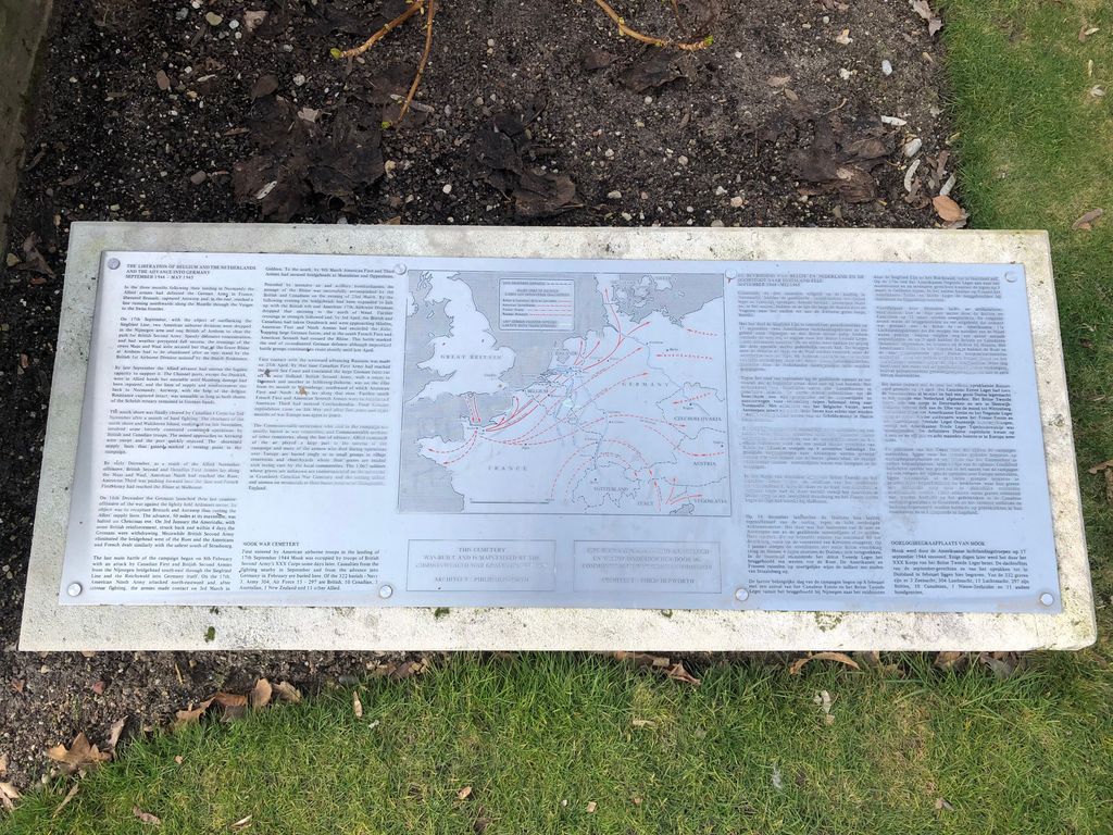
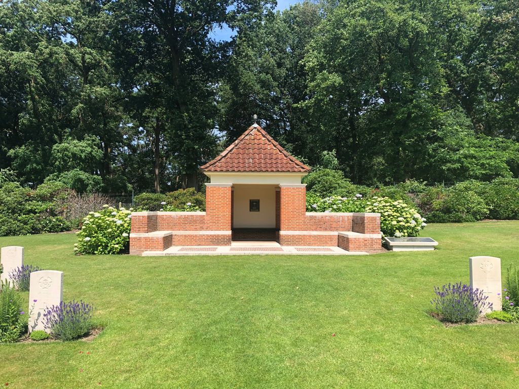
| Description | : | The village of Mook is in the east of the Netherlands, approx 11kms south east of the city of Nijmegen. From the A73 motorway NIJMEGEN to VENLO take exit 3 (Afrit 3) MALDEN / GROESBEEK / MOOK / HEUMEN / OVERASSELT. Follow signs for N271 MOOK. Continue through the village of MOLENHOEK and in the village of MOOK turn left at the roundabout (CWGC sign for MOOK WAR CEMETERY) onto the GROESBEEKSEWEG. The cemetery is approx 400m on the left. The village was entered by parachutists of the 82nd U.S. Airborne Division on 17th September, 1944; fighting continued... Read More |
frequently asked questions (FAQ):
-
Where is Mook War Cemetery?
Mook War Cemetery is located at Groesbeekseweg Mook, Mook en Middelaar Municipality ,Limburg , 6585Netherlands.
-
Mook War Cemetery cemetery's updated grave count on graveviews.com?
1 memorials
-
Where are the coordinates of the Mook War Cemetery?
Latitude: 51.7541200
Longitude: 5.8854300


Nearby Cemetories:
1. Mook-en-Middelaar Roman Catholic Churchyard
Mook, Mook en Middelaar Municipality, Netherlands
Coordinate: 51.7531600, 5.8854200
2. Beers Rooms Katholieke Begraafplaats
Beers, Cuijk Municipality, Netherlands
Coordinate: 51.7261800, 5.8265400
3. Milsbeek War Cemetery
Milsbeek, Gennep Municipality, Netherlands
Coordinate: 51.7254400, 5.9511900
4. Groesbeek Canadian War Cemetery and Memorial
Groesbeek, Berg en Dal Municipality, Netherlands
Coordinate: 51.7982900, 5.9321900
5. Heilig Landstichting Burial Park
Heilig Landstichting, Berg en Dal Municipality, Netherlands
Coordinate: 51.8173600, 5.8907100
6. Vredehof Cemetery
Nijmegen, Nijmegen Municipality, Netherlands
Coordinate: 51.8147800, 5.8286100
7. Begraafplaats Jonkerbos
Nijmegen, Nijmegen Municipality, Netherlands
Coordinate: 51.8134300, 5.8243700
8. Jonkerbos War Cemetery
Nijmegen, Nijmegen Municipality, Netherlands
Coordinate: 51.8222800, 5.8303900
9. Rustoord Cemetery
Nijmegen, Nijmegen Municipality, Netherlands
Coordinate: 51.8305100, 5.8808600
10. Joodse Begraafplaats
Nijmegen, Nijmegen Municipality, Netherlands
Coordinate: 51.8308300, 5.8836000
11. Ottersum Roman Catholic Cemetery
Ottersum, Gennep Municipality, Netherlands
Coordinate: 51.7020800, 5.9824600
12. Begraafplaats Het Witte Kerkje
Ubbergen, Berg en Dal Municipality, Netherlands
Coordinate: 51.8361166, 5.9018954
13. Begraafplaats Graafseweg
Nijmegen, Nijmegen Municipality, Netherlands
Coordinate: 51.8310800, 5.8324100
14. Algemene Begraafplaats Stenenkruisstraat
Nijmegen, Nijmegen Municipality, Netherlands
Coordinate: 51.8395021, 5.8679939
15. Grave Roman Catholic Cemetery
Grave, Grave Municipality, Netherlands
Coordinate: 51.7545100, 5.7454800
16. Algemene begraafplaats
Grave Municipality, Netherlands
Coordinate: 51.7547000, 5.7454600
17. Joodse Begraafplaats
Grave Municipality, Netherlands
Coordinate: 51.7548700, 5.7454100
18. Neerbosch Cemetery
Nijmegen, Nijmegen Municipality, Netherlands
Coordinate: 51.8353200, 5.8192130
19. Saint Bonifacius
Niel, Kreis Kleve, Germany
Coordinate: 51.8261350, 6.0182900
20. St Johannes de Doperkerk Begraafplaats
Balgoij, Wijchen Municipality, Netherlands
Coordinate: 51.7822580, 5.7134373
21. Wijchen Roman Catholic Cemetery
Wijchen, Wijchen Municipality, Netherlands
Coordinate: 51.8057800, 5.7257300
22. Friedhof Nütterden
Kranenburg, Kreis Kleve, Germany
Coordinate: 51.7904340, 6.0629380
23. Boxmeer Roman Catholic Churchyard
Boxmeer, Boxmeer Municipality, Netherlands
Coordinate: 51.6427910, 5.9497830
24. Reichswald Forest War Cemetery
Kleve, Kreis Kleve, Germany
Coordinate: 51.7406464, 6.0824242