
| Memorials | : | 1 |
| Location | : | Birmingham, Metropolitan Borough of Birmingham, England |
| Coordinate | : | 52.4181900, -1.8991100 |
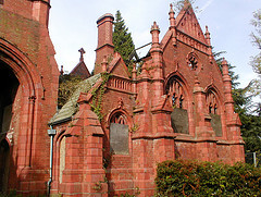
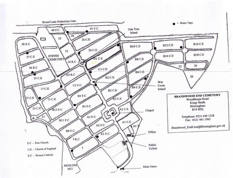
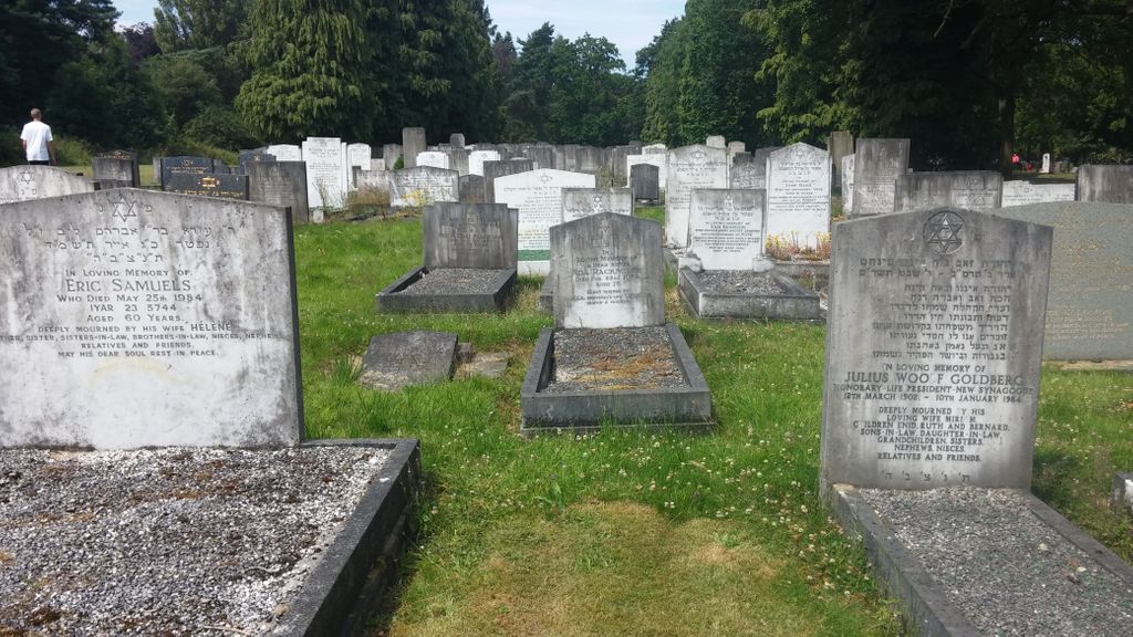
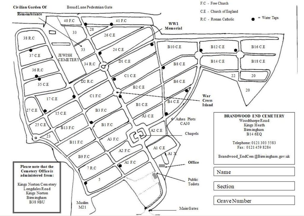
| Description | : | Brandwood End cemetery opened in 1899 and is located in the Brandwood ward of Birmingham. It covers an area of about 53 acres, and has rows of Scots Pine, Cypress and Wellingtonia trees. The records for Brandwood End cemetery are held at Kings Norton cemetery. |
frequently asked questions (FAQ):
-
Where is Brandwood End Cemetery?
Brandwood End Cemetery is located at Woodthorpe Road Birmingham, Metropolitan Borough of Birmingham ,West Midlands ,England.
-
Brandwood End Cemetery cemetery's updated grave count on graveviews.com?
1 memorials
-
Where are the coordinates of the Brandwood End Cemetery?
Latitude: 52.4181900
Longitude: -1.8991100
Nearby Cemetories:
1. All Saints Churchyard
Kings Heath, Metropolitan Borough of Birmingham, England
Coordinate: 52.4330710, -1.8937240
2. Saint Nicolas Churchyard
Kings Norton, Metropolitan Borough of Birmingham, England
Coordinate: 52.4086480, -1.9289630
3. Christ Church Churchyard
Yardley Wood, Metropolitan Borough of Birmingham, England
Coordinate: 52.4128140, -1.8645350
4. Our Lady of Lourdes
Yardley Wood, Metropolitan Borough of Birmingham, England
Coordinate: 52.4221570, -1.8605590
5. Kings Norton Cemetery
Kings Norton, Metropolitan Borough of Birmingham, England
Coordinate: 52.3984090, -1.9220470
6. Sisters of Charity of St Paul the Apostle Convent
Birmingham, Metropolitan Borough of Birmingham, England
Coordinate: 52.4393400, -1.9205200
7. St. Paul's Convent Cemetery
Birmingham, Metropolitan Borough of Birmingham, England
Coordinate: 52.4401580, -1.9217800
8. Kingswood Chapel Graveyard
Hollywood, Bromsgrove District, England
Coordinate: 52.3913600, -1.8872000
9. St. Mary's Churchyard
Moseley, Metropolitan Borough of Birmingham, England
Coordinate: 52.4462000, -1.8866900
10. Friends Meeting House Burial Ground
Bournville, Metropolitan Borough of Birmingham, England
Coordinate: 52.4363270, -1.9424810
11. Saint Marys Church
Selly Oak, Metropolitan Borough of Birmingham, England
Coordinate: 52.4380500, -1.9457100
12. Lodge Hill Cemetery and Crematorium
Birmingham, Metropolitan Borough of Birmingham, England
Coordinate: 52.4384670, -1.9537400
13. Church of The Ascension
Hall Green, Metropolitan Borough of Birmingham, England
Coordinate: 52.4341000, -1.8398200
14. St Laurence Churchyard Extension
Northfield, Metropolitan Borough of Birmingham, England
Coordinate: 52.4121060, -1.9641390
15. St Bartholomew Churchyard
Edgbaston, Metropolitan Borough of Birmingham, England
Coordinate: 52.4606870, -1.9170890
16. Wythall Cemetery
Wythall, Bromsgrove District, England
Coordinate: 52.3745100, -1.8908450
17. St James the Great Churchyard
Shirley, Metropolitan Borough of Solihull, England
Coordinate: 52.4072050, -1.8257760
18. St. Mary's Churchyard
Wythall, Bromsgrove District, England
Coordinate: 52.3720200, -1.8940700
19. Robin Hood Cemetery and Crematorium
Solihull, Metropolitan Borough of Solihull, England
Coordinate: 52.4206910, -1.8210050
20. St. Peter's Churchyard
Harborne, Metropolitan Borough of Birmingham, England
Coordinate: 52.4533600, -1.9589050
21. St. Mary's Churchyard
Harborne, Metropolitan Borough of Birmingham, England
Coordinate: 52.4566000, -1.9540700
22. St. Mary's Churchyard
Acocks Green, Metropolitan Borough of Birmingham, England
Coordinate: 52.4475900, -1.8255700
23. Holy Trinity Churchyard
Bordesley, Metropolitan Borough of Birmingham, England
Coordinate: 52.4706200, -1.8776200
24. Olton Franciscan Cemetery
Solihull, Metropolitan Borough of Solihull, England
Coordinate: 52.4262290, -1.8103680