
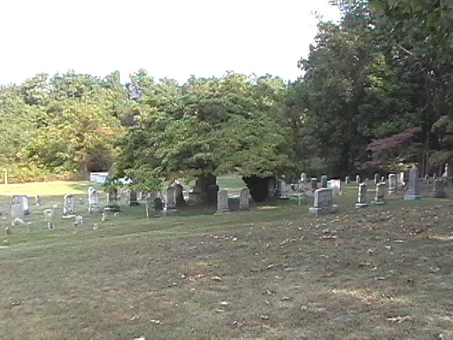
| Memorials | : | 20 |
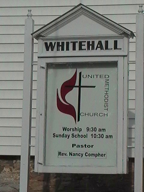
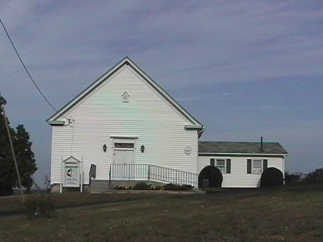
| Location | : | White Hall, Frederick County, USA |
| Phone | : | 540-665-2926 |
| Coordinate | : | 39.2937012, -78.1489029 |
frequently asked questions (FAQ):
-
Where is White Hall United Methodist Church Cemetery?
White Hall United Methodist Church Cemetery is located at 3265 Apple Pie Ridge White Hall, Frederick County ,Virginia , 22602USA.
-
White Hall United Methodist Church Cemetery cemetery's updated grave count on graveviews.com?
20 memorials
-
Where are the coordinates of the White Hall United Methodist Church Cemetery?
Latitude: 39.2937012
Longitude: -78.1489029
Nearby Cemetories:
1. Old Stone Church Cemetery
Green Spring, Frederick County, USA
Coordinate: 39.3011017, -78.1675034
2. Pleasant Valley United Methodist Church Cemetery
Cedar Grove, Frederick County, USA
Coordinate: 39.2834015, -78.1800995
3. Galilee Christian Church Cemetery
Clear Brook, Frederick County, USA
Coordinate: 39.2640991, -78.1341019
4. Little Mountain United Methodist Church Cemetery
Cedar Grove, Frederick County, USA
Coordinate: 39.2728004, -78.1891022
5. Mount Pleasant Cemetery
Gerrardstown, Berkeley County, USA
Coordinate: 39.3338730, -78.1343120
6. Welltown United Methodist Church Cemetery
Welltown, Frederick County, USA
Coordinate: 39.2532997, -78.1333008
7. Hopewell Friends Burial Ground
Clear Brook, Frederick County, USA
Coordinate: 39.2564011, -78.1147003
8. Weidman - Suver Cemetery
Bunker Hill, Berkeley County, USA
Coordinate: 39.3335340, -78.1162690
9. Rest United Methodist Church Cemetery
Rest, Frederick County, USA
Coordinate: 39.2919006, -78.0820999
10. Upper Ridge Cemetery
Nain, Frederick County, USA
Coordinate: 39.2346992, -78.1808014
11. Pine Grove United Methodist Church Cemetery
De Haven, Frederick County, USA
Coordinate: 39.3513985, -78.1857986
12. Brannon Cemetery
Glengary, Berkeley County, USA
Coordinate: 39.3626100, -78.1798300
13. Chestnut Grove Cemetery
Siler, Frederick County, USA
Coordinate: 39.3306007, -78.2304001
14. Grace Bible Fellowship Cemetery
Clear Brook, Frederick County, USA
Coordinate: 39.2643747, -78.0620388
15. Mount Olive Cemetery
Gerrardstown, Berkeley County, USA
Coordinate: 39.3647780, -78.1253350
16. Paynes Chapel Cemetery
Bunker Hill, Berkeley County, USA
Coordinate: 39.2897700, -78.0539900
17. Milburn Methodist Chapel Cemetery
Stephenson, Frederick County, USA
Coordinate: 39.2235985, -78.1136017
18. Yeakley Cemetery
Frederick County, USA
Coordinate: 39.2416992, -78.2208023
19. Brucetown United Methodist Church Cemetery
Clear Brook, Frederick County, USA
Coordinate: 39.2524986, -78.0606003
20. Kaes Park
Frederick County, USA
Coordinate: 39.3218200, -78.2454900
21. Bunker Hill Cemetery
Bunker Hill, Berkeley County, USA
Coordinate: 39.3339005, -78.0585022
22. Mount Tabor Church Cemetery
Bunker Hill, Berkeley County, USA
Coordinate: 39.3317032, -78.0534286
23. Howards Chapel United Methodist Church Cemetery
Siler, Frederick County, USA
Coordinate: 39.3585014, -78.2171021
24. Gerrardstown Presbyterian Church Cemetery
Gerrardstown, Berkeley County, USA
Coordinate: 39.3692398, -78.0989532