
| Memorials | : | 8 |
| Location | : | Florence, Boone County, USA |
| Coordinate | : | 39.0289460, -84.6280990 |
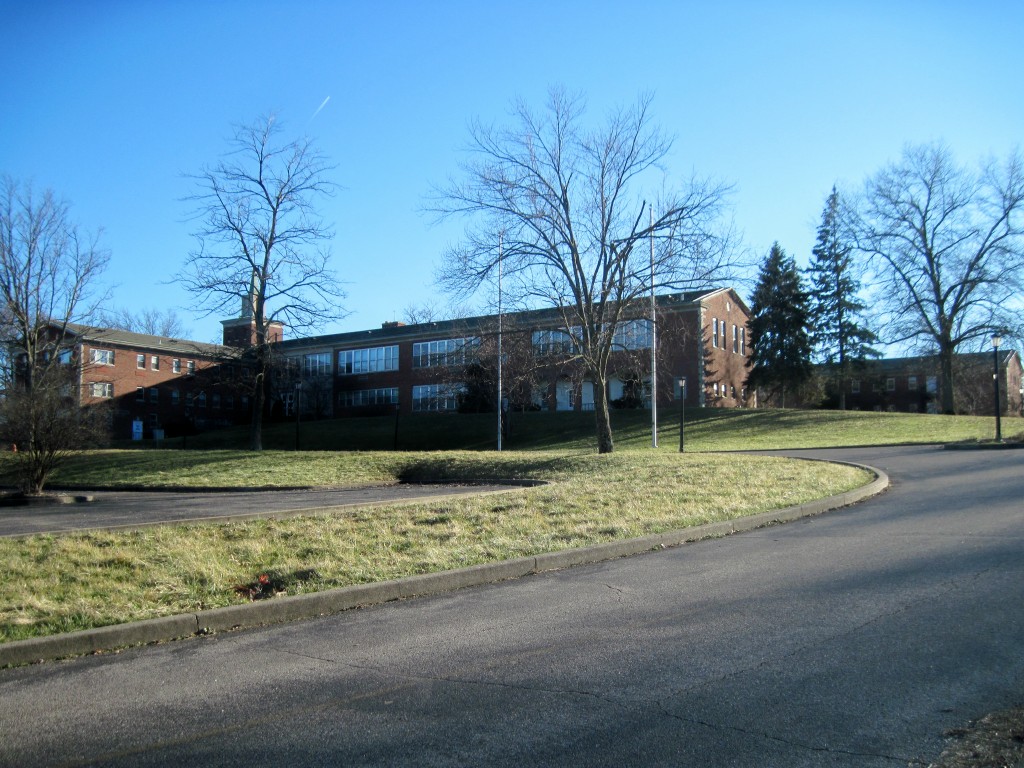
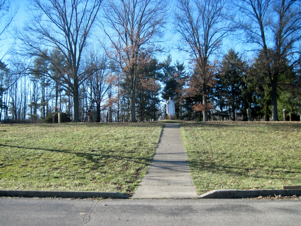
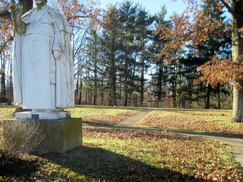
| Description | : | This cemetery is located on the west side of Seminary Road across from the Saint Pius X Seminary about 1900 feet from its junction with Marydale Road. The cemetery is for the burial of Catholic priests of the Diocese of Covington. The Boone County GIS unique ID assigned to this cemetery is 111 (Marydale Cemetery). The cemetery has an index number of 112 (Marydale Cemetery) on the Boone County Kentucky Cemetery Map published in 2005 by the Boone County Planning Commission in conjunction with Johnson-Wilson Cemetery Stewards Association. |
frequently asked questions (FAQ):
-
Where is Saint Pius X Seminary Cemetery?
Saint Pius X Seminary Cemetery is located at Seminary Road Florence, Boone County ,Kentucky , 41042USA.
-
Saint Pius X Seminary Cemetery cemetery's updated grave count on graveviews.com?
4 memorials
-
Where are the coordinates of the Saint Pius X Seminary Cemetery?
Latitude: 39.0289460
Longitude: -84.6280990
Nearby Cemetories:
1. Passionist Monastery Cemetery
Erlanger, Kenton County, USA
Coordinate: 39.0350600, -84.6305300
2. Ashbrook-Cheek Cemetery (Defunct)
Florence, Boone County, USA
Coordinate: 39.0116670, -84.6308350
3. Walton Cemetery
Hebron, Boone County, USA
Coordinate: 39.0456700, -84.6198900
4. Riggs Cemetery (Defunct)
Crescent Springs, Kenton County, USA
Coordinate: 39.0494440, -84.6138890
5. Clutterbuck Cemetery
Florence, Boone County, USA
Coordinate: 39.0041670, -84.6297230
6. Vaughan-Marquis Cemetery
Florence, Boone County, USA
Coordinate: 39.0120470, -84.6527480
7. Joshua Zimmerman Cemetery
Florence, Boone County, USA
Coordinate: 39.0074220, -84.6462590
8. Tupman Cemetery
Villa Hills, Kenton County, USA
Coordinate: 39.0528600, -84.6153440
9. Barlow–Airport Cemetery (Defunct)
Florence, Boone County, USA
Coordinate: 39.0200560, -84.6594120
10. Brown Family Cemetery
Florence, Boone County, USA
Coordinate: 39.0548528, -84.6346639
11. Stevenson Cemetery (Defunct)
Edgewood, Kenton County, USA
Coordinate: 39.0163320, -84.5980660
12. Brown Cemetery
Hebron, Boone County, USA
Coordinate: 39.0377780, -84.6613890
13. Christy Family Cemetery
Burlington, Boone County, USA
Coordinate: 39.0380790, -84.6617180
14. Ann Popham Cemetery
Limaburg, Boone County, USA
Coordinate: 39.0333330, -84.6633330
15. Popham Cemetery #02 (Defunct)
Limaburg, Boone County, USA
Coordinate: 39.0309770, -84.6647720
16. Florence Cemetery
Florence, Boone County, USA
Coordinate: 39.0001000, -84.6309800
17. Forest Lawn Memorial Park
Erlanger, Kenton County, USA
Coordinate: 39.0163994, -84.5932999
18. Daniel Beemon Cemetery
Florence, Boone County, USA
Coordinate: 39.0141670, -84.6641670
19. Wilhoit Cemetery
Florence, Boone County, USA
Coordinate: 38.9974070, -84.6187990
20. Casey Cemetery
Edgewood, Kenton County, USA
Coordinate: 39.0254170, -84.5865000
21. Garnet Cemetery
Florence, Boone County, USA
Coordinate: 39.0377998, -84.6694031
22. French Cemetery
Elsmere, Kenton County, USA
Coordinate: 39.0077780, -84.5944500
23. Limaburg Cemetery
Limaburg, Boone County, USA
Coordinate: 39.0303260, -84.6741860
24. Hopeful Lutheran Church Cemetery
Florence, Boone County, USA
Coordinate: 39.0005302, -84.6577225