
| Memorials | : | 1 |
| Location | : | Shrivenham, Vale of White Horse District, England |
| Coordinate | : | 51.6000270, -1.6537370 |
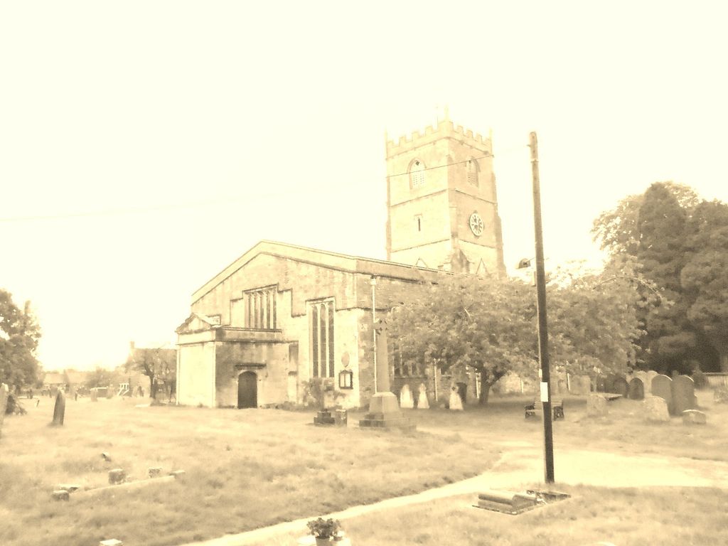
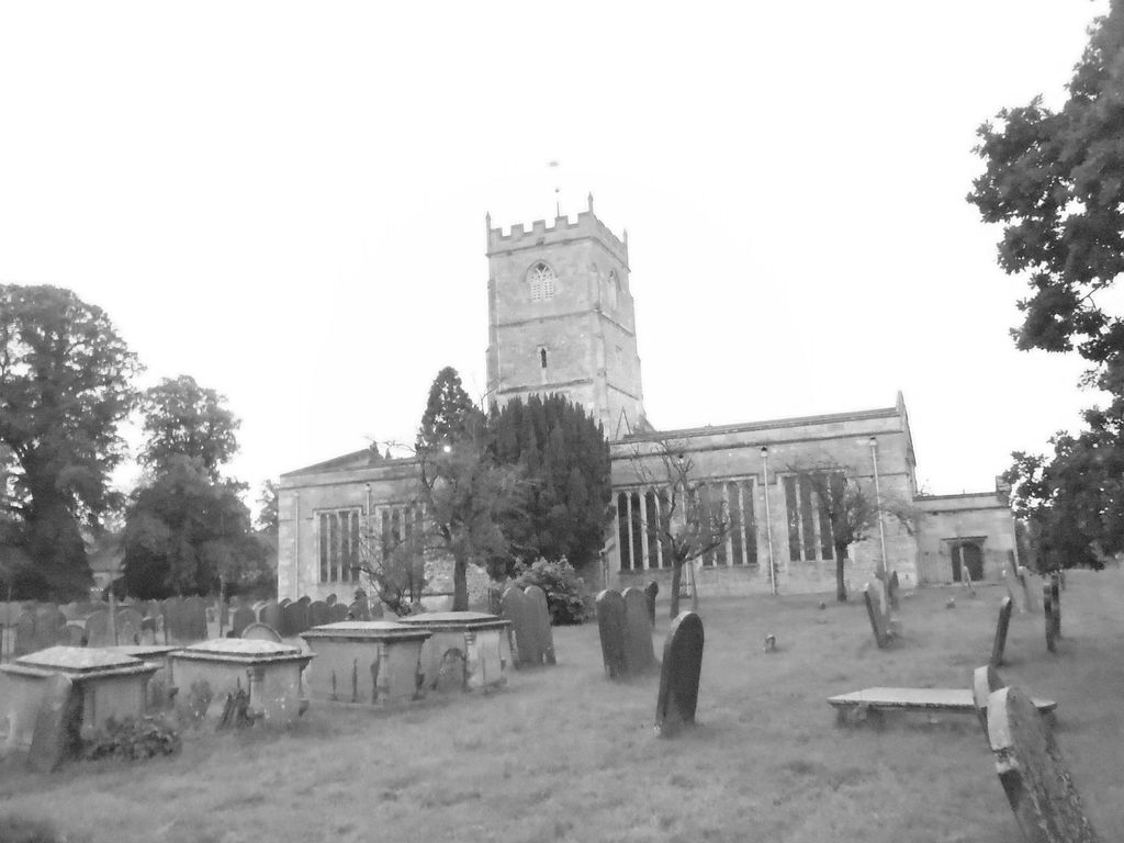
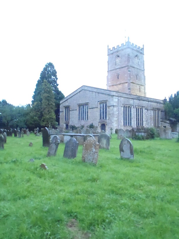
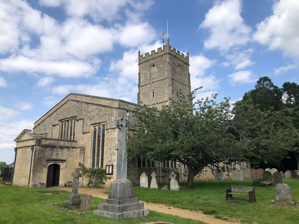
| Description | : | Shrivenham is a large village and civil parish in Oxfordshire, England, close to the boundary with Wiltshire. It is in the Vale of White Horse, between Swindon and Faringdon. It was part of Berkshire until the 1974 boundary changes transferred it to Oxfordshire The Church of England parish church of Saint Andrew was rebuilt in 1638 around the central bell tower that dates from about 1400. |
frequently asked questions (FAQ):
-
Where is St. Andrew's Churchyard?
St. Andrew's Churchyard is located at Shrivenham, Vale of White Horse District ,Oxfordshire , SN6 8ANEngland.
-
St. Andrew's Churchyard cemetery's updated grave count on graveviews.com?
1 memorials
-
Where are the coordinates of the St. Andrew's Churchyard?
Latitude: 51.6000270
Longitude: -1.6537370
Nearby Cemetories:
1. Shrivenham Parish Cemetery
Shrivenham, Vale of White Horse District, England
Coordinate: 51.5942061, -1.6517227
2. St. Thomas Churchyard
Watchfield, Vale of White Horse District, England
Coordinate: 51.6107409, -1.6468265
3. Watchfield Cemetery
Watchfield, Vale of White Horse District, England
Coordinate: 51.6109220, -1.6467980
4. Watchfield Military Cemetery
Watchfield, Vale of White Horse District, England
Coordinate: 51.6110800, -1.6469400
5. St. James Churchyard
Bourton, Cherwell District, England
Coordinate: 51.5794090, -1.6638890
6. St. James' Churchyard
Sevenhampton, Swindon Unitary Authority, England
Coordinate: 51.6119590, -1.6984440
7. St Mary the Virgin Parish Churchyard
Longcot, Vale of White Horse District, England
Coordinate: 51.6146420, -1.6056320
8. St Swithun
Compton Beauchamp, Vale of White Horse District, England
Coordinate: 51.5814163, -1.5981875
9. Saint Mary Magdalene Church Cemetery
South Marston, Swindon Unitary Authority, England
Coordinate: 51.5903900, -1.7195100
10. All Saints Churchyard
Coleshill, Vale of White Horse District, England
Coordinate: 51.6422960, -1.6611320
11. St Mary the Virgin Church
Ashbury, Vale of White Horse District, England
Coordinate: 51.5626390, -1.6183810
12. St. Giles Churchyard
Great Coxwell, Vale of White Horse District, England
Coordinate: 51.6389520, -1.6114148
13. St. Mary the Virgin Churchyard
Bishopstone, Swindon Unitary Authority, England
Coordinate: 51.5519060, -1.6499760
14. All Saints
Woolstone, Vale of White Horse District, England
Coordinate: 51.5870310, -1.5765330
15. Highworth Cemetery
Highworth, Swindon Unitary Authority, England
Coordinate: 51.6285450, -1.7212890
16. St Swithun Churchyard Hinton Prava
Swindon Unitary Authority, England
Coordinate: 51.5481447, -1.6669194
17. St Swithun Churchyard Hinton Prava
Swindon Unitary Authority, England
Coordinate: 51.5481447, -1.6669194
18. St John the Evangelist Churchyard
Fernham, Vale of White Horse District, England
Coordinate: 51.6251600, -1.5777100
19. St. Mary's Churchyard
Little Coxwell, Vale of White Horse District, England
Coordinate: 51.6398280, -1.5941840
20. St Mary Churchyard
Uffington, Vale of White Horse District, England
Coordinate: 51.6018480, -1.5649000
21. St Margaret Churchyard
Stratton St Margaret, Swindon Unitary Authority, England
Coordinate: 51.5824430, -1.7422550
22. Kingsdown Crematorium
Swindon, Swindon Unitary Authority, England
Coordinate: 51.5968450, -1.7513770
23. Saint Andrew's Church
Wanborough, Swindon Unitary Authority, England
Coordinate: 51.5415040, -1.7018220
24. Buscot Park
Faringdon, Vale of White Horse District, England
Coordinate: 51.6684973, -1.6518000