
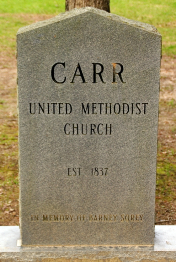
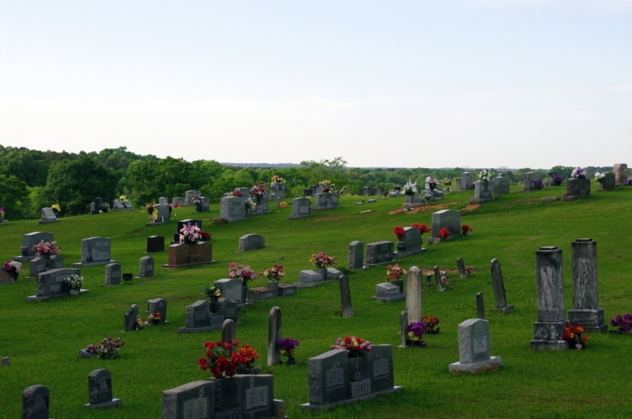
| Memorials | : | 2 |
| Location | : | Smith County, USA |
| Coordinate | : | 32.2058300, -89.4074200 |
| Description | : | From Lake, MS proceed South on Steve Lee Drive for 2.3 miles to the intersection of Mudline Road. Turn Left (South) onto Mudline Road and proceed 8.4 miles to the intersection of Mississippi Highway 501 (MS 501.) Turn Left (South) onto MS 15 and continue 2.3 miles to the intersection of Smith County Road 515 (SCR 515) and make a Left turn (East) onto SCR 515. Continue on SCR 515 approximately 2 tenths of a mile. Cemetery will be on Laft (North) side of road, specifically NE1/4 NE 1/4, S7, T4N-R9E, Smith, Pineville Quadrangle map, USNG 16S BA 73109 65747. |
frequently asked questions (FAQ):
-
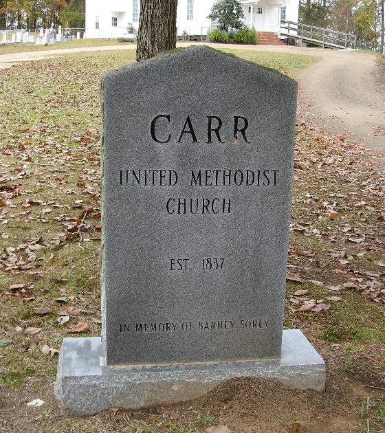
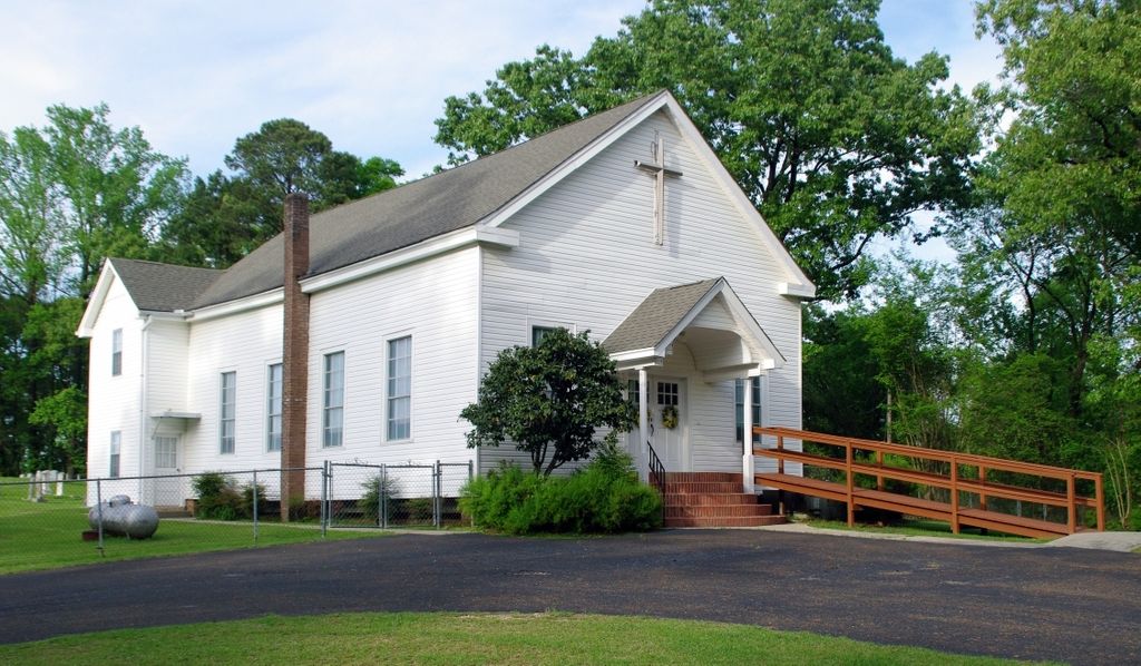
Where is Carr Methodist Church Cemetery?
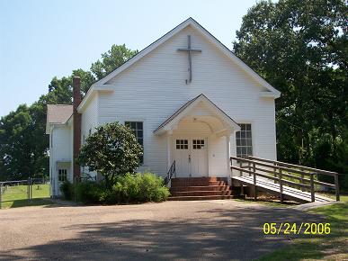
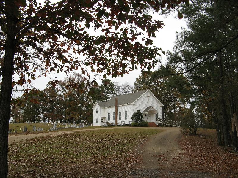
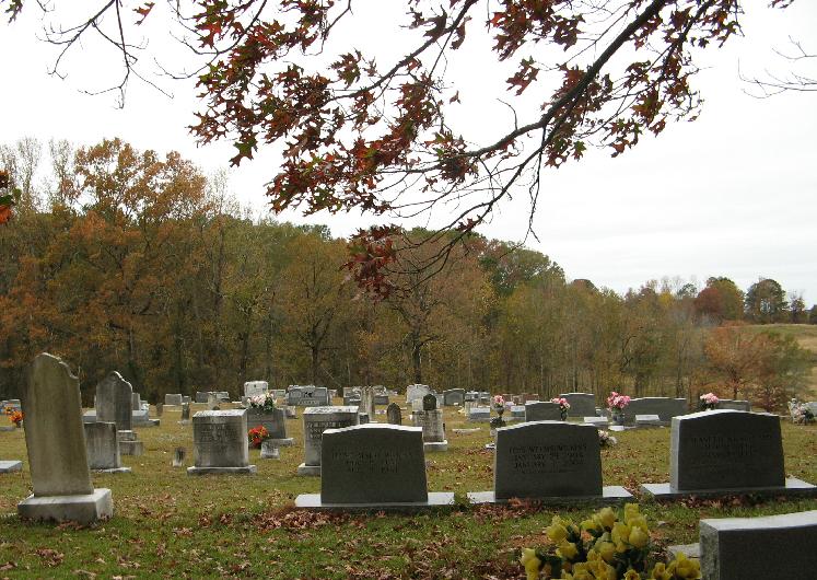
Carr Methodist Church Cemetery is located at Smith County Road 515 Smith County ,Mississippi , 39092USA.
-
Carr Methodist Church Cemetery cemetery's updated grave count on graveviews.com?
1 memorials
-
Where are the coordinates of the Carr Methodist Church Cemetery?
Latitude: 32.2058300
Longitude: -89.4074200
Nearby Cemetories:
1. Galilee Missionary Baptist Church Cemetery
Lake, Scott County, USA
Coordinate: 32.2338200, -89.3846400
2. Crout Sisters Cemetery
Scott County, USA
Coordinate: 32.2421800, -89.4403800
3. Mount Carmel Cemetery
Smith County, USA
Coordinate: 32.1748200, -89.4593010
4. Mount Zion Missionary Baptist Cemetery
Lake, Scott County, USA
Coordinate: 32.2572400, -89.4454100
5. Union Grove Cemetery
Smith County, USA
Coordinate: 32.1888520, -89.4801290
6. Sherman Hill Church Cemetery
Lake, Scott County, USA
Coordinate: 32.2681100, -89.3791500
7. Burnett Cemetery
Pineville, Smith County, USA
Coordinate: 32.1528900, -89.3477000
8. Noblin Cemetery
Forest, Scott County, USA
Coordinate: 32.2310210, -89.4952380
9. Hopewell Baptist Church Cemetery
Lake, Scott County, USA
Coordinate: 32.2765500, -89.4498400
10. Pineville-Leaf River Cemetery
Smith County, USA
Coordinate: 32.1266000, -89.3987200
11. Clear Springs Baptist Church Cemetery
Smith County, USA
Coordinate: 32.1437000, -89.3439400
12. Lorena Baptist Church Extension Cemetery
Smith County, USA
Coordinate: 32.1976340, -89.5059530
13. Gatewood Cemetery
Scott County, USA
Coordinate: 32.2800200, -89.4547200
14. Lorena Baptist Church Cemetery
Lorena, Smith County, USA
Coordinate: 32.1917890, -89.5061570
15. Homewood Methodist Church Cemetery
Forest, Scott County, USA
Coordinate: 32.2410500, -89.5046000
16. High Hill Methodist Cemetery
Norris, Scott County, USA
Coordinate: 32.2926292, -89.4359665
17. Mount Calvary Baptist Church Cemetery
Montrose, Jasper County, USA
Coordinate: 32.2019170, -89.2967180
18. Decedar Baptist Church Cemetery
Louin, Jasper County, USA
Coordinate: 32.2052600, -89.2927200
19. Oak Grove Church of God Cemetery
Morton, Scott County, USA
Coordinate: 32.3047254, -89.3982867
20. Oak Grove Baptist Church Cemetery
Norris, Scott County, USA
Coordinate: 32.3048401, -89.3981934
21. Russell - Boykin Cemetery
Smith County, USA
Coordinate: 32.1066472, -89.3997402
22. Sylvan Grove Cemetery
Smith County, USA
Coordinate: 32.1137310, -89.4530439
23. Lemon Christian Cemetery
Raleigh, Smith County, USA
Coordinate: 32.1225570, -89.4748020
24. Goodwater Baptist Church Cemetery
Smith County, USA
Coordinate: 32.1415200, -89.5027900