
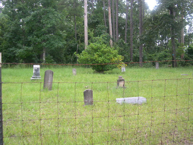
| Memorials | : | 0 |
| Location | : | Smith County, USA |
| Coordinate | : | 32.1137310, -89.4530439 |
| Description | : | From Raleigh, Mississippi proceed 4.9 miles North on Highway 35 to the intersection of Smith County Road 120 (SCR 120) and turn right (East.) Continue miles on SCR 120 4.75 miles and turn left (North) continuing for 1.6 miles to the intersection of Smith County Road 581-B (SCR 581-B) and turn right (East.) In approximately 125 feet, SCR 581-B splits into two roads going two different direction (SCR 581-B actually makes a circle in this are.) At this point, take the left (North) road. Continue 650 to 700 feet on the North branch of SCR 581-B until the intersection... Read More |
frequently asked questions (FAQ):
-
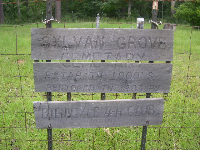
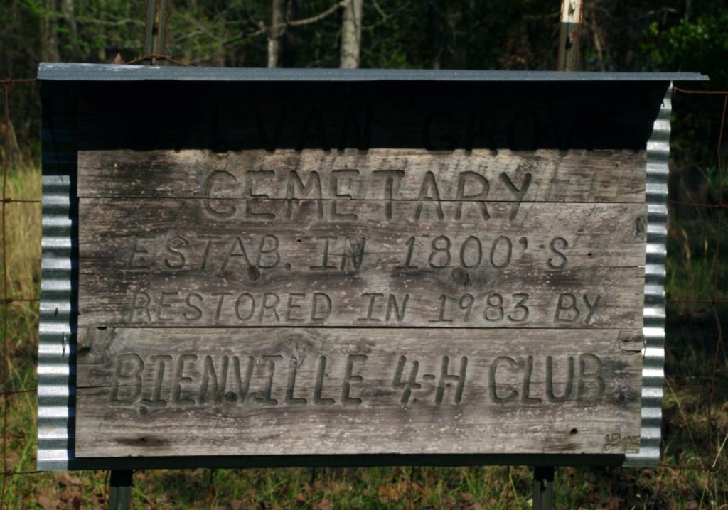
Where is Sylvan Grove Cemetery?
Sylvan Grove Cemetery is located at Smith County Road 581B Smith County ,Mississippi , 39152USA.
-
Sylvan Grove Cemetery cemetery's updated grave count on graveviews.com?
0 memorials
-
Where are the coordinates of the Sylvan Grove Cemetery?
Latitude: 32.1137310
Longitude: -89.4530439
Nearby Cemetories:
1. Lemon Christian Cemetery
Raleigh, Smith County, USA
Coordinate: 32.1225570, -89.4748020
2. Mount Nebo Cemetery
Smith County, USA
Coordinate: 32.0951900, -89.4677200
3. Mount Nebo Baptist Cemetery
Raleigh, Smith County, USA
Coordinate: 32.0981000, -89.4317400
4. Trinity Methodist Cemetery
Raleigh, Smith County, USA
Coordinate: 32.0920600, -89.4753300
5. Old Henderson Cemetery
Smith County, USA
Coordinate: 32.1199100, -89.4919700
6. High Hill Baptist Church Cemetery
Raleigh, Smith County, USA
Coordinate: 32.0860100, -89.4780800
7. Royals & Webb Cemetery
Raleigh, Smith County, USA
Coordinate: 32.0932999, -89.4096985
8. Russell - Boykin Cemetery
Smith County, USA
Coordinate: 32.1066472, -89.3997402
9. Pineville-Leaf River Cemetery
Smith County, USA
Coordinate: 32.1266000, -89.3987200
10. Barnes Cemetery
Raleigh, Smith County, USA
Coordinate: 32.0946999, -89.5068970
11. Goodwater Baptist Church Cemetery
Smith County, USA
Coordinate: 32.1415200, -89.5027900
12. Henderson Family Cemetery
Smith County, USA
Coordinate: 32.1207008, -89.5181122
13. Cedar Grove Methodist Church Cemetery
Raleigh, Smith County, USA
Coordinate: 32.0664100, -89.4145800
14. Mount Carmel Cemetery
Smith County, USA
Coordinate: 32.1748200, -89.4593010
15. Austin Cemetery
Shongelo, Smith County, USA
Coordinate: 32.0875015, -89.5233002
16. Double Church Cemetery
Raleigh, Smith County, USA
Coordinate: 32.0460420, -89.4574910
17. Jesus Name Church Cemetery
Raleigh, Smith County, USA
Coordinate: 32.0610700, -89.3933700
18. Burns Baptist Church Cemetery
Raleigh, Smith County, USA
Coordinate: 32.1321880, -89.5384430
19. Barber Cemetery
Raleigh, Smith County, USA
Coordinate: 32.1321810, -89.5385960
20. Burns United Methodist Church Cemetery
Burns, Smith County, USA
Coordinate: 32.1310501, -89.5399399
21. Union Grove Cemetery
Smith County, USA
Coordinate: 32.1888520, -89.4801290
22. Page Cemetery
Raleigh, Smith County, USA
Coordinate: 32.0891991, -89.5432968
23. Turner Chapel Cemetery
Raleigh, Smith County, USA
Coordinate: 32.0474700, -89.5075300
24. William F. Jones Cemetery
Raleigh, Smith County, USA
Coordinate: 32.0672200, -89.3739800