
| Memorials | : | 2 |
| Location | : | Jefferson County, USA |
| Coordinate | : | 41.0705185, -79.0066376 |
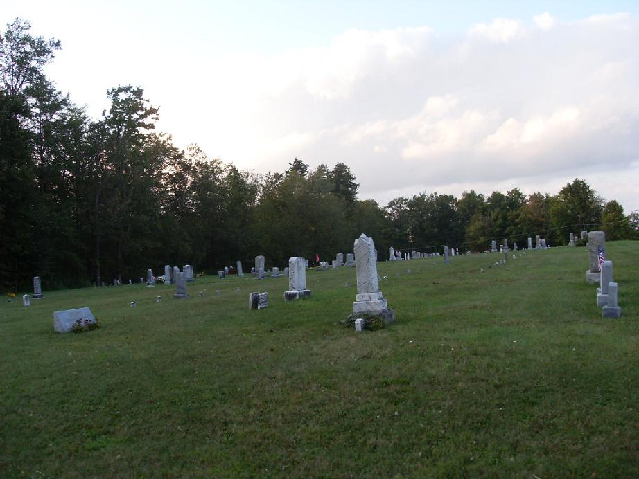
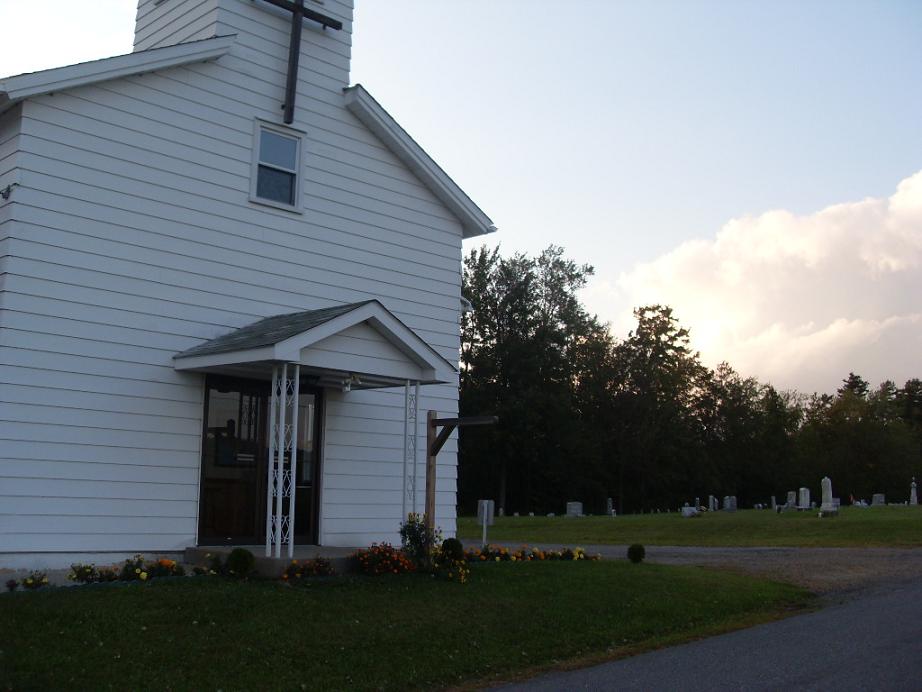
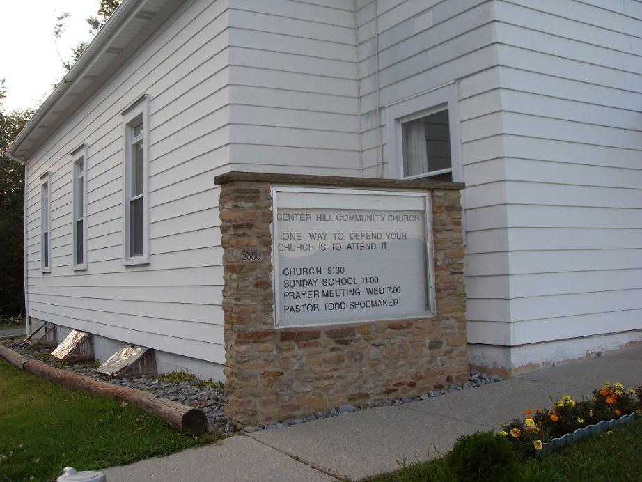
| Description | : | Next to this, the Centre Hill grave-yard is the oldest in the township, it having been sold by Frederick Gillhousen to Daniel Rhoads and Jacob Wolf, in trust for the Evangelical Association, about the year 1840, consideration, 25 cents. Mr. Gillhousen having lost his life in the Gettysburg fight without a deed having been left on record, a second deed was made by Rachel Gillhousen (one of the heirs) somewhere about the year 1880. The Evangelical Association is at present erecting a church building close to this grave-yard, which event is warmly welcomed by all the citizens. Source: Brookville Republican... Read More |
frequently asked questions (FAQ):
-
Where is Center Hill Cemetery?
Center Hill Cemetery is located at Knox Township Jefferson County ,Pennsylvania ,USA.
-
Center Hill Cemetery cemetery's updated grave count on graveviews.com?
2 memorials
-
Where are the coordinates of the Center Hill Cemetery?
Latitude: 41.0705185
Longitude: -79.0066376
Nearby Cemetories:
1. Knoxdale Mount Pleasant Cemetery
Knox Dale, Jefferson County, USA
Coordinate: 41.0911903, -79.0241013
2. Saint Matthews Evangelical Lutheran Cemetery
Ramsaytown, Jefferson County, USA
Coordinate: 41.0742600, -79.0574100
3. Meade Chapel Cemetery
Knox Township, Jefferson County, USA
Coordinate: 41.1163000, -79.0259000
4. United Brethren Cemetery
Panic, Jefferson County, USA
Coordinate: 41.0362816, -78.9549637
5. Milliron Cemetery
Emerickville, Jefferson County, USA
Coordinate: 41.1227000, -78.9821000
6. Ramsaytown United Methodist Cemetery
Ramsaytown, Jefferson County, USA
Coordinate: 41.0799000, -79.0792000
7. Moore Cemetery
Emerickville, Jefferson County, USA
Coordinate: 41.1178017, -78.9669037
8. Zion Presbyterian Cemetery
Panic, Jefferson County, USA
Coordinate: 41.0244300, -78.9530800
9. Emerickville Lutheran Cemetery
Emerickville, Jefferson County, USA
Coordinate: 41.1321259, -78.9805374
10. Burkett Hollow Cemetery
Markton, Jefferson County, USA
Coordinate: 41.0175000, -79.0575000
11. Saint Pauls Lutheran Cemetery
Coolspring, Jefferson County, USA
Coordinate: 41.0328170, -79.0810670
12. Mount Tabor United Methodist Church Cemetery
Battle Hollow, Jefferson County, USA
Coordinate: 41.0030000, -78.9970000
13. Coolspring Cemetery
Coolspring, Jefferson County, USA
Coordinate: 41.0339012, -79.0847015
14. Church of God Cemetery
Emerickville, Jefferson County, USA
Coordinate: 41.1389618, -78.9900055
15. Markton Cemetery
Markton, Jefferson County, USA
Coordinate: 41.0101000, -79.0605000
16. Anita Cemetery
Anita, Jefferson County, USA
Coordinate: 40.9972500, -78.9770700
17. Adrian-Anita Roman Catholic Cemetery
Anita, Jefferson County, USA
Coordinate: 40.9958000, -78.9805984
18. Lakelawn Memorial Park and Mausoleum
Reynoldsville, Jefferson County, USA
Coordinate: 41.0783005, -78.9039001
19. Olive Cemetery
Oliveburg, Jefferson County, USA
Coordinate: 40.9940000, -79.0270000
20. Anita Community Cemetery
Anita, Jefferson County, USA
Coordinate: 40.9932450, -78.9790390
21. Beaver Run Cemetery
Stanton, Jefferson County, USA
Coordinate: 41.0734634, -79.1145248
22. Syphrit Cemetery
Reynoldsville, Jefferson County, USA
Coordinate: 41.0561000, -78.8950000
23. Reynoldsville Cemetery
Reynoldsville, Jefferson County, USA
Coordinate: 41.0829000, -78.8940000
24. Saint Johns Cemetery
Stanton, Jefferson County, USA
Coordinate: 41.1091995, -79.1136017