
| Memorials | : | 203 |
| Location | : | Charing, Ashford Borough, England |
| Coordinate | : | 51.2120247, 0.7922290 |
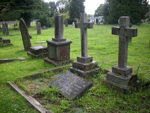
| Description | : | The cemetery was established in 1887. The name Charing first appears in 799 as Ciorrincg. The name probably comes from the Anglo-Saxon word 'cerring', which means a bend in the road, or it may be from Ceorra-ingas, which is Anglo-Saxon, meaning people of Ceorra. Its most famous building is the Archbishop's Palace, which lies by the church and was an ancient possession of the Archbishop of Canterbury. It has been a farmhouse for the last 300 years. The church of St Peter and St Paul, just along the road from the cemetery, is said to contain the stone on which John the... Read More |
frequently asked questions (FAQ):
-
Where is Charing Cemetery?
Charing Cemetery is located at Charing, Ashford Borough ,Kent ,England.
-
Charing Cemetery cemetery's updated grave count on graveviews.com?
201 memorials
-
Where are the coordinates of the Charing Cemetery?
Latitude: 51.2120247
Longitude: 0.7922290
Nearby Cemetories:
1. St. Peter and St. Paul Churchyard
Charing, Ashford Borough, England
Coordinate: 51.2102230, 0.7966500
2. Kent County Crematorium
Charing, Ashford Borough, England
Coordinate: 51.2026560, 0.8006770
3. Holy Trinity Churchyard
Charing Heath, Ashford Borough, England
Coordinate: 51.2117420, 0.7510860
4. St. Mary's Churchyard
Stalisfield, Swale Borough, England
Coordinate: 51.2371410, 0.8169790
5. Westwell Burial Ground
Westwell, Ashford Borough, England
Coordinate: 51.1900100, 0.8434000
6. St Mary Churchyard
Westwell, Ashford Borough, England
Coordinate: 51.1919020, 0.8473350
7. St. James Churchyard
Egerton, Ashford Borough, England
Coordinate: 51.1953860, 0.7295170
8. St. Nicholas' Churchyard
Pluckley, Ashford Borough, England
Coordinate: 51.1749440, 0.7548470
9. Church of St. Margaret
Hothfield, Ashford Borough, England
Coordinate: 51.1661000, 0.8158000
10. Lenham Cemetery
Lenham, Maidstone Borough, England
Coordinate: 51.2389480, 0.7223940
11. St Mary Churchyard
Lenham, Maidstone Borough, England
Coordinate: 51.2366860, 0.7191470
12. St Cosmas and St Damian Churchyard
Challock, Ashford Borough, England
Coordinate: 51.2065340, 0.8781660
13. Egerton Free Church Graveyard
Egerton, Ashford Borough, England
Coordinate: 51.1871830, 0.7050080
14. St. Nicholas' Churchyard
Boughton Malherbe, Maidstone Borough, England
Coordinate: 51.2142160, 0.6935330
15. St. Margaret's Churchyard
Wichling, Maidstone Borough, England
Coordinate: 51.2682226, 0.7455862
16. St. Mary Churchyard
Eastling, Swale Borough, England
Coordinate: 51.2740700, 0.8155000
17. St. Laurence Churchyard
Leaveland, Swale Borough, England
Coordinate: 51.2501510, 0.8773610
18. St. Michael and All Angels Churchyard
Throwley, Swale Borough, England
Coordinate: 51.2651000, 0.8540800
19. St Peter Churchyard
Molash, Ashford Borough, England
Coordinate: 51.2328420, 0.8974670
20. Sts Peter & Paul Churchyard Extension
Newnham, Swale Borough, England
Coordinate: 51.2840000, 0.8026500
21. St Peter and St Paul Churchyard
Newnham, Swale Borough, England
Coordinate: 51.2842590, 0.8006070
22. The Beheading of St. John the Baptist Churchyard
Doddington, Swale Borough, England
Coordinate: 51.2843350, 0.7805830
23. St. Mary the Virgin Churchyard
Great Chart, Ashford Borough, England
Coordinate: 51.1422350, 0.8285800
24. All Saints Churchyard
Boughton Aluph, Ashford Borough, England
Coordinate: 51.1963280, 0.9086490