
| Memorials | : | 298 |
| Location | : | Egerton, Ashford Borough, England |
| Coordinate | : | 51.1953860, 0.7295170 |
frequently asked questions (FAQ):
-
Where is St. James Churchyard?
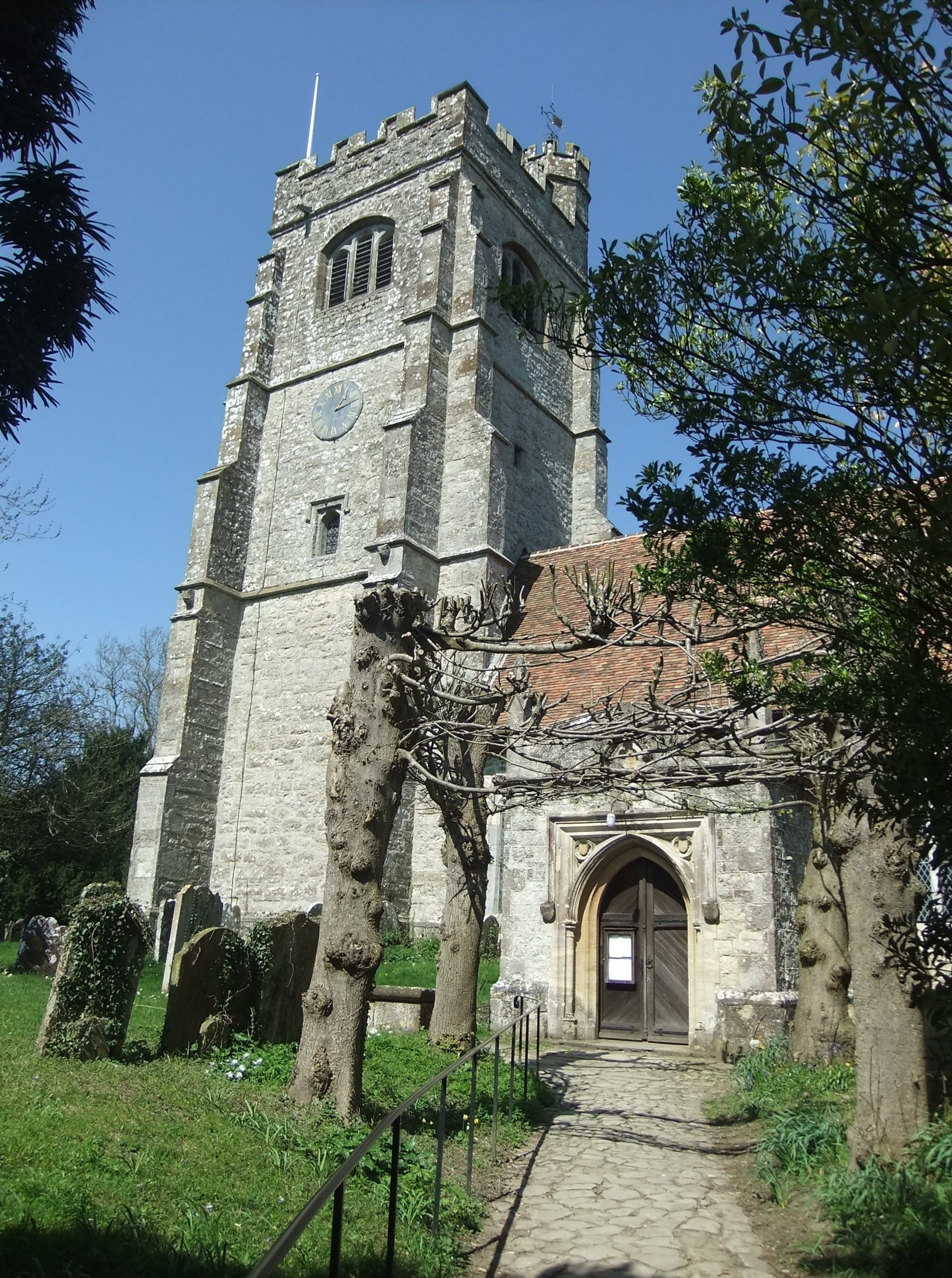
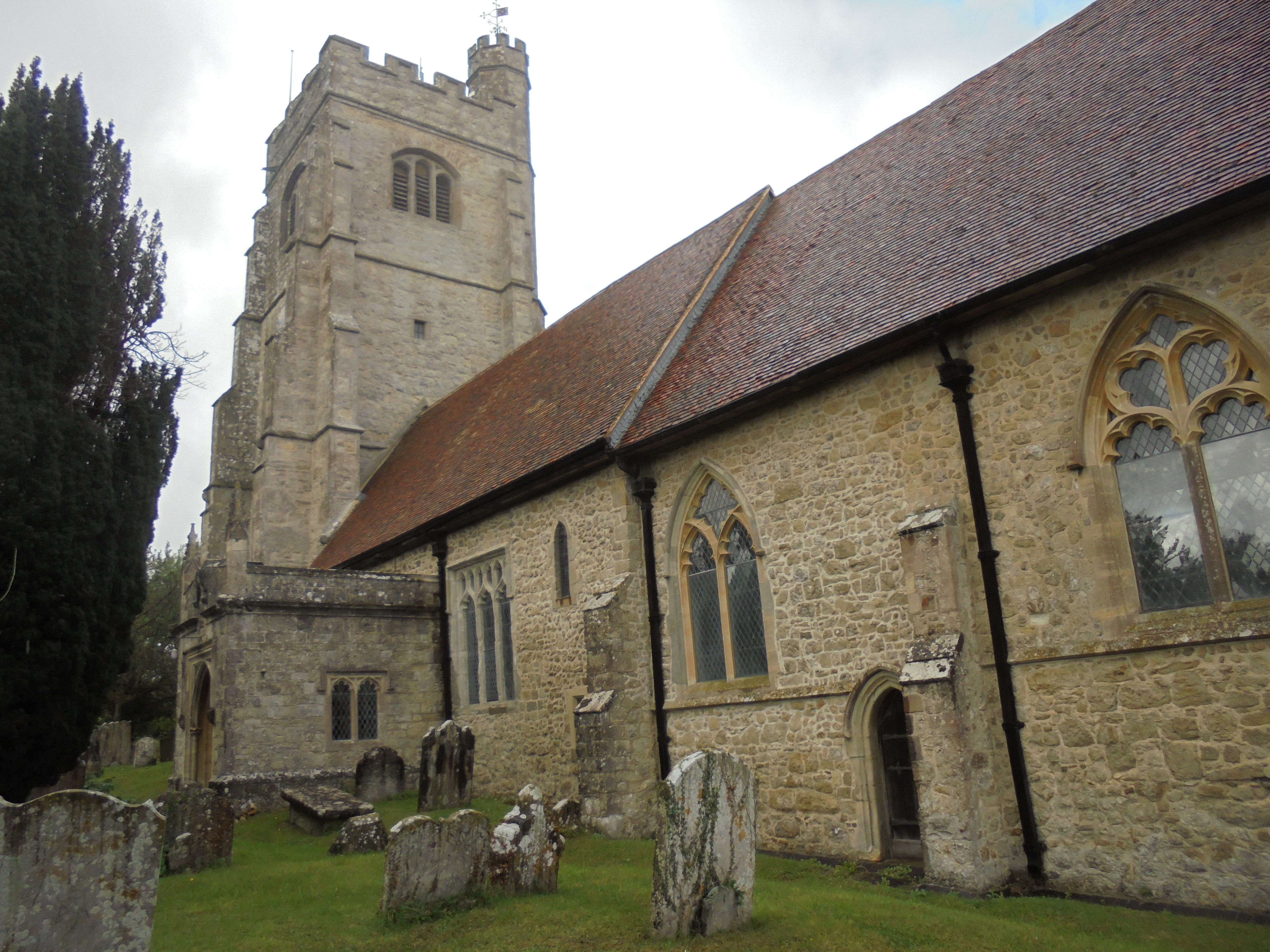
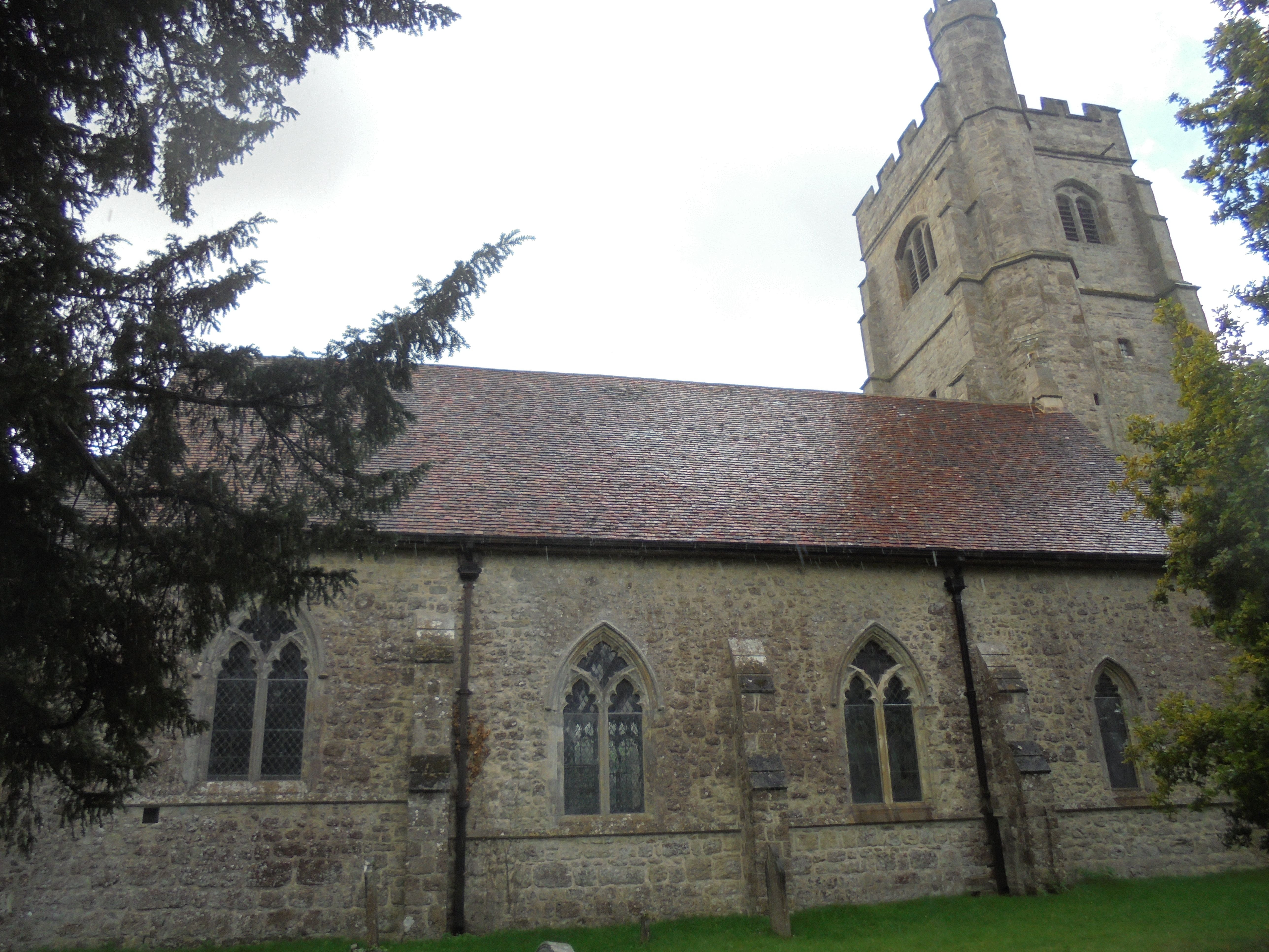
St. James Churchyard is located at The Street Egerton, Ashford Borough ,Kent , TN27 9DJEngland.
-
St. James Churchyard cemetery's updated grave count on graveviews.com?
298 memorials
-
Where are the coordinates of the St. James Churchyard?
Latitude: 51.1953860
Longitude: 0.7295170


Nearby Cemetories:
1. Egerton Free Church Graveyard
Egerton, Ashford Borough, England
Coordinate: 51.1871830, 0.7050080
2. Holy Trinity Churchyard
Charing Heath, Ashford Borough, England
Coordinate: 51.2117420, 0.7510860
3. St. Nicholas' Churchyard
Pluckley, Ashford Borough, England
Coordinate: 51.1749440, 0.7548470
4. St. Nicholas' Churchyard
Boughton Malherbe, Maidstone Borough, England
Coordinate: 51.2142160, 0.6935330
5. St Mary Churchyard
Lenham, Maidstone Borough, England
Coordinate: 51.2366860, 0.7191470
6. Charing Cemetery
Charing, Ashford Borough, England
Coordinate: 51.2120247, 0.7922290
7. Lenham Cemetery
Lenham, Maidstone Borough, England
Coordinate: 51.2389480, 0.7223940
8. St. Peter and St. Paul Churchyard
Charing, Ashford Borough, England
Coordinate: 51.2102230, 0.7966500
9. Kent County Crematorium
Charing, Ashford Borough, England
Coordinate: 51.2026560, 0.8006770
10. St. Michael the Archangel Churchyard
Smarden, Ashford Borough, England
Coordinate: 51.1490030, 0.6861940
11. St. John the Baptist Churchyard
Harrietsham, Maidstone Borough, England
Coordinate: 51.2453990, 0.6847930
12. All Saints Churchyard
Ulcombe, Maidstone Borough, England
Coordinate: 51.2171930, 0.6426440
13. All Saints Churchyard Extension
Ulcombe, Maidstone Borough, England
Coordinate: 51.2178000, 0.6420200
14. Church of St. Margaret
Hothfield, Ashford Borough, England
Coordinate: 51.1661000, 0.8158000
15. St. Margaret's Churchyard
Bethersden, Ashford Borough, England
Coordinate: 51.1291440, 0.7538760
16. St. Mary's Churchyard
Stalisfield, Swale Borough, England
Coordinate: 51.2371410, 0.8169790
17. Headcorn Baptist Churchyard
Headcorn, Maidstone Borough, England
Coordinate: 51.1674156, 0.6247670
18. Westwell Burial Ground
Westwell, Ashford Borough, England
Coordinate: 51.1900100, 0.8434000
19. Headcorn War Memorial
Headcorn, Maidstone Borough, England
Coordinate: 51.1677480, 0.6212560
20. St. Margaret's Churchyard
Wichling, Maidstone Borough, England
Coordinate: 51.2682226, 0.7455862
21. St. Peter and St. Paul Churchyard
Headcorn, Maidstone Borough, England
Coordinate: 51.1678543, 0.6203760
22. Headcorn Methodist Churchyard
Headcorn, Maidstone Borough, England
Coordinate: 51.1674940, 0.6205670
23. St Mary Churchyard
Westwell, Ashford Borough, England
Coordinate: 51.1919020, 0.8473350
24. Headcorn Parish Burial Ground
Headcorn, Maidstone Borough, England
Coordinate: 51.1671257, 0.6204750