
| Memorials | : | 0 |
| Location | : | Willaston, Cheshire West and Chester Unitary Authority, England |
| Coordinate | : | 53.2925500, -3.0086100 |
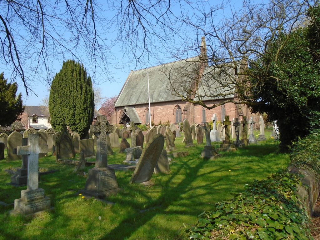
| Description | : | Willaston is a large village situated on the Wirral Peninsula, Wirral, England.As at August 2014,it is within the part of the Wirral Peninsula that still remains under the authority of Cheshire West and Chester. Centred on a village green, it is located between Neston and Ellesmere Port, less than a mile south of the boundary with the Metropolitan Borough of Wirral. Christ Church is located in Neston Road, Willaston. It is an active Anglican parish church in the deanery of Wirral South, the archdeaconry of Chester, and the diocese of Chester. The church, designated by English Heritage as a Grade... Read More |
frequently asked questions (FAQ):
-
Where is Christ Church Churchyard?
Christ Church Churchyard is located at Neston Road Willaston, Cheshire West and Chester Unitary Authority ,Cheshire ,England.
-
Christ Church Churchyard cemetery's updated grave count on graveviews.com?
0 memorials
-
Where are the coordinates of the Christ Church Churchyard?
Latitude: 53.2925500
Longitude: -3.0086100

Nearby Cemetories:
1. Christ Church Churchyard
Willaston, Cheshire East Unitary Authority, England
Coordinate: 53.2929220, -3.0086860
2. Neston Cemetery
Neston, Cheshire West and Chester Unitary Authority, England
Coordinate: 53.2943100, -3.0571400
3. Saint Winefride Churchyard
Little Neston, Cheshire West and Chester Unitary Authority, England
Coordinate: 53.2849200, -3.0592100
4. St Mary of the Angels Hooton
Hooton, Cheshire West and Chester Unitary Authority, England
Coordinate: 53.2971800, -2.9569700
5. St Nicholas Churchyard
Burton, Cheshire West and Chester Unitary Authority, England
Coordinate: 53.2616430, -3.0251070
6. St Mary and St Helen Neston
Neston, Cheshire West and Chester Unitary Authority, England
Coordinate: 53.2892600, -3.0640600
7. St. Paul's Churchyard
Hooton, Cheshire West and Chester Unitary Authority, England
Coordinate: 53.2902200, -2.9511400
8. St. Mary's Churchyard
Eastham, Metropolitan Borough of Wirral, England
Coordinate: 53.3133500, -2.9614500
9. All Saints Churchyard
Thornton Hough, Metropolitan Borough of Wirral, England
Coordinate: 53.3203500, -3.0444780
10. Plymyard Cemetery
Bromborough, Metropolitan Borough of Wirral, England
Coordinate: 53.3207700, -2.9725400
11. St Barnabas Bromborough
Bromborough, Metropolitan Borough of Wirral, England
Coordinate: 53.3324700, -2.9784000
12. Mayfields Woodland Remembrance Park
Eastham, Metropolitan Borough of Wirral, England
Coordinate: 53.3255100, -2.9550200
13. St John The Evangelist
Great Sutton, Cheshire West and Chester Unitary Authority, England
Coordinate: 53.2733100, -2.9364800
14. Holy Trinity Churchyard
Capenhurst, Cheshire West and Chester Unitary Authority, England
Coordinate: 53.2574000, -2.9492900
15. Overpool Cemetery
Ellesmere Port, Cheshire West and Chester Unitary Authority, England
Coordinate: 53.2881800, -2.9215590
16. St. Michael's Churchyard
Shotwick Park, Cheshire West and Chester Unitary Authority, England
Coordinate: 53.2388600, -2.9947400
17. St Andrews Parish Churchyard
Bebington, Metropolitan Borough of Wirral, England
Coordinate: 53.3479800, -3.0035400
18. Christ Church Churchyard
Port Sunlight, Metropolitan Borough of Wirral, England
Coordinate: 53.3534920, -2.9953750
19. St Peter's Churchyard
Heswall, Metropolitan Borough of Wirral, England
Coordinate: 53.3227400, -3.1036400
20. Barnston Cemetery
Barnston, Metropolitan Borough of Wirral, England
Coordinate: 53.3408590, -3.0820730
21. Bebington Cemetery
Bebington, Metropolitan Borough of Wirral, England
Coordinate: 53.3588030, -3.0165370
22. Christ Church
Bebington, Metropolitan Borough of Wirral, England
Coordinate: 53.3584460, -3.0254810
23. Christ Church Churchyard
Ellesmere Port, Cheshire West and Chester Unitary Authority, England
Coordinate: 53.2861000, -2.8950800
24. All Saints Churchyard
Saughall, Cheshire West and Chester Unitary Authority, England
Coordinate: 53.2271271, -2.9550779