
| Memorials | : | 0 |
| Location | : | Christchurch, Christchurch Borough, England |
| Coordinate | : | 50.7321550, -1.7742810 |
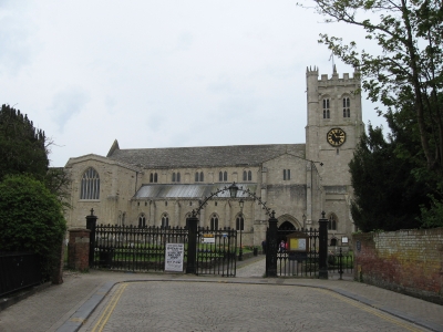
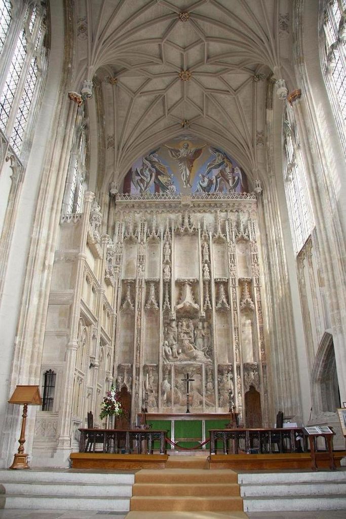
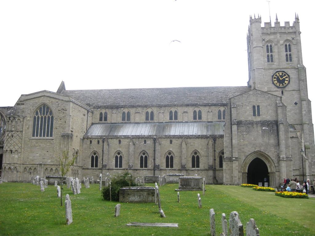
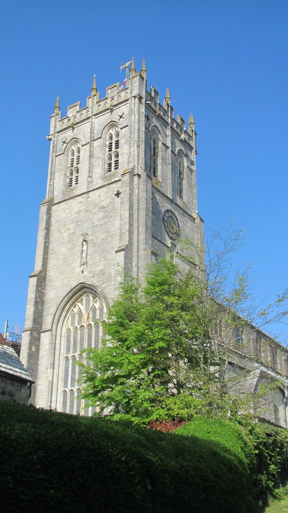
| Description | : | For over nine centuries, this church has stood as a place of pilgrimage. A Saxon Minster on this site was established probably in the 7th C by St. Birinus and was demolished on the orders of King William II chief minister Ranul Flambard. The nave and transepts are mostly in the heavy columns and rounded arches Norman Style where the Great Quire and Lady Chapel are in the more delicate and sophisticated Perpendicular style. The "Miraculous Beam" which can be seen high up in an archway of the triforium of the Lady Chapel ambulatory is a famous feature of the... Read More |
frequently asked questions (FAQ):
-
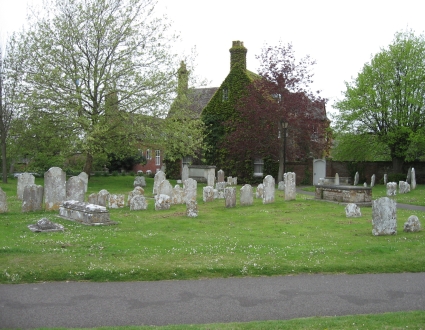
Where is Christchurch Priory Churchyard?
Christchurch Priory Churchyard is located at Christchurch, Christchurch Borough ,Dorset ,England.
-
Christchurch Priory Churchyard cemetery's updated grave count on graveviews.com?
0 memorials
-
Where are the coordinates of the Christchurch Priory Churchyard?
Latitude: 50.7321550
Longitude: -1.7742810
Nearby Cemetories:
1. Christchurch Congregational Church Graveyards
Christchurch, Christchurch Borough, England
Coordinate: 50.7347966, -1.7762867
2. Christchurch Cemetery
Christchurch, Christchurch Borough, England
Coordinate: 50.7427800, -1.7940900
3. St Luke's Churchyard
Burton, Christchurch Borough, England
Coordinate: 50.7532240, -1.7650090
4. Pokesdown Congregational Church
Southbourne, Bournemouth Unitary Authority, England
Coordinate: 50.7308910, -1.8197670
5. St James Churchyard
Bournemouth Unitary Authority, England
Coordinate: 50.7325437, -1.8208692
6. St John the Evangelist Churchyard
Bournemouth Unitary Authority, England
Coordinate: 50.7564980, -1.8191740
7. St Michael and All Angels Churchyard
Sopley, New Forest District, England
Coordinate: 50.7697400, -1.7794200
8. East Cemetery
Bournemouth, Bournemouth Unitary Authority, England
Coordinate: 50.7318590, -1.8348290
9. St. Mark Churchyard
Highcliffe, Christchurch Borough, England
Coordinate: 50.7402900, -1.7100050
10. Sopley Cemetery
Sopley, New Forest District, England
Coordinate: 50.7774250, -1.7847770
11. St Clement's Churchyard
Boscombe, Bournemouth Unitary Authority, England
Coordinate: 50.7287580, -1.8496680
12. St Mary the Virgin Churchyard
Bransgore, New Forest District, England
Coordinate: 50.7766150, -1.7302940
13. Bournemouth Crematorium and North Cemetery
Bournemouth, Bournemouth Unitary Authority, England
Coordinate: 50.7455406, -1.8576280
14. Throop Jewish Cemetery
Bournemouth, Bournemouth Unitary Authority, England
Coordinate: 50.7600190, -1.8504310
15. St Michael and All Angels Churchyard
Hinton, New Forest District, England
Coordinate: 50.7623700, -1.7002000
16. Throop United Reform Churchyard
Throop, Bournemouth Unitary Authority, England
Coordinate: 50.7630100, -1.8497100
17. Hinton Park Woodland Burial Ground
Walkford, Christchurch Borough, England
Coordinate: 50.7572900, -1.6907090
18. Wimborne Road Cemetery
Bournemouth, Bournemouth Unitary Authority, England
Coordinate: 50.7323220, -1.8739990
19. St Peter Churchyard
Bournemouth, Bournemouth Unitary Authority, England
Coordinate: 50.7205020, -1.8755870
20. St John the Baptist Churchyard
Bournemouth, Bournemouth Unitary Authority, England
Coordinate: 50.7500600, -1.8778700
21. St Mary Magdalene Churchyard
New Milton, New Forest District, England
Coordinate: 50.7481200, -1.6645700
22. New Milton Cemetery
New Milton, New Forest District, England
Coordinate: 50.7507690, -1.6650340
23. All Saints Churchyard
Thorney Hill, New Forest District, England
Coordinate: 50.7966900, -1.7215500
24. All Saints Churchyard
West Parley, East Dorset District, England
Coordinate: 50.7710152, -1.8783700