
| Memorials | : | 0 |
| Location | : | Southbourne, Bournemouth Unitary Authority, England |
| Coordinate | : | 50.7308910, -1.8197670 |
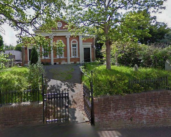
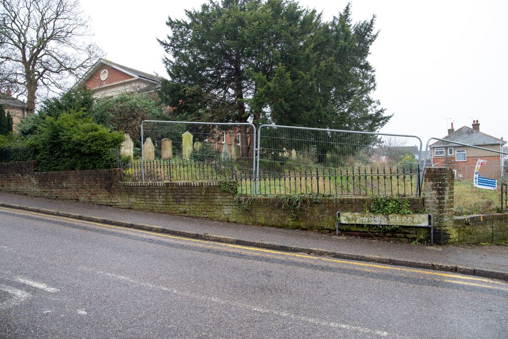
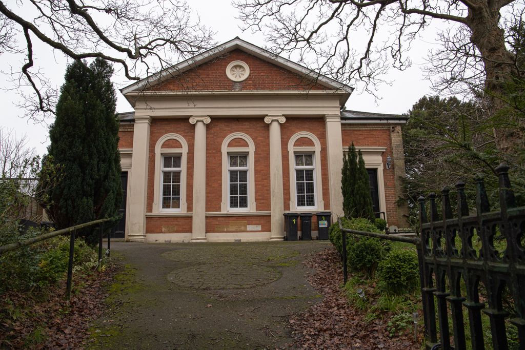
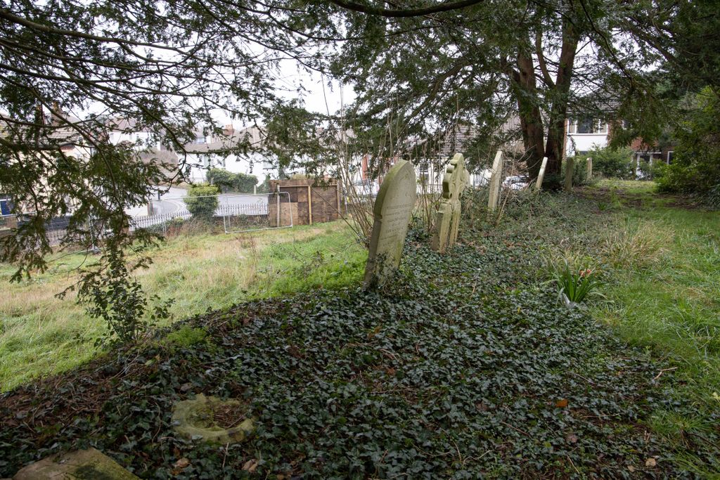
| Description | : | The original church which stood on this site was built in 1820 and demolished in 1857, when the foundation stone for the current building was laid. It was greatly improved and enlarged between 1870 and 1895 to accommodate the growing congregation. The building was decommissioned after being closed for some years and was converted into private flats in 2007. In 2016 it was decided by the property developer to exhume the remains of those buried in the grounds in order to landscape the grounds as garden area for the tenants of the flats. To date this work has not been carried out, but... Read More |
frequently asked questions (FAQ):
-
Where is Pokesdown Congregational Church?
Pokesdown Congregational Church is located at 18 Southbourne Road Southbourne, Bournemouth Unitary Authority ,Dorset , BH5 6AEEngland.
-
Pokesdown Congregational Church cemetery's updated grave count on graveviews.com?
0 memorials
-
Where are the coordinates of the Pokesdown Congregational Church?
Latitude: 50.7308910
Longitude: -1.8197670
Nearby Cemetories:
1. St James Churchyard
Bournemouth Unitary Authority, England
Coordinate: 50.7325437, -1.8208692
2. East Cemetery
Bournemouth, Bournemouth Unitary Authority, England
Coordinate: 50.7318590, -1.8348290
3. St Clement's Churchyard
Boscombe, Bournemouth Unitary Authority, England
Coordinate: 50.7287580, -1.8496680
4. Christchurch Cemetery
Christchurch, Christchurch Borough, England
Coordinate: 50.7427800, -1.7940900
5. St John the Evangelist Churchyard
Bournemouth Unitary Authority, England
Coordinate: 50.7564980, -1.8191740
6. Christchurch Congregational Church Graveyards
Christchurch, Christchurch Borough, England
Coordinate: 50.7347966, -1.7762867
7. Bournemouth Crematorium and North Cemetery
Bournemouth, Bournemouth Unitary Authority, England
Coordinate: 50.7455406, -1.8576280
8. Christchurch Priory Churchyard
Christchurch, Christchurch Borough, England
Coordinate: 50.7321550, -1.7742810
9. Wimborne Road Cemetery
Bournemouth, Bournemouth Unitary Authority, England
Coordinate: 50.7323220, -1.8739990
10. Throop Jewish Cemetery
Bournemouth, Bournemouth Unitary Authority, England
Coordinate: 50.7600190, -1.8504310
11. St Peter Churchyard
Bournemouth, Bournemouth Unitary Authority, England
Coordinate: 50.7205020, -1.8755870
12. Throop United Reform Churchyard
Throop, Bournemouth Unitary Authority, England
Coordinate: 50.7630100, -1.8497100
13. St Luke's Churchyard
Burton, Christchurch Borough, England
Coordinate: 50.7532240, -1.7650090
14. St John the Baptist Churchyard
Bournemouth, Bournemouth Unitary Authority, England
Coordinate: 50.7500600, -1.8778700
15. St Michael and All Angels Churchyard
Sopley, New Forest District, England
Coordinate: 50.7697400, -1.7794200
16. Sopley Cemetery
Sopley, New Forest District, England
Coordinate: 50.7774250, -1.7847770
17. St Ambrose Church
Bournemouth Unitary Authority, England
Coordinate: 50.7176530, -1.9004020
18. All Saints Churchyard
West Parley, East Dorset District, England
Coordinate: 50.7710152, -1.8783700
19. St. Mark's Churchyard
Bournemouth Unitary Authority, England
Coordinate: 50.7464670, -1.9026870
20. East Howe United Reformed Church Cemetery
Bournemouth, Bournemouth Unitary Authority, England
Coordinate: 50.7590790, -1.8996290
21. Kinson Cemetery
Bournemouth, Bournemouth Unitary Authority, England
Coordinate: 50.7612600, -1.9030400
22. All Saints Churchyard
Poole, Poole Unitary Authority, England
Coordinate: 50.7134060, -1.9165840
23. St. Andrew's Churchyard
Kinson, Bournemouth Unitary Authority, England
Coordinate: 50.7718700, -1.9049920
24. St. Mark Churchyard
Highcliffe, Christchurch Borough, England
Coordinate: 50.7402900, -1.7100050