
| Memorials | : | 0 |
| Location | : | Randolph County, USA |
| Coordinate | : | 39.5901710, -92.6709040 |
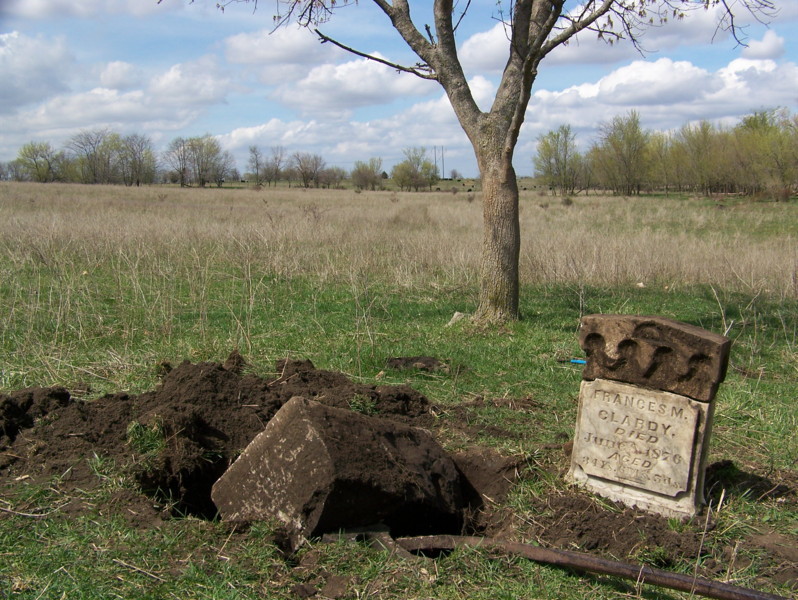
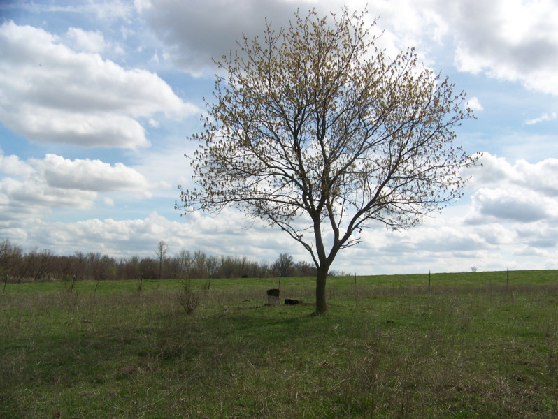
| Description | : | Located in T55 R16 S2 in a field almost 1/2 mile south of CR 1080 and almost directly north of Mt Carmel Cemetery. This cemetery has been destroyed by cattle over the years, and we could only locate one stone. The current owner of this land remembers there being more stones, one with "Infant" on it, but probing resulted only in a base. In addition, we were told there were headstones in a creek in the treeline bordering the field, but again, we found nothing. If anyone has any further information about this family, I would appreciate being contacted! |
frequently asked questions (FAQ):
-
Where is Clardy Cemetery?
Clardy Cemetery is located at Randolph County ,Missouri ,USA.
-
Clardy Cemetery cemetery's updated grave count on graveviews.com?
0 memorials
-
Where are the coordinates of the Clardy Cemetery?
Latitude: 39.5901710
Longitude: -92.6709040
Nearby Cemetories:
1. Mount Carmel Cemetery
Clifton Hill, Randolph County, USA
Coordinate: 39.5825400, -92.6701700
2. Dameron Family Cemetery
Randolph County, USA
Coordinate: 39.5952870, -92.6459750
3. Hebron Cemetery
Macon, Macon County, USA
Coordinate: 39.6171608, -92.6407776
4. Mount Olivette Cemetery
Darksville, Randolph County, USA
Coordinate: 39.5949170, -92.5946970
5. Kitchen Cemetery
Macon County, USA
Coordinate: 39.6164100, -92.5964000
6. Eldad Cumberland Presbyterian Cemetery
Randolph County, USA
Coordinate: 39.5380800, -92.6190800
7. Broaddus Cemetery
Darksville, Randolph County, USA
Coordinate: 39.5655550, -92.5902770
8. Marvin-Carter Cemetery
Randolph County, USA
Coordinate: 39.5957680, -92.5744400
9. Darksville Cemetery
Darksville, Randolph County, USA
Coordinate: 39.5542700, -92.5814900
10. Fawks Cemetery
Wayland Township, Chariton County, USA
Coordinate: 39.5264015, -92.7288971
11. Hall Family Cemetery
Darksville, Randolph County, USA
Coordinate: 39.5613890, -92.5769090
12. Mount Shiloh Baptist Church Cemetery
Darksville, Randolph County, USA
Coordinate: 39.5534360, -92.5814940
13. Johnson Cemetery
Bee Branch Township, Chariton County, USA
Coordinate: 39.6500015, -92.7369003
14. College Mound Cemetery
College Mound, Macon County, USA
Coordinate: 39.6227600, -92.5749400
15. Morrow Family Cemetery
Callao, Macon County, USA
Coordinate: 39.6693400, -92.6453410
16. Barnhart Cemetery
Randolph County, USA
Coordinate: 39.5731010, -92.5671997
17. Hickory Grove Cemetery
Randolph County, USA
Coordinate: 39.5402985, -92.5852966
18. Prairie Hill Cemetery
Wayland Township, Chariton County, USA
Coordinate: 39.5121994, -92.7153015
19. McCully-Haines Cemetery
Randolph County, USA
Coordinate: 39.5080870, -92.6410220
20. Rice Cemetery
Bee Branch Township, Chariton County, USA
Coordinate: 39.6652985, -92.7341995
21. Krueger Cemetery
Cockrell Township, Chariton County, USA
Coordinate: 39.5891991, -92.7879028
22. Teter Cemetery
College Mound, Macon County, USA
Coordinate: 39.6275570, -92.5563600
23. Martin Green Cemetery
Randolph County, USA
Coordinate: 39.4972340, -92.6369320
24. Clarkson-Brammer Cemetery
Macon County, USA
Coordinate: 39.6707680, -92.5990880