
| Memorials | : | 0 |
| Location | : | Randolph County, USA |
| Coordinate | : | 39.5957680, -92.5744400 |
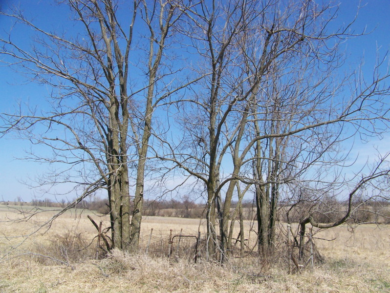
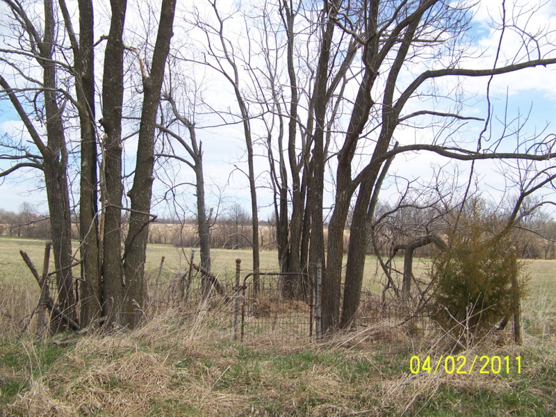
| Description | : | Located in T55 R15 S3 on the east side of Rt C north of Darksville This small cemetery is overgrown but still protected by a fence. Only two stones are visible, but there is space for several more burials. James Kerfoot and Amelia (Crisman) Carter owned this land at the time of their deaths and may be buried here, as no other burial site has been found for them. James Kerfoot Carter died during the Civil War and some sources say he was shot by bushwackers. Additionally, some sources say Joseph Elza Richeson (1825-1863) was executed by... Read More |
frequently asked questions (FAQ):
-
Where is Marvin-Carter Cemetery?
Marvin-Carter Cemetery is located at Randolph County ,Missouri ,USA.
-
Marvin-Carter Cemetery cemetery's updated grave count on graveviews.com?
0 memorials
-
Where are the coordinates of the Marvin-Carter Cemetery?
Latitude: 39.5957680
Longitude: -92.5744400


Nearby Cemetories:
1. Mount Olivette Cemetery
Darksville, Randolph County, USA
Coordinate: 39.5949170, -92.5946970
2. Barnhart Cemetery
Randolph County, USA
Coordinate: 39.5731010, -92.5671997
3. Kitchen Cemetery
Macon County, USA
Coordinate: 39.6164100, -92.5964000
4. College Mound Cemetery
College Mound, Macon County, USA
Coordinate: 39.6227600, -92.5749400
5. Broaddus Cemetery
Darksville, Randolph County, USA
Coordinate: 39.5655550, -92.5902770
6. Hall Family Cemetery
Darksville, Randolph County, USA
Coordinate: 39.5613890, -92.5769090
7. Teter Cemetery
College Mound, Macon County, USA
Coordinate: 39.6275570, -92.5563600
8. Darksville Cemetery
Darksville, Randolph County, USA
Coordinate: 39.5542700, -92.5814900
9. Mount Shiloh Baptist Church Cemetery
Darksville, Randolph County, USA
Coordinate: 39.5534360, -92.5814940
10. Ardmore Black Cemetery
Macon County, USA
Coordinate: 39.6456010, -92.5444840
11. Dameron Family Cemetery
Randolph County, USA
Coordinate: 39.5952870, -92.6459750
12. Hebron Cemetery
Macon, Macon County, USA
Coordinate: 39.6171608, -92.6407776
13. Hickory Grove Cemetery
Randolph County, USA
Coordinate: 39.5402985, -92.5852966
14. Gilchrist Cemetery
Macon County, USA
Coordinate: 39.6450210, -92.5369770
15. Eads Chapel Cemetery
Randolph County, USA
Coordinate: 39.5742580, -92.5052750
16. Gregory Cemetery
Randolph County, USA
Coordinate: 39.5640660, -92.5119030
17. Summers Family Cemetery
Huntsville, Randolph County, USA
Coordinate: 39.5439036, -92.5413740
18. Reynolds Cemetery
Jacksonville, Randolph County, USA
Coordinate: 39.5855700, -92.4982300
19. Union Cemetery
Bevier, Macon County, USA
Coordinate: 39.6584100, -92.5710400
20. Eldad Cumberland Presbyterian Cemetery
Randolph County, USA
Coordinate: 39.5380800, -92.6190800
21. Stevens-Coulter Family Cemetery
Macon County, USA
Coordinate: 39.6126850, -92.4840747
22. Mount Salem Cemetery
Excello, Macon County, USA
Coordinate: 39.6227600, -92.4864700
23. Missouri Veterans Cemetery at Jacksonville
Jacksonville, Randolph County, USA
Coordinate: 39.5817795, -92.4808426
24. Clardy Cemetery
Randolph County, USA
Coordinate: 39.5901710, -92.6709040