
| Memorials | : | 1 |
| Location | : | Macon County, USA |
| Coordinate | : | 39.6164100, -92.5964000 |
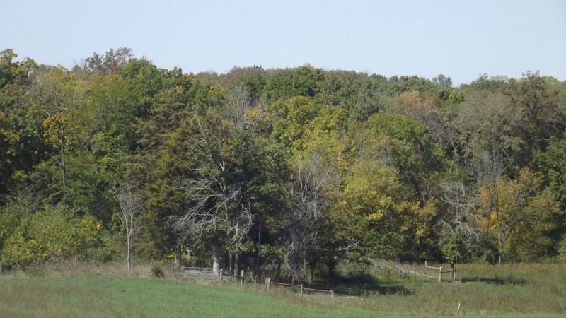
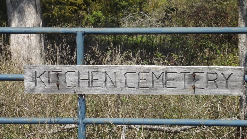
| Description | : | Located in Morrow Twp 56 R15 S33 on the north side of Gazelle St (in 2012) This cemetery is very overgrown, but is fenced and somewhat protected. Most stones have fallen, but all but one are readable. There are several graves marked only with native stones. This land was homesteaded by Thomas & Rebecca (Griffen) Banning in 1837. Their son, Clark, was the earliest known burial here. Update received from a family member August 2017: The cemetery was very overgrown but has been cleaned up, new fence built and is now maintained. The cemetery was vandalized years ago; many stones... Read More |
frequently asked questions (FAQ):
-
Where is Kitchen Cemetery?
Kitchen Cemetery is located at Macon County ,Missouri ,USA.
-
Kitchen Cemetery cemetery's updated grave count on graveviews.com?
1 memorials
-
Where are the coordinates of the Kitchen Cemetery?
Latitude: 39.6164100
Longitude: -92.5964000


Nearby Cemetories:
1. College Mound Cemetery
College Mound, Macon County, USA
Coordinate: 39.6227600, -92.5749400
2. Mount Olivette Cemetery
Darksville, Randolph County, USA
Coordinate: 39.5949170, -92.5946970
3. Marvin-Carter Cemetery
Randolph County, USA
Coordinate: 39.5957680, -92.5744400
4. Teter Cemetery
College Mound, Macon County, USA
Coordinate: 39.6275570, -92.5563600
5. Hebron Cemetery
Macon, Macon County, USA
Coordinate: 39.6171608, -92.6407776
6. Dameron Family Cemetery
Randolph County, USA
Coordinate: 39.5952870, -92.6459750
7. Union Cemetery
Bevier, Macon County, USA
Coordinate: 39.6584100, -92.5710400
8. Barnhart Cemetery
Randolph County, USA
Coordinate: 39.5731010, -92.5671997
9. Ardmore Black Cemetery
Macon County, USA
Coordinate: 39.6456010, -92.5444840
10. Broaddus Cemetery
Darksville, Randolph County, USA
Coordinate: 39.5655550, -92.5902770
11. Gilchrist Cemetery
Macon County, USA
Coordinate: 39.6450210, -92.5369770
12. Clarkson-Brammer Cemetery
Macon County, USA
Coordinate: 39.6707680, -92.5990880
13. Teter-Phares Burial Site
Chariton, Macon County, USA
Coordinate: 39.6706900, -92.5780500
14. Hall Family Cemetery
Darksville, Randolph County, USA
Coordinate: 39.5613890, -92.5769090
15. Clardy Cemetery
Randolph County, USA
Coordinate: 39.5901710, -92.6709040
16. Darksville Cemetery
Darksville, Randolph County, USA
Coordinate: 39.5542700, -92.5814900
17. Mount Shiloh Baptist Church Cemetery
Darksville, Randolph County, USA
Coordinate: 39.5534360, -92.5814940
18. Morrow Family Cemetery
Callao, Macon County, USA
Coordinate: 39.6693400, -92.6453410
19. Mount Carmel Cemetery
Clifton Hill, Randolph County, USA
Coordinate: 39.5825400, -92.6701700
20. Hickory Grove Cemetery
Randolph County, USA
Coordinate: 39.5402985, -92.5852966
21. Eldad Cumberland Presbyterian Cemetery
Randolph County, USA
Coordinate: 39.5380800, -92.6190800
22. Reynolds Cemetery
Jacksonville, Randolph County, USA
Coordinate: 39.5855700, -92.4982300
23. Eads Chapel Cemetery
Randolph County, USA
Coordinate: 39.5742580, -92.5052750
24. Antioch Cemetery
Bevier, Macon County, USA
Coordinate: 39.6978500, -92.5817610