
| Memorials | : | 0 |
| Location | : | Darksville, Randolph County, USA |
| Coordinate | : | 39.5534360, -92.5814940 |
frequently asked questions (FAQ):
-
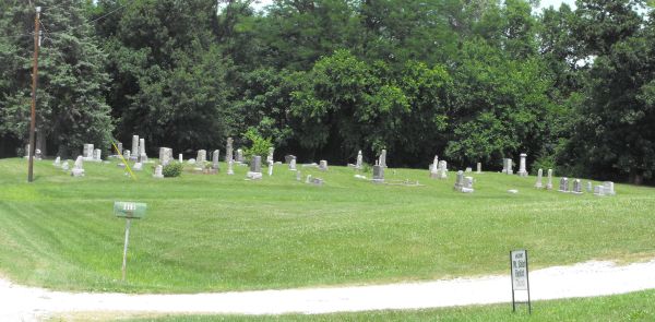
Where is Mount Shiloh Baptist Church Cemetery?
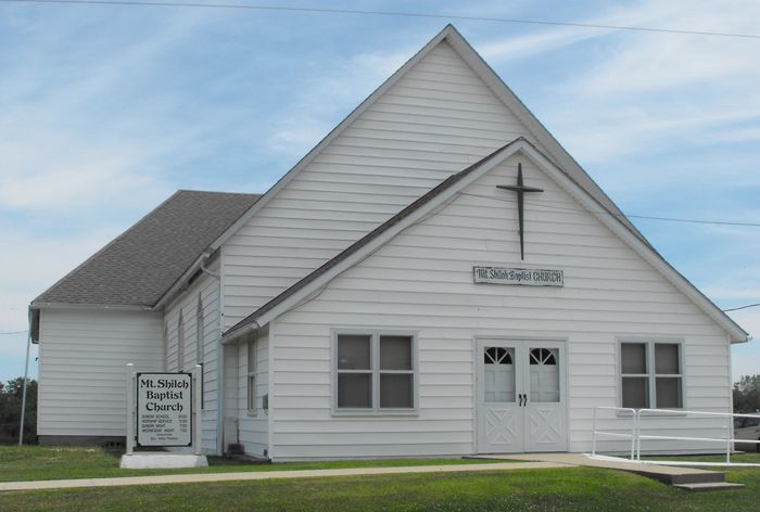
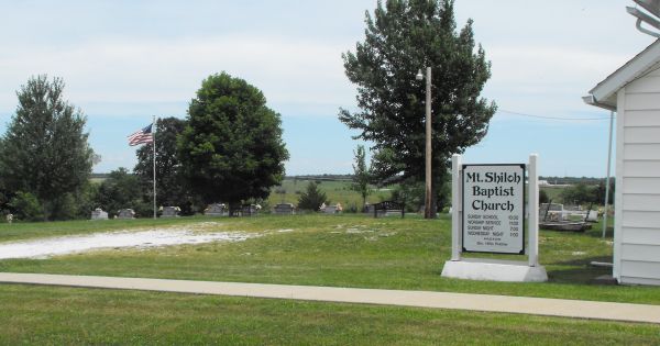
Mount Shiloh Baptist Church Cemetery is located at Darksville, Randolph County ,Missouri ,USA.
-
Mount Shiloh Baptist Church Cemetery cemetery's updated grave count on graveviews.com?
0 memorials
-
Where are the coordinates of the Mount Shiloh Baptist Church Cemetery?
Latitude: 39.5534360
Longitude: -92.5814940
Nearby Cemetories:
1. Darksville Cemetery
Darksville, Randolph County, USA
Coordinate: 39.5542700, -92.5814900
2. Hall Family Cemetery
Darksville, Randolph County, USA
Coordinate: 39.5613890, -92.5769090
3. Hickory Grove Cemetery
Randolph County, USA
Coordinate: 39.5402985, -92.5852966
4. Broaddus Cemetery
Darksville, Randolph County, USA
Coordinate: 39.5655550, -92.5902770
5. Barnhart Cemetery
Randolph County, USA
Coordinate: 39.5731010, -92.5671997
6. Summers Family Cemetery
Huntsville, Randolph County, USA
Coordinate: 39.5439036, -92.5413740
7. Eldad Cumberland Presbyterian Cemetery
Randolph County, USA
Coordinate: 39.5380800, -92.6190800
8. Marvin-Carter Cemetery
Randolph County, USA
Coordinate: 39.5957680, -92.5744400
9. Mount Olivette Cemetery
Darksville, Randolph County, USA
Coordinate: 39.5949170, -92.5946970
10. Cleveland Cemetery
Darksville, Randolph County, USA
Coordinate: 39.5018380, -92.6006240
11. Gregory Cemetery
Randolph County, USA
Coordinate: 39.5640660, -92.5119030
12. Terry Cemetery
Huntsville, Randolph County, USA
Coordinate: 39.4985470, -92.5585630
13. Eads Chapel Cemetery
Randolph County, USA
Coordinate: 39.5742580, -92.5052750
14. Ancell Cemetery
Cairo, Randolph County, USA
Coordinate: 39.5324600, -92.5044200
15. Kitchen Cemetery
Macon County, USA
Coordinate: 39.6164100, -92.5964000
16. McCully-Haines Cemetery
Randolph County, USA
Coordinate: 39.5080870, -92.6410220
17. Dameron Family Cemetery
Randolph County, USA
Coordinate: 39.5952870, -92.6459750
18. Mason-Payton Cemetery
Randolph County, USA
Coordinate: 39.5067770, -92.5215990
19. College Mound Cemetery
College Mound, Macon County, USA
Coordinate: 39.6227600, -92.5749400
20. Martin Green Cemetery
Randolph County, USA
Coordinate: 39.4972340, -92.6369320
21. Reynolds Cemetery
Jacksonville, Randolph County, USA
Coordinate: 39.5855700, -92.4982300
22. Mount Carmel Cemetery
Clifton Hill, Randolph County, USA
Coordinate: 39.5825400, -92.6701700
23. Teter Cemetery
College Mound, Macon County, USA
Coordinate: 39.6275570, -92.5563600
24. Clardy Cemetery
Randolph County, USA
Coordinate: 39.5901710, -92.6709040