
| Memorials | : | 3 |
| Location | : | Posey Township, Clay County, USA |
| Phone | : | 812-446-1551 |
| Coordinate | : | 39.5141983, -87.1733017 |
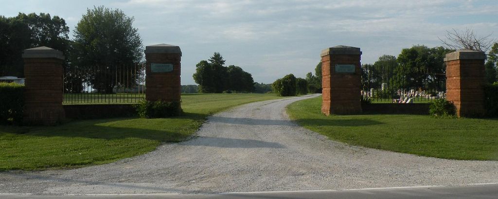
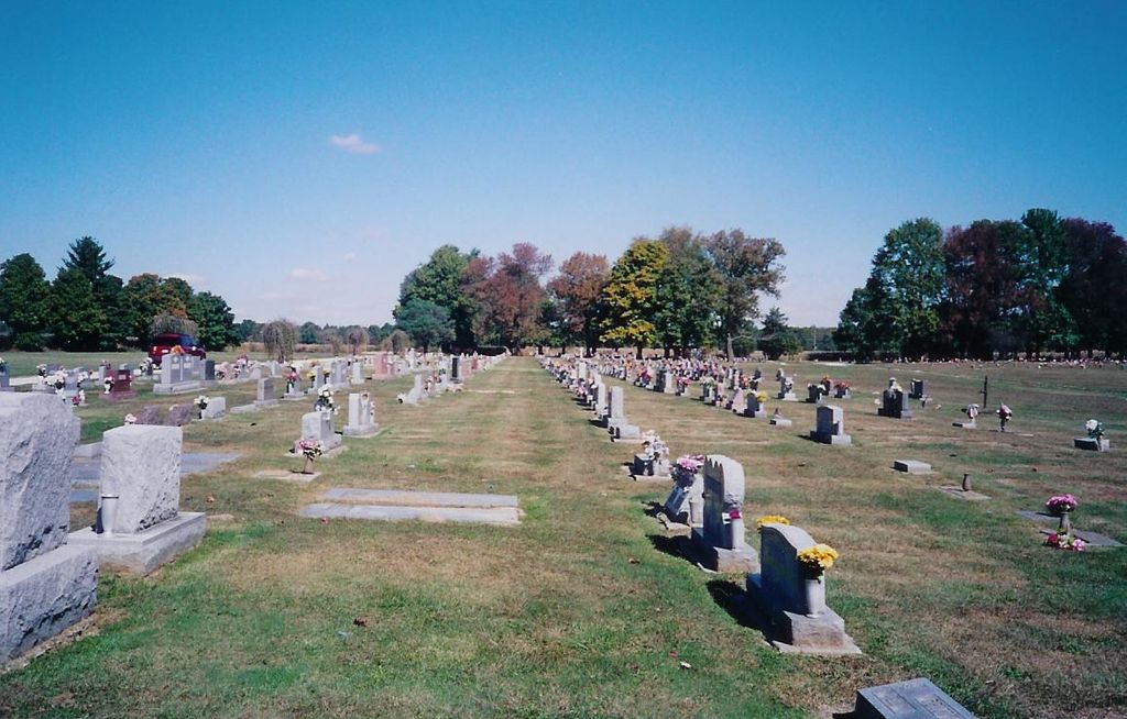
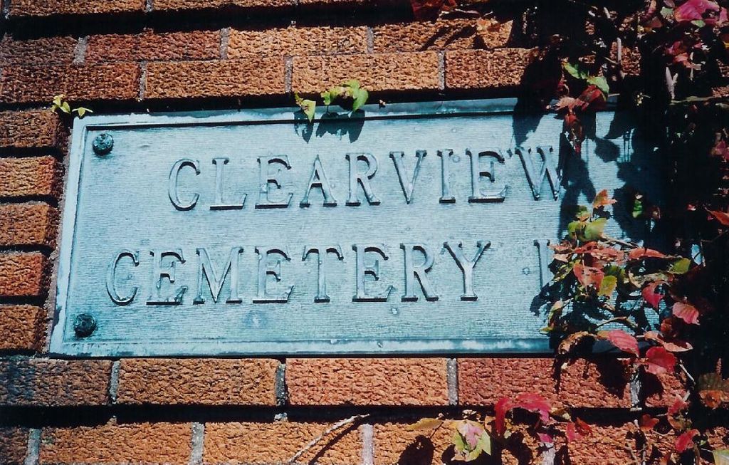
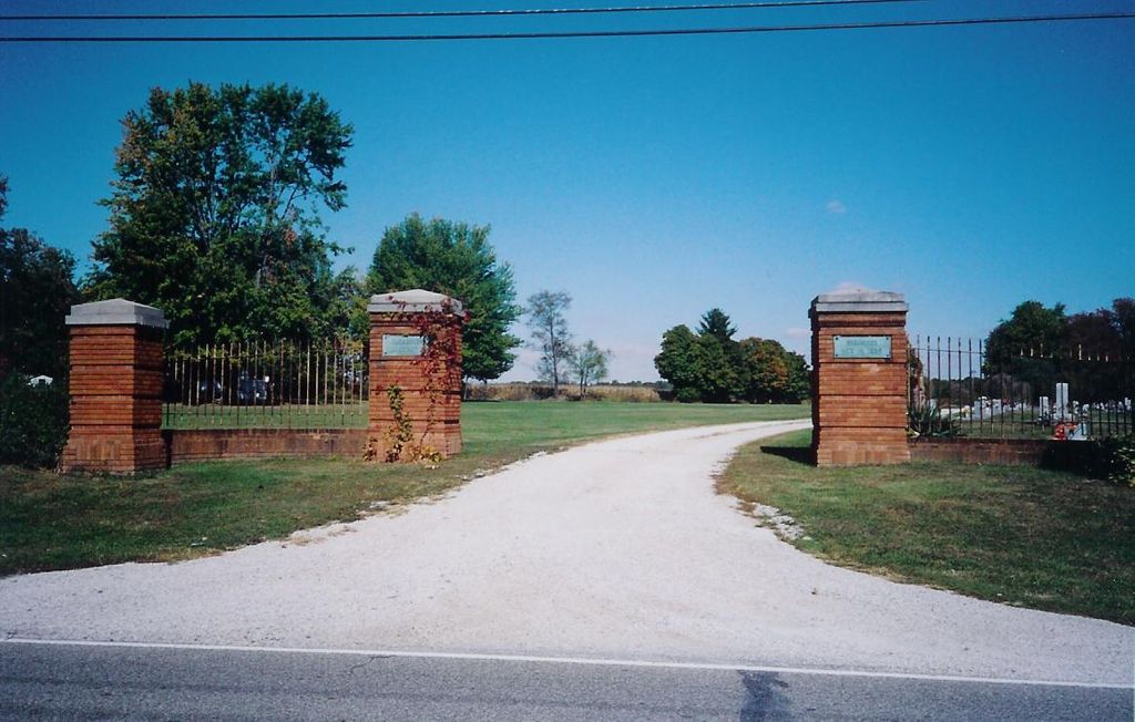
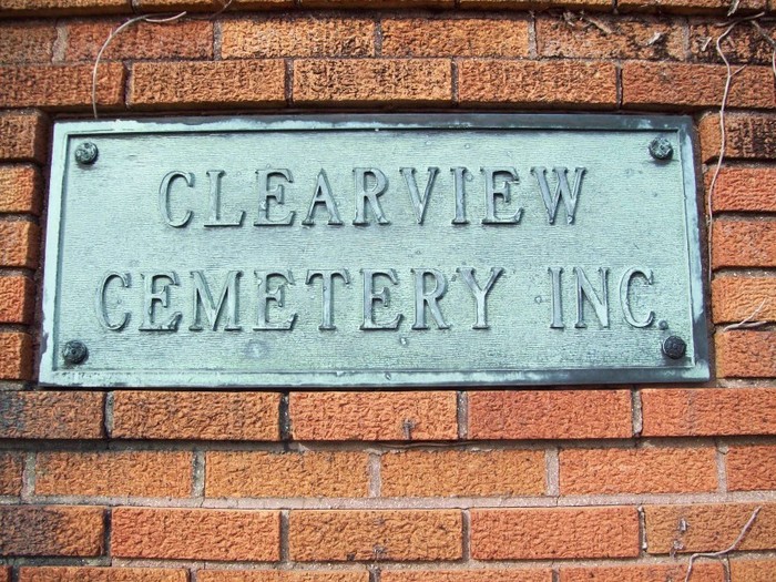
| Description | : | The cemetery is located in Posey Township (E half of the SE quadrant of the SW quadrant of Section 3 Township 12N Range 7W) on the north side of Indiana State Highway 340 about 0.6 miles west of its intersection with N County Road 300 W. Indiana Cemetery Locations, Volume 4, published by the Indiana Genealogical Society (April 2009), gives the primary cemetery name as Clearview Cemetery. The cemetery is listed in the Cemetery and Burial Grounds Registry of the Indiana Department of Natural Resources (DNR) and in the State Historical Architectural and Archaeological Research Database (SHAARD) with... Read More |
frequently asked questions (FAQ):
-
Where is Clearview Cemetery?
Clearview Cemetery is located at 3640 Indiana State Highway 340 Posey Township, Clay County ,Indiana , 47834USA.
-
Clearview Cemetery cemetery's updated grave count on graveviews.com?
3 memorials
-
Where are the coordinates of the Clearview Cemetery?
Latitude: 39.5141983
Longitude: -87.1733017
Nearby Cemetories:
1. Cottage Hill Cemetery
Brazil, Clay County, USA
Coordinate: 39.5186005, -87.1517029
2. Billtown Cemetery
Billtown, Clay County, USA
Coordinate: 39.5083008, -87.1996994
3. Bee Ridge Cemetery
Brazil, Clay County, USA
Coordinate: 39.5367584, -87.1687469
4. Old Hill Cemetery
Brazil, Clay County, USA
Coordinate: 39.5198300, -87.1432100
5. Summit Lawn Cemetery
Brazil, Clay County, USA
Coordinate: 39.4998190, -87.1445310
6. Harpold Cemetery
Ehrmandale, Vigo County, USA
Coordinate: 39.5205994, -87.2144012
7. Wools Cemetery
Staunton, Clay County, USA
Coordinate: 39.4895690, -87.1446970
8. Staunton German Lutheran Cemetery
Staunton, Clay County, USA
Coordinate: 39.4806510, -87.1839270
9. Vest Cemetery
Staunton, Clay County, USA
Coordinate: 39.4795685, -87.1728516
10. Bemis Cemetery
Ehrmandale, Vigo County, USA
Coordinate: 39.5483550, -87.2061220
11. Stunkard Cemetery
Brazil, Clay County, USA
Coordinate: 39.5463982, -87.1346970
12. Reffet Cemetery
Brazil, Clay County, USA
Coordinate: 39.4891960, -87.1260020
13. Eppert Cemetery
Cloverland, Clay County, USA
Coordinate: 39.5020332, -87.2316666
14. Saint John's Evangelical Lutheran Cemetery
Center Point, Clay County, USA
Coordinate: 39.4683609, -87.1544952
15. German Cemetery
Clay County, USA
Coordinate: 39.4681015, -87.1547012
16. Moreland Cemetery
Ehrmandale, Vigo County, USA
Coordinate: 39.5443600, -87.2239600
17. Brazil Cemetery
Brazil, Clay County, USA
Coordinate: 39.5352500, -87.1149000
18. Restlawn Cemetery
Brazil, Clay County, USA
Coordinate: 39.5353000, -87.1142000
19. Carpenter Cemetery
Cloverland, Clay County, USA
Coordinate: 39.4939600, -87.2341100
20. Otter Creek Cemetery
Cardonia, Clay County, USA
Coordinate: 39.5473500, -87.1224000
21. Hoskins Cemetery
Seelyville, Vigo County, USA
Coordinate: 39.5060030, -87.2395880
22. Richter Cemetery
Fontanet, Vigo County, USA
Coordinate: 39.5388985, -87.2382965
23. Carter Cemetery
Clay County, USA
Coordinate: 39.5703011, -87.1964035
24. Poplar Cemetery
Knightsville, Clay County, USA
Coordinate: 39.5042000, -87.0980988