
| Memorials | : | 0 |
| Location | : | Taplow, South Bucks District, England |
| Coordinate | : | 51.5571020, -0.6899240 |
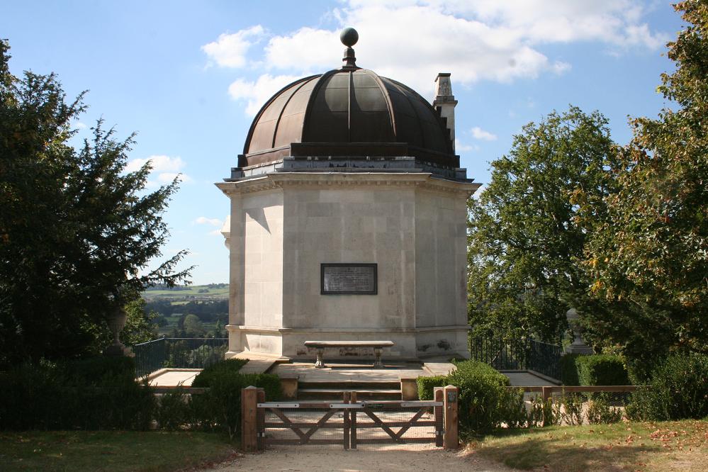
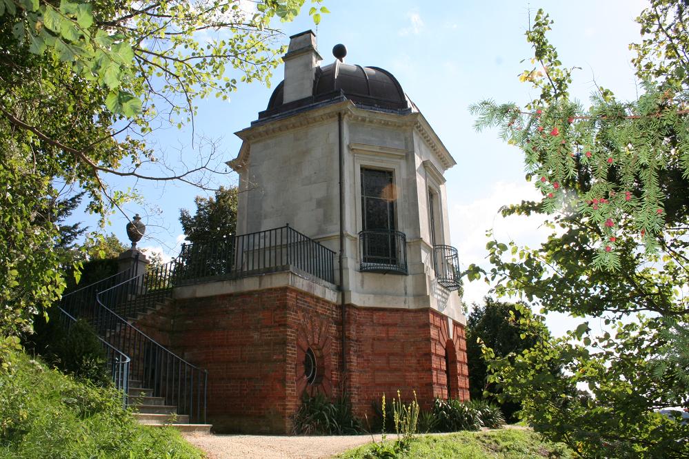
| Description | : | Octagon Temple was designed by Giacomo Leoni in the 18th century as a ‘little cool room, by way of grotto' – a place to relax during summer walks in the vast Cliveden Estate. In 1893, soon after he purchased Cliveden, William Waldorf Astor employed an architect to convert it into a Chapel, with its walls and dome encrusted with mosaics. He and other members of the Astor family have since been buried there, five people so far. |
frequently asked questions (FAQ):
-
Where is Cliveden Chapel?
Cliveden Chapel is located at Taplow, South Bucks District ,Buckinghamshire ,England.
-
Cliveden Chapel cemetery's updated grave count on graveviews.com?
0 memorials
-
Where are the coordinates of the Cliveden Chapel?
Latitude: 51.5571020
Longitude: -0.6899240
Nearby Cemetories:
1. Cliveden War Memorial Cemetery
Taplow, South Bucks District, England
Coordinate: 51.5578380, -0.6900160
2. Cliveden House Pet Cemetery
Taplow, South Bucks District, England
Coordinate: 51.5590770, -0.6880610
3. St Nicholas Churchyard
Hedsor, Wycombe District, England
Coordinate: 51.5675780, -0.6924980
4. Holy Trinity Churchyard
Cookham, Windsor and Maidenhead Royal Borough, England
Coordinate: 51.5613910, -0.7074150
5. Nashdom Abbey Cemetery
Burnham, South Bucks District, England
Coordinate: 51.5490600, -0.6739000
6. United Reformed Church Cemetery
Bourne End, Wycombe District, England
Coordinate: 51.5769930, -0.6972670
7. Bethel Chapel Cores End-Independent
Wooburn, Wycombe District, England
Coordinate: 51.5770400, -0.6971420
8. Wooburn & Bourne End Cemetery
Wooburn, Wycombe District, England
Coordinate: 51.5795260, -0.6919400
9. St. Mary's Churchyard
Hitcham, South Bucks District, England
Coordinate: 51.5346430, -0.6750330
10. St. Paul's Churchyard
Wooburn, Wycombe District, England
Coordinate: 51.5816640, -0.6886330
11. Cookham Parish Cemetery
Cookham, Windsor and Maidenhead Royal Borough, England
Coordinate: 51.5485170, -0.7270770
12. St. Nicolas' Churchyard
Taplow, South Bucks District, England
Coordinate: 51.5313140, -0.6867530
13. St Anne Churchyard
Dropmore, South Bucks District, England
Coordinate: 51.5693020, -0.6530820
14. The Old Churchyard
Taplow, South Bucks District, England
Coordinate: 51.5312190, -0.6950540
15. Zion Chapel Burial Ground
Burnham, South Bucks District, England
Coordinate: 51.5358700, -0.6594930
16. St Peter Churchyard
Burnham, South Bucks District, England
Coordinate: 51.5328060, -0.6598430
17. St John the Baptist Churchyard
Cookham Dean, Windsor and Maidenhead Royal Borough, England
Coordinate: 51.5581960, -0.7447210
18. St Luke Cemetery
Maidenhead, Windsor and Maidenhead Royal Borough, England
Coordinate: 51.5265500, -0.7233700
19. Fern Lane Cemetery
Little Marlow, Wycombe District, England
Coordinate: 51.5887390, -0.7273880
20. St. John the Baptist Churchyard
Little Marlow, Wycombe District, England
Coordinate: 51.5826450, -0.7398600
21. Holtspur Cemetery
Beaconsfield, South Bucks District, England
Coordinate: 51.5964280, -0.6663890
22. All Saints Cemetery
Maidenhead, Windsor and Maidenhead Royal Borough, England
Coordinate: 51.5262600, -0.7421200
23. Burnham Abbey Church of St. Mary
Burnham, South Bucks District, England
Coordinate: 51.5155000, -0.6607100
24. All Saints Churchyard
Maidenhead, Windsor and Maidenhead Royal Borough, England
Coordinate: 51.5199210, -0.7367710