
| Memorials | : | 0 |
| Location | : | Taplow, South Bucks District, England |
| Website | : | st-nicolas-taplow.org |
| Coordinate | : | 51.5313140, -0.6867530 |
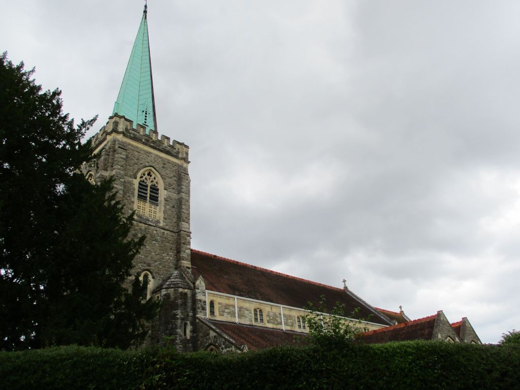
| Description | : | There has been a Christian presence in Taplow since the 7th century and a Norman church was built next to Taplow Court at the top of Berry Hill. That church was pulled down in the 1820s and a new church built on the present site in the village a few years later. In 1865, the chancel was added at the east end; then in 1911/12 the rest of the church was substantially rebuilt with the copper spire added to the tower. The dedication to St. Nicolas has been spelt in that way only since the 20th century - a window... Read More |
frequently asked questions (FAQ):
-
Where is St. Nicolas' Churchyard?
St. Nicolas' Churchyard is located at High Street Taplow, South Bucks District ,Buckinghamshire , SL6 0ETEngland.
-
St. Nicolas' Churchyard cemetery's updated grave count on graveviews.com?
0 memorials
-
Where are the coordinates of the St. Nicolas' Churchyard?
Latitude: 51.5313140
Longitude: -0.6867530
Nearby Cemetories:
1. The Old Churchyard
Taplow, South Bucks District, England
Coordinate: 51.5312190, -0.6950540
2. St. Mary's Churchyard
Hitcham, South Bucks District, England
Coordinate: 51.5346430, -0.6750330
3. St Peter Churchyard
Burnham, South Bucks District, England
Coordinate: 51.5328060, -0.6598430
4. Zion Chapel Burial Ground
Burnham, South Bucks District, England
Coordinate: 51.5358700, -0.6594930
5. Nashdom Abbey Cemetery
Burnham, South Bucks District, England
Coordinate: 51.5490600, -0.6739000
6. Burnham Abbey Church of St. Mary
Burnham, South Bucks District, England
Coordinate: 51.5155000, -0.6607100
7. St Luke Cemetery
Maidenhead, Windsor and Maidenhead Royal Borough, England
Coordinate: 51.5265500, -0.7233700
8. St Michael Churchyard
Bray, Windsor and Maidenhead Royal Borough, England
Coordinate: 51.5090920, -0.7020450
9. Cliveden Chapel
Taplow, South Bucks District, England
Coordinate: 51.5571020, -0.6899240
10. Cliveden War Memorial Cemetery
Taplow, South Bucks District, England
Coordinate: 51.5578380, -0.6900160
11. Cliveden House Pet Cemetery
Taplow, South Bucks District, England
Coordinate: 51.5590770, -0.6880610
12. Braywick Cemetery
Maidenhead, Windsor and Maidenhead Royal Borough, England
Coordinate: 51.5086460, -0.7141110
13. St James the Less Churchyard
Dorney, South Bucks District, England
Coordinate: 51.5030670, -0.6689740
14. Cookham Parish Cemetery
Cookham, Windsor and Maidenhead Royal Borough, England
Coordinate: 51.5485170, -0.7270770
15. Holy Trinity Churchyard
Cookham, Windsor and Maidenhead Royal Borough, England
Coordinate: 51.5613910, -0.7074150
16. All Saints Churchyard
Maidenhead, Windsor and Maidenhead Royal Borough, England
Coordinate: 51.5199210, -0.7367710
17. Bray Parish Cemetery
Bray, Windsor and Maidenhead Royal Borough, England
Coordinate: 51.4975520, -0.6989780
18. All Saints Cemetery
Maidenhead, Windsor and Maidenhead Royal Borough, England
Coordinate: 51.5262600, -0.7421200
19. St Nicholas Churchyard
Hedsor, Wycombe District, England
Coordinate: 51.5675780, -0.6924980
20. St Anne Churchyard
Dropmore, South Bucks District, England
Coordinate: 51.5693020, -0.6530820
21. St. Mary Churchyard
Farnham Royal, South Bucks District, England
Coordinate: 51.5351250, -0.6149910
22. St John the Baptist Churchyard
Cookham Dean, Windsor and Maidenhead Royal Borough, England
Coordinate: 51.5581960, -0.7447210
23. United Reformed Church Cemetery
Bourne End, Wycombe District, England
Coordinate: 51.5769930, -0.6972670
24. Bethel Chapel Cores End-Independent
Wooburn, Wycombe District, England
Coordinate: 51.5770400, -0.6971420