
| Memorials | : | 0 |
| Location | : | Racine, Racine County, USA |
| Phone | : | 262-634-5529 |
| Coordinate | : | 42.7262800, -87.7829500 |
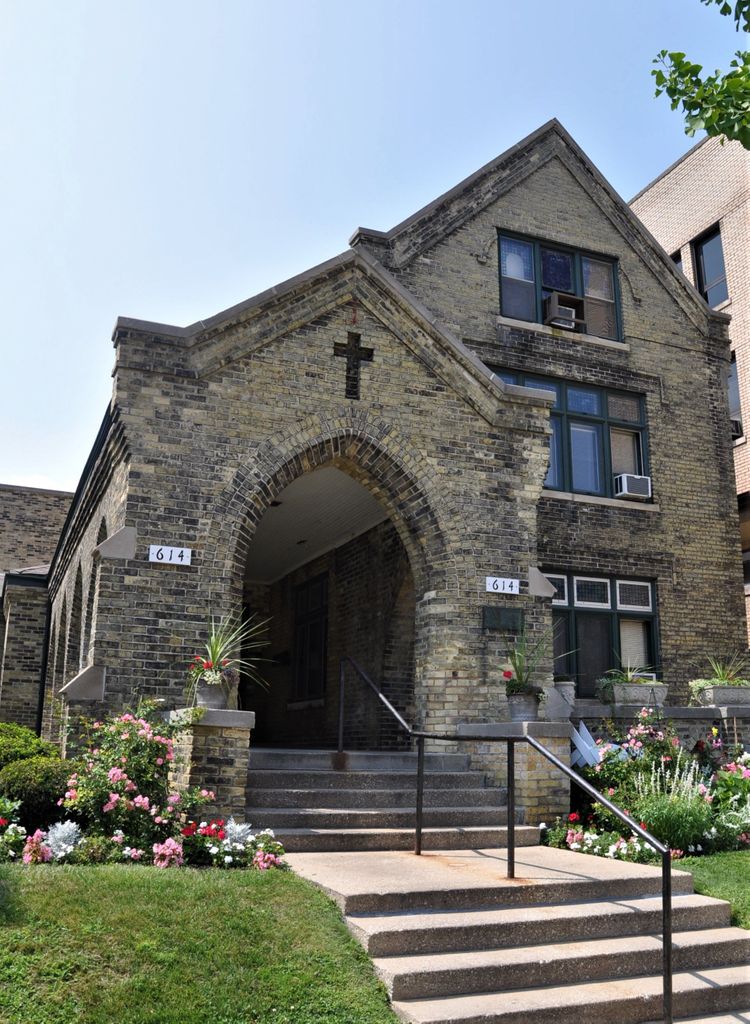
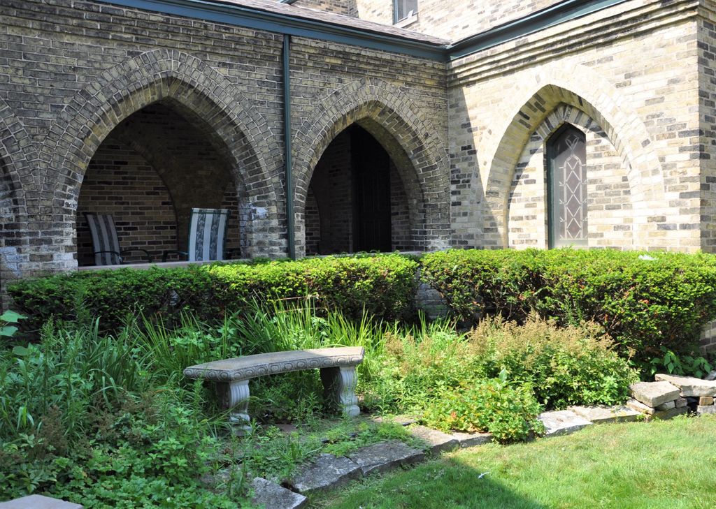
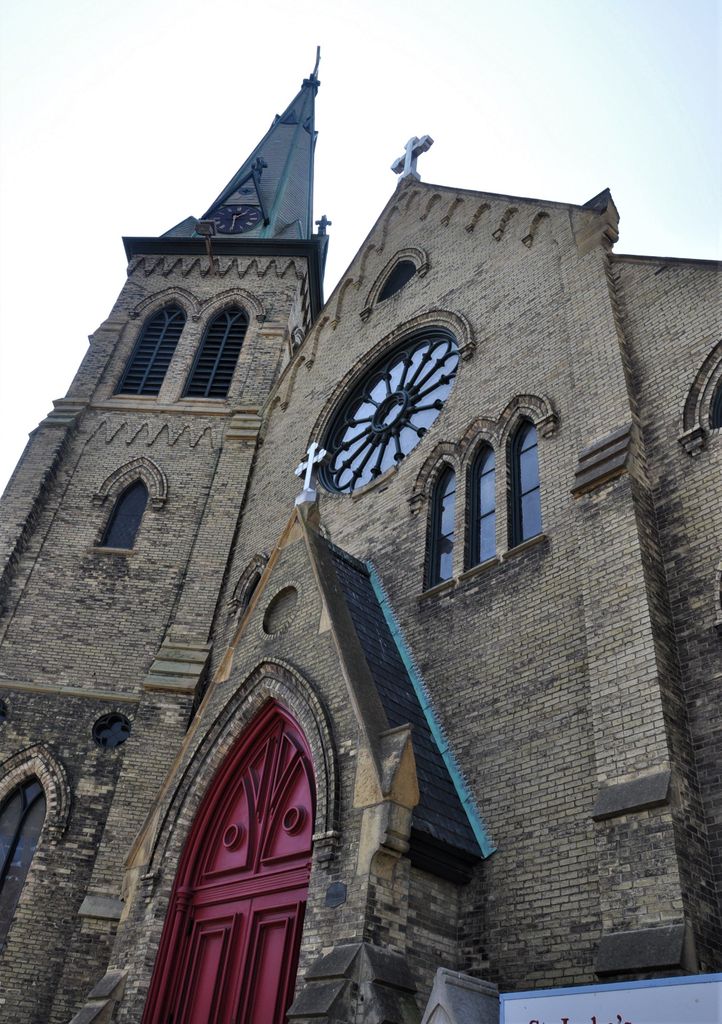
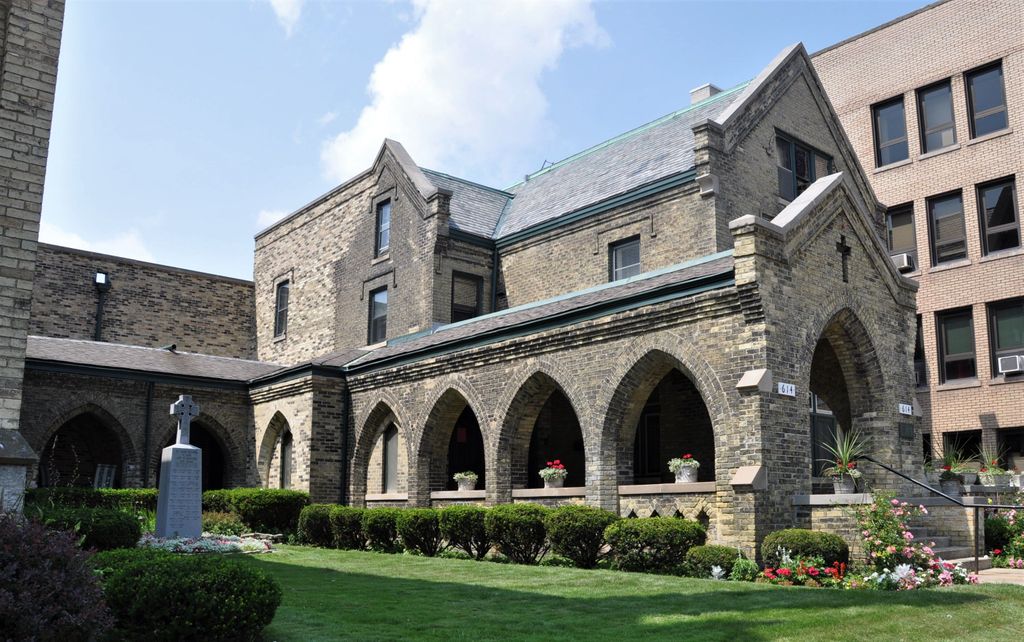
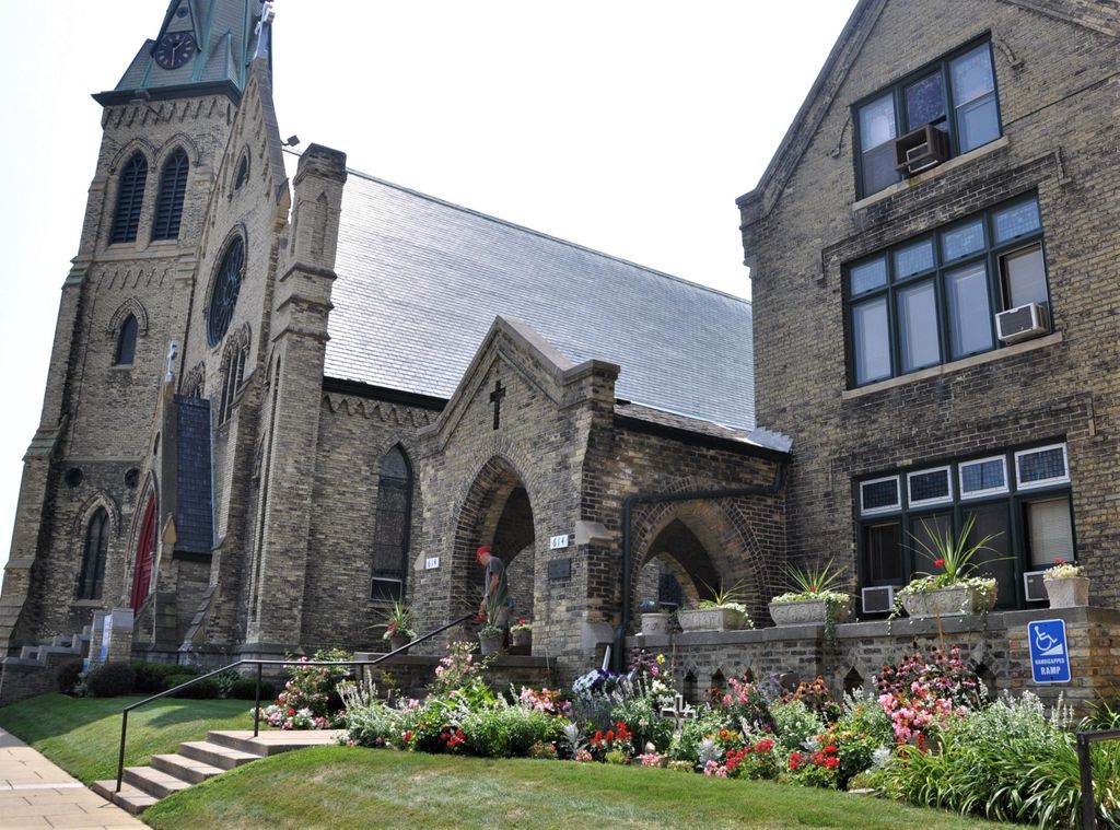
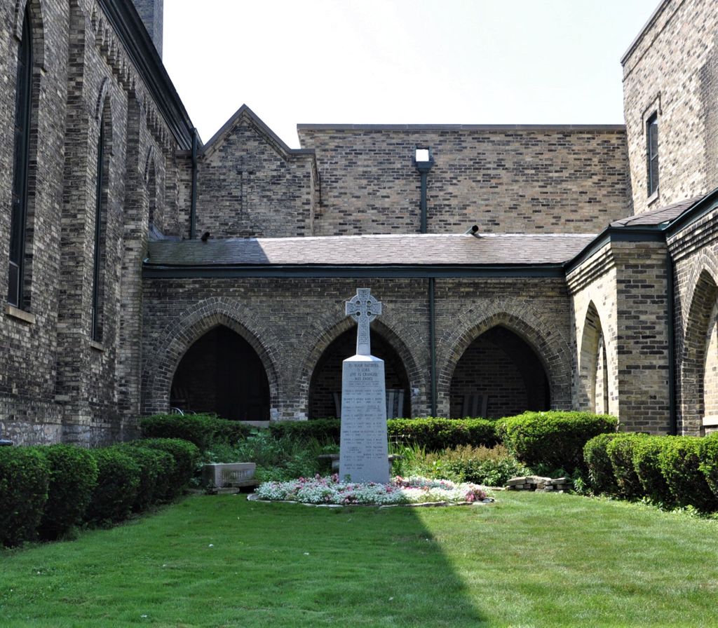
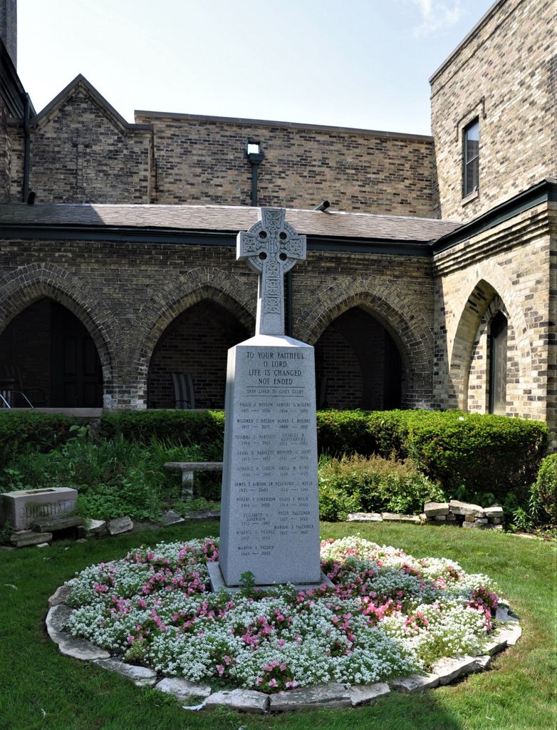
| Description | : | Saint Luke's Episcopal Church Columbarium is located in the courtyard of Saint Luke's Episcopal Church. It is located at the intersection of Main Street and 7th Street, both of which are also designated as Wisconsin Highway 32. |
frequently asked questions (FAQ):
-
Where is Saint Lukes Episcopal Church Columbarium?
Saint Lukes Episcopal Church Columbarium is located at 614 Main Street/Wisconsin State Highway 32 Racine, Racine County ,Wisconsin , 53403USA.
-
Saint Lukes Episcopal Church Columbarium cemetery's updated grave count on graveviews.com?
0 memorials
-
Where are the coordinates of the Saint Lukes Episcopal Church Columbarium?
Latitude: 42.7262800
Longitude: -87.7829500
Nearby Cemetories:
1. Collegiate Church of Saint John Chapel Grounds
Racine, Racine County, USA
Coordinate: 42.7054860, -87.7861730
2. Mound Cemetery
Racine, Racine County, USA
Coordinate: 42.7206001, -87.8131027
3. Calvary Catholic Cemetery & Mausoleum
Racine, Racine County, USA
Coordinate: 42.7263985, -87.8143997
4. Holy Cross Catholic Cemetery
Racine, Racine County, USA
Coordinate: 42.7242012, -87.8163986
5. Graceland Cemetery
Racine, Racine County, USA
Coordinate: 42.7263700, -87.8220000
6. Racine Jewish Memorial Cemetery
Racine, Racine County, USA
Coordinate: 42.7254900, -87.8276000
7. East Meadows Cemetery
Racine, Racine County, USA
Coordinate: 42.6975020, -87.8407900
8. Holy Cross Catholic Cemetery
Caledonia, Racine County, USA
Coordinate: 42.7919006, -87.8186035
9. Parker Family Cemetery
Sturtevant, Racine County, USA
Coordinate: 42.6973000, -87.8848400
10. West Lawn Memorial Park
Mount Pleasant, Racine County, USA
Coordinate: 42.7235985, -87.8972015
11. Holy Family Catholic Cemetery
Caledonia, Racine County, USA
Coordinate: 42.8011017, -87.8364029
12. Bohemian National Cemetery
Caledonia, Racine County, USA
Coordinate: 42.7987700, -87.8474700
13. Country Haven Cemetery
Caledonia, Racine County, USA
Coordinate: 42.7987010, -87.8487160
14. Pet Valhalla Cemetery
Franksville, Racine County, USA
Coordinate: 42.7545440, -87.9083540
15. B'nai Zedek Cemetery
Kenosha, Kenosha County, USA
Coordinate: 42.6255188, -87.8248978
16. Oakwood Cemetery
Somers, Kenosha County, USA
Coordinate: 42.6394005, -87.8743973
17. Saint George Cemetery
Kenosha, Kenosha County, USA
Coordinate: 42.6147003, -87.8238983
18. Caledonia Memorial Park
Caledonia, Racine County, USA
Coordinate: 42.8072014, -87.8955994
19. Colonel Howe Estate Cemetery
Kenosha, Kenosha County, USA
Coordinate: 42.6015010, -87.8222180
20. Historic Evangelical Lutheran Emanuel Cemetery
Oak Creek, Milwaukee County, USA
Coordinate: 42.8462400, -87.8542500
21. Trinity Evangelical Lutheran Cemetery
Caledonia, Racine County, USA
Coordinate: 42.8283653, -87.8954620
22. Sylvania Cemetery
Sylvania, Racine County, USA
Coordinate: 42.6819600, -87.9538400
23. Saint Casimir Cemetery
Kenosha, Kenosha County, USA
Coordinate: 42.6060982, -87.8641968
24. Sunset Ridge Memorial Park
Kenosha, Kenosha County, USA
Coordinate: 42.6007996, -87.8833008