
| Memorials | : | 0 |
| Location | : | Francisville, Boone County, USA |
| Coordinate | : | 39.1102982, -84.7474976 |
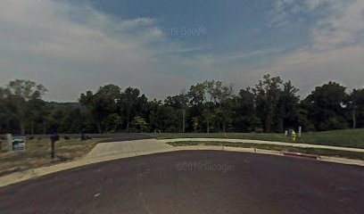
| Description | : | The grave site is located about 1000 feet northwest of the north end of Summerwoods Drive. The U.S. Geological Survey (USGS) Geographic Names Information System (GNIS) feature ID for the cemetery is 489877 (Colonal Abraham Depew Grave). The Boone County GIS unique ID assigned to this cemetery is 60 (Depew Cemetery). The cemetery has an index number of 61 (Depew) on the Boone County Kentucky Cemetery Map published in 2005 by the Boone County Planning Commission in conjunction with Johnson-Wilson Cemetery Stewards Association. The cemetery is identified as Depew in the index and listed as Depew Grave on page 151 of the book “Boone... Read More |
frequently asked questions (FAQ):
-
Where is Colonel Abraham Depew Grave?
Colonel Abraham Depew Grave is located at Summerwoods Drive Francisville, Boone County ,Kentucky , 41048USA.
-
Colonel Abraham Depew Grave cemetery's updated grave count on graveviews.com?
0 memorials
-
Where are the coordinates of the Colonel Abraham Depew Grave?
Latitude: 39.1102982
Longitude: -84.7474976
Nearby Cemetories:
1. Love Cemetery
Hebron, Boone County, USA
Coordinate: 39.1067060, -84.7486480
2. Bates Cemetery
Francisville, Boone County, USA
Coordinate: 39.1073980, -84.7582210
3. Whitaker Cemetery
Francisville, Boone County, USA
Coordinate: 39.1105995, -84.7699966
4. Sand Run Baptist Church Cemetery
Francisville, Boone County, USA
Coordinate: 39.1035156, -84.7259293
5. Graves-Duncan Cemetery
Francisville, Boone County, USA
Coordinate: 39.0963080, -84.7268580
6. Brown Cemetery
Francisville, Boone County, USA
Coordinate: 39.1239014, -84.7699966
7. Moore Cemetery
Taylorsport, Boone County, USA
Coordinate: 39.1136017, -84.7782974
8. Bateman Family Cemetery
Finney, Hamilton County, USA
Coordinate: 39.1278343, -84.7776871
9. Beasley Cemetery
Francisville, Boone County, USA
Coordinate: 39.1388890, -84.7588890
10. Gaines-Graves Cemetery
Idlewild, Boone County, USA
Coordinate: 39.0863800, -84.7716110
11. Watts Cemetery
Hebron, Boone County, USA
Coordinate: 39.0788994, -84.7427979
12. Souther Cemetery
Taylorsport, Boone County, USA
Coordinate: 39.0972830, -84.7071080
13. Bullittsburg Baptist Church Cemetery
Idlewild, Boone County, USA
Coordinate: 39.0898323, -84.7871399
14. William Henry Harrison Tomb State Memorial
North Bend, Hamilton County, USA
Coordinate: 39.1507610, -84.7509610
15. Congress Green Cemetery
North Bend, Hamilton County, USA
Coordinate: 39.1514700, -84.7540200
16. Taylorsport Cemetery
Taylorsport, Boone County, USA
Coordinate: 39.0996972, -84.6945611
17. Crisler-Millakin Place Cemetery
Burlington, Boone County, USA
Coordinate: 39.0676970, -84.7441380
18. McMurry Cemetery
Idlewild, Boone County, USA
Coordinate: 39.1044006, -84.8043976
19. Barnard Cemetery
Idlewild, Boone County, USA
Coordinate: 39.1044006, -84.8086014
20. Hicks Cemetery
Hebron, Boone County, USA
Coordinate: 39.0711110, -84.7013890
21. Botts Cemetery
Idlewild, Boone County, USA
Coordinate: 39.0783005, -84.8031006
22. Graves Family Cemetery
Petersburg, Boone County, USA
Coordinate: 39.0911110, -84.8130560
23. Van Blaricum Cemetery
Mack, Hamilton County, USA
Coordinate: 39.1335040, -84.6795180
24. Maple Grove Cemetery
Cleves, Hamilton County, USA
Coordinate: 39.1661710, -84.7665380