
| Memorials | : | 6 |
| Location | : | Francisville, Boone County, USA |
| Phone | : | (859) 689-7110 |
| Coordinate | : | 39.1035156, -84.7259293 |
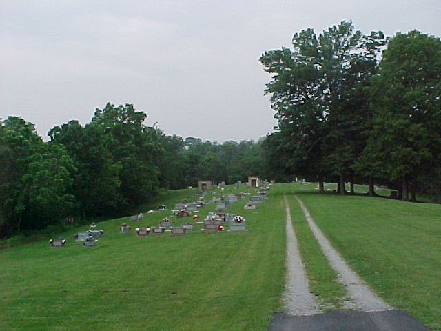
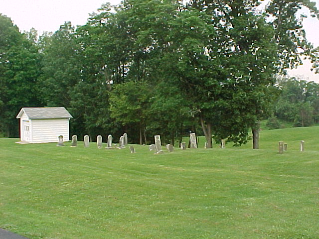
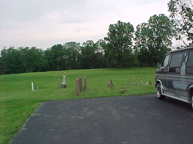
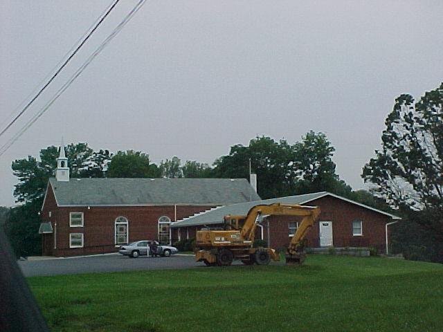
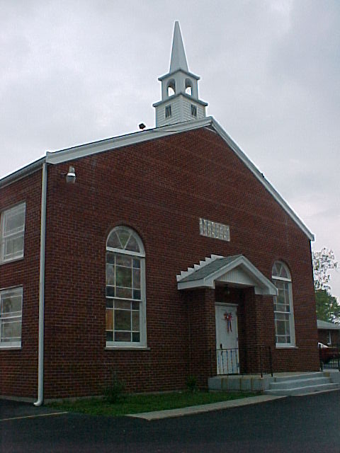
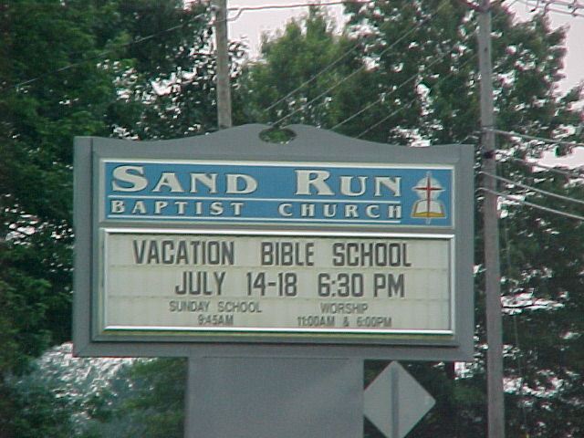
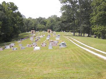
| Description | : | This active cemetery is located on the south side of the Sand Run Baptist Church on the northwest corner of the intersection of Sand Run Road and North Bend Road (Kentucky State Highway 237). The Boone County GIS unique ID assigned to this cemetery is 149 (Sand Run Baptist Cemetery). The cemetery has an index number of 151 (Sand Run Baptist) on the Boone County Kentucky Cemetery Map published in 2005 by the Boone County Planning Commission in conjunction with Johnson-Wilson Cemetery Stewards Association. The cemetery is identified as Sand Run Baptist Church in the index and listed as Sand Run Baptist Church... Read More |
frequently asked questions (FAQ):
-
Where is Sand Run Baptist Church Cemetery?
Sand Run Baptist Church Cemetery is located at 1327 North Bend Road Francisville, Boone County ,Kentucky , 41048USA.
-
Sand Run Baptist Church Cemetery cemetery's updated grave count on graveviews.com?
5 memorials
-
Where are the coordinates of the Sand Run Baptist Church Cemetery?
Latitude: 39.1035156
Longitude: -84.7259293
Nearby Cemetories:
1. Graves-Duncan Cemetery
Francisville, Boone County, USA
Coordinate: 39.0963080, -84.7268580
2. Souther Cemetery
Taylorsport, Boone County, USA
Coordinate: 39.0972830, -84.7071080
3. Love Cemetery
Hebron, Boone County, USA
Coordinate: 39.1067060, -84.7486480
4. Colonel Abraham Depew Grave
Francisville, Boone County, USA
Coordinate: 39.1102982, -84.7474976
5. Taylorsport Cemetery
Taylorsport, Boone County, USA
Coordinate: 39.0996972, -84.6945611
6. Bates Cemetery
Francisville, Boone County, USA
Coordinate: 39.1073980, -84.7582210
7. Watts Cemetery
Hebron, Boone County, USA
Coordinate: 39.0788994, -84.7427979
8. Whitaker Cemetery
Francisville, Boone County, USA
Coordinate: 39.1105995, -84.7699966
9. Hicks Cemetery
Hebron, Boone County, USA
Coordinate: 39.0711110, -84.7013890
10. Crisler-Millakin Place Cemetery
Burlington, Boone County, USA
Coordinate: 39.0676970, -84.7441380
11. Gaines-Graves Cemetery
Idlewild, Boone County, USA
Coordinate: 39.0863800, -84.7716110
12. Brown Cemetery
Francisville, Boone County, USA
Coordinate: 39.1239014, -84.7699966
13. Moore Cemetery
Taylorsport, Boone County, USA
Coordinate: 39.1136017, -84.7782974
14. Beasley Cemetery
Francisville, Boone County, USA
Coordinate: 39.1388890, -84.7588890
15. Hebron Lutheran Church Cemetery
Hebron, Boone County, USA
Coordinate: 39.0641677, -84.6988889
16. Crigler-Clore-Smith Cemetery
Hebron, Boone County, USA
Coordinate: 39.0580560, -84.7141670
17. Van Blaricum Cemetery
Mack, Hamilton County, USA
Coordinate: 39.1335040, -84.6795180
18. Bateman Family Cemetery
Finney, Hamilton County, USA
Coordinate: 39.1278343, -84.7776871
19. Bullittsburg Baptist Church Cemetery
Idlewild, Boone County, USA
Coordinate: 39.0898323, -84.7871399
20. William Henry Harrison Tomb State Memorial
North Bend, Hamilton County, USA
Coordinate: 39.1507610, -84.7509610
21. Congress Green Cemetery
North Bend, Hamilton County, USA
Coordinate: 39.1514700, -84.7540200
22. Klasserner-Wilson Family Cemetery
Taylorsport, Boone County, USA
Coordinate: 39.0895810, -84.6596880
23. Markland Cemetery
Hamilton County, USA
Coordinate: 39.1479300, -84.6870800
24. Darby-Lee Cemetery
Delhi, Hamilton County, USA
Coordinate: 39.0995930, -84.6535850