
| Memorials | : | 1 |
| Location | : | Hebron, Boone County, USA |
| Coordinate | : | 39.0788994, -84.7427979 |
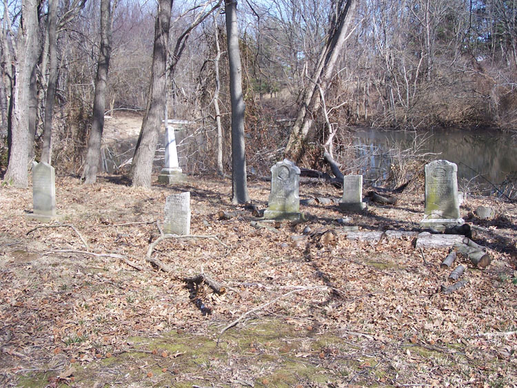
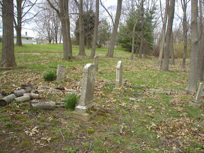
| Description | : | The cemetery is located on the north side of Petersburg Road (Kentucky State Highway 20) about 2.4 miles west of its intersection with North Bend Road (Kentucky State Highway 237). The U.S. Geological Survey (USGS) Geographic Names Information System (GNIS) feature ID for the cemetery is 509437 (Watts Cemetery). The Boone County GIS unique ID assigned to this cemetery is 186 (Watts Cemetery). The cemetery has an index number of 187 (Watts) on the Boone County Kentucky Cemetery Map published in 2005 by the Boone County Planning Commission in conjunction with Johnson-Wilson Cemetery Stewards Association. The cemetery is identified as Watts in the index... Read More |
frequently asked questions (FAQ):
-
Where is Watts Cemetery?
Watts Cemetery is located at 3190 Petersburg Road (Kentucky State Highway 20) Hebron, Boone County ,Kentucky , 41005USA.
-
Watts Cemetery cemetery's updated grave count on graveviews.com?
1 memorials
-
Where are the coordinates of the Watts Cemetery?
Latitude: 39.0788994
Longitude: -84.7427979
Nearby Cemetories:
1. Crisler-Millakin Place Cemetery
Burlington, Boone County, USA
Coordinate: 39.0676970, -84.7441380
2. Graves-Duncan Cemetery
Francisville, Boone County, USA
Coordinate: 39.0963080, -84.7268580
3. Gaines-Graves Cemetery
Idlewild, Boone County, USA
Coordinate: 39.0863800, -84.7716110
4. Sand Run Baptist Church Cemetery
Francisville, Boone County, USA
Coordinate: 39.1035156, -84.7259293
5. Love Cemetery
Hebron, Boone County, USA
Coordinate: 39.1067060, -84.7486480
6. Crigler-Clore-Smith Cemetery
Hebron, Boone County, USA
Coordinate: 39.0580560, -84.7141670
7. Bates Cemetery
Francisville, Boone County, USA
Coordinate: 39.1073980, -84.7582210
8. Duncan Cemetery
Burlington, Boone County, USA
Coordinate: 39.0478230, -84.7459560
9. Colonel Abraham Depew Grave
Francisville, Boone County, USA
Coordinate: 39.1102982, -84.7474976
10. Hicks Cemetery
Hebron, Boone County, USA
Coordinate: 39.0711110, -84.7013890
11. Souther Cemetery
Taylorsport, Boone County, USA
Coordinate: 39.0972830, -84.7071080
12. Bullittsburg Baptist Church Cemetery
Idlewild, Boone County, USA
Coordinate: 39.0898323, -84.7871399
13. Hebron Lutheran Church Cemetery
Hebron, Boone County, USA
Coordinate: 39.0641677, -84.6988889
14. Whitaker Cemetery
Francisville, Boone County, USA
Coordinate: 39.1105995, -84.7699966
15. Zinn Cemetery
Burlington, Boone County, USA
Coordinate: 39.0447220, -84.7183330
16. Utz Slave Cemetery
Burlington, Boone County, USA
Coordinate: 39.0416670, -84.7172220
17. Utz Cemetery
Burlington, Boone County, USA
Coordinate: 39.0414170, -84.7177350
18. Taylorsport Cemetery
Taylorsport, Boone County, USA
Coordinate: 39.0996972, -84.6945611
19. Boone County Infirmary Cemetery
Burlington, Boone County, USA
Coordinate: 39.0350560, -84.7384820
20. Moore Cemetery
Taylorsport, Boone County, USA
Coordinate: 39.1136017, -84.7782974
21. Potters Field Cemetery
Burlington, Boone County, USA
Coordinate: 39.0341670, -84.7319440
22. Botts Cemetery
Idlewild, Boone County, USA
Coordinate: 39.0783005, -84.8031006
23. Rouse-Utz Cemetery
Burlington, Boone County, USA
Coordinate: 39.0372220, -84.7127780
24. Johnson-Wilson Cemetery
Burlington, Boone County, USA
Coordinate: 39.0299150, -84.7434200