
| Memorials | : | 0 |
| Location | : | Taylorsport, Boone County, USA |
| Coordinate | : | 39.0972830, -84.7071080 |
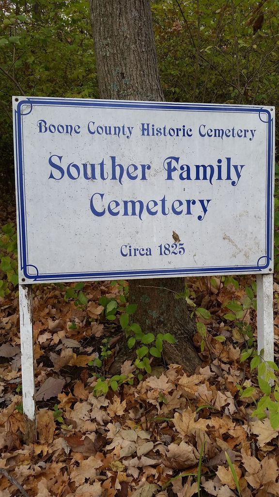
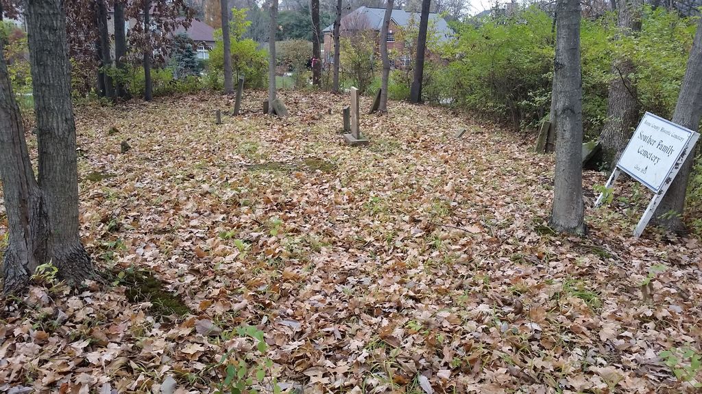
| Description | : | The cemetery is located in the Parlor Grove Subdivision south of the south end of Blair Drive. Burials occurred between 1825 and 1856. The Boone County GIS unique ID assigned to this cemetery is 156 (Souther Cemetery). The cemetery has an index number of 158 (Souther) on the Boone County Kentucky Cemetery Map published in 2005 by the Boone County Planning Commission in conjunction with Johnson-Wilson Cemetery Stewards Association. The cemetery is identified as Souther in the index and listed as Souther Cemetery on page 71 of the book “Boone County, Kentucky Cemeteries” by Stephen W. Worrel, M.A. & Anne W. Fitzgerald, B.S.,... Read More |
frequently asked questions (FAQ):
-
Where is Souther Cemetery?
Souther Cemetery is located at 2214-2221 Blair Drive Taylorsport, Boone County ,Kentucky , 41048USA.
-
Souther Cemetery cemetery's updated grave count on graveviews.com?
0 memorials
-
Where are the coordinates of the Souther Cemetery?
Latitude: 39.0972830
Longitude: -84.7071080
Nearby Cemetories:
1. Taylorsport Cemetery
Taylorsport, Boone County, USA
Coordinate: 39.0996972, -84.6945611
2. Graves-Duncan Cemetery
Francisville, Boone County, USA
Coordinate: 39.0963080, -84.7268580
3. Sand Run Baptist Church Cemetery
Francisville, Boone County, USA
Coordinate: 39.1035156, -84.7259293
4. Hicks Cemetery
Hebron, Boone County, USA
Coordinate: 39.0711110, -84.7013890
5. Watts Cemetery
Hebron, Boone County, USA
Coordinate: 39.0788994, -84.7427979
6. Love Cemetery
Hebron, Boone County, USA
Coordinate: 39.1067060, -84.7486480
7. Hebron Lutheran Church Cemetery
Hebron, Boone County, USA
Coordinate: 39.0641677, -84.6988889
8. Colonel Abraham Depew Grave
Francisville, Boone County, USA
Coordinate: 39.1102982, -84.7474976
9. Klasserner-Wilson Family Cemetery
Taylorsport, Boone County, USA
Coordinate: 39.0895810, -84.6596880
10. Crigler-Clore-Smith Cemetery
Hebron, Boone County, USA
Coordinate: 39.0580560, -84.7141670
11. Bates Cemetery
Francisville, Boone County, USA
Coordinate: 39.1073980, -84.7582210
12. Crisler-Millakin Place Cemetery
Burlington, Boone County, USA
Coordinate: 39.0676970, -84.7441380
13. Darby-Lee Cemetery
Delhi, Hamilton County, USA
Coordinate: 39.0995930, -84.6535850
14. Van Blaricum Cemetery
Mack, Hamilton County, USA
Coordinate: 39.1335040, -84.6795180
15. Nancy Harper Cemetery (Defunct)
Stringtown, Boone County, USA
Coordinate: 39.0800000, -84.6550000
16. Sisters of Charity Cemetery
Cincinnati, Hamilton County, USA
Coordinate: 39.0992700, -84.6476200
17. Schumann Cemetery
Cincinnati, Hamilton County, USA
Coordinate: 39.0926860, -84.6464460
18. Calvin Peeno Cemetery
Stringtown, Boone County, USA
Coordinate: 39.0815917, -84.6461861
19. Whitaker Cemetery
Francisville, Boone County, USA
Coordinate: 39.1105995, -84.7699966
20. McNeal Family Cemetery
Florence, Boone County, USA
Coordinate: 39.0638790, -84.6581350
21. Gaines-Graves Cemetery
Idlewild, Boone County, USA
Coordinate: 39.0863800, -84.7716110
22. Markland Cemetery
Hamilton County, USA
Coordinate: 39.1479300, -84.6870800
23. Laycock Farm Cemetery
Anderson Ferry, Hamilton County, USA
Coordinate: 39.0877780, -84.6399190
24. Peeno Cemetery
Constance, Boone County, USA
Coordinate: 39.0752983, -84.6446991