
| Memorials | : | 0 |
| Location | : | Wendover, Aylesbury Vale District, England |
| Coordinate | : | 51.7530340, -0.7716060 |
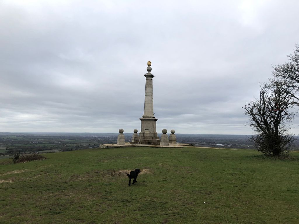
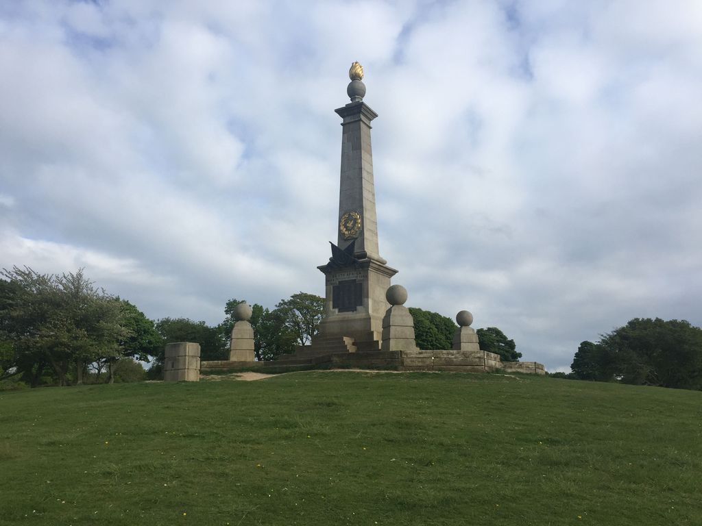
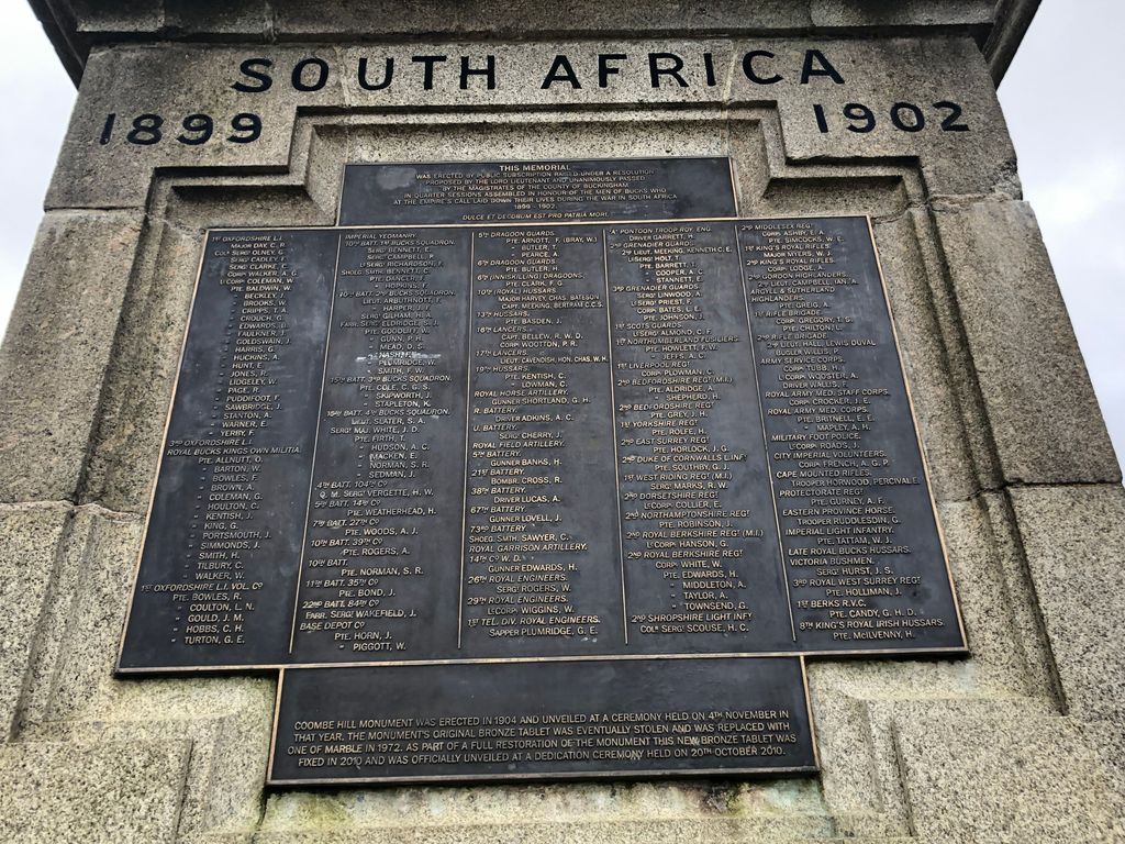
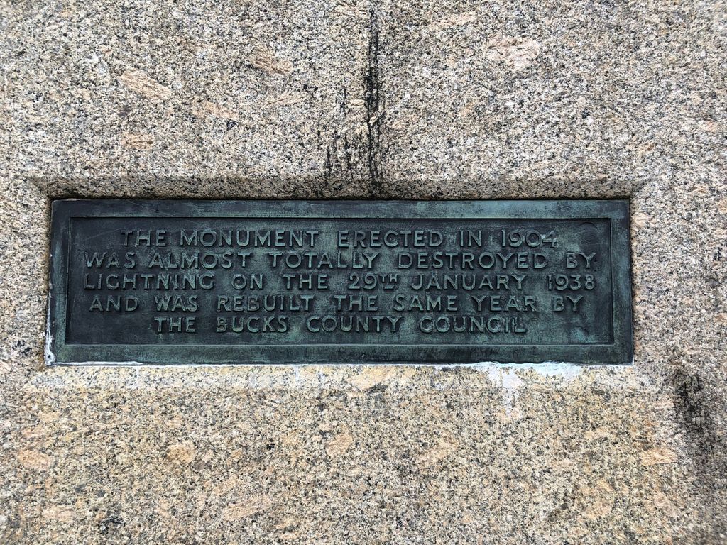
| Description | : | *A note from the Curators: No individual memorials are to be created for local military service monuments. This is a commemoration memorial only. This Grade II Listed monument was created for the men of Buckinghamshire who died in the Second Boer War (1899 - 1902). |
frequently asked questions (FAQ):
-
Where is Coombe Hill Second Boer War Monument?
Coombe Hill Second Boer War Monument is located at Wendover, Aylesbury Vale District ,Buckinghamshire ,England.
-
Coombe Hill Second Boer War Monument cemetery's updated grave count on graveviews.com?
0 memorials
-
Where are the coordinates of the Coombe Hill Second Boer War Monument?
Latitude: 51.7530340
Longitude: -0.7716060
Nearby Cemetories:
1. Ss. Peter and Paul Churchyard
Ellesborough, Wycombe District, England
Coordinate: 51.7528350, -0.7898410
2. All Saints Churchyard
Little Kimble, Wycombe District, England
Coordinate: 51.7504600, -0.8042100
3. St Mary Churchyard
Wendover, Aylesbury Vale District, England
Coordinate: 51.7578360, -0.7390050
4. St. Nicholas Churchyard
Great Kimble, Wycombe District, England
Coordinate: 51.7463600, -0.8053600
5. Little Hampden Churchyard
Little Hampden, Wycombe District, England
Coordinate: 51.7237241, -0.7556049
6. St Mary the Virgin Churchyard
Weston Turville, Aylesbury Vale District, England
Coordinate: 51.7846280, -0.7557710
7. St. Mary the Virgin Churchyard
Stoke Mandeville, Aylesbury Vale District, England
Coordinate: 51.7861990, -0.7913990
8. St. Michael Churchyard
Halton, Aylesbury Vale District, England
Coordinate: 51.7828900, -0.7341500
9. St Dunstan Churchyard
Monks Risborough, Wycombe District, England
Coordinate: 51.7320710, -0.8253050
10. St Mary Magdalene Churchyard
Great Hampden, Wycombe District, England
Coordinate: 51.7136220, -0.7732700
11. Stratton Memorial Gardens
Princes Risborough, Wycombe District, England
Coordinate: 51.7281320, -0.8247490
12. Baptist Church Cemetery
Princes Risborough, Wycombe District, England
Coordinate: 51.7220500, -0.8296700
13. St Mary Churchyard
Princes Risborough, Wycombe District, England
Coordinate: 51.7242980, -0.8340970
14. St. John The Baptist Churchyard
The Lee, Chiltern District, England
Coordinate: 51.7309539, -0.6998248
15. St. Michael and All Angels Churchyard
Aston Clinton, Aylesbury Vale District, England
Coordinate: 51.7993580, -0.7261320
16. St. Leonard's Churchyard
St Leonards, Chiltern District, England
Coordinate: 51.7547000, -0.6830429
17. Lee Common Primitive Methodist Chapel
Great Missenden, Chiltern District, England
Coordinate: 51.7286620, -0.6853732
18. St. Michael's and All Angels Churchyard
Horsenden, Wycombe District, England
Coordinate: 51.7193800, -0.8527040
19. All Saints Churchyard
Buckland, Aylesbury Vale District, England
Coordinate: 51.8037310, -0.7134010
20. Lacey Green Methodist Cemetery
Lacey Green, Wycombe District, England
Coordinate: 51.6962930, -0.8138030
21. Speen Baptist Churchyard
Wycombe District, England
Coordinate: 51.6903980, -0.7796780
22. Loosley Row Cemetery
Losley Row, Wycombe District, England
Coordinate: 51.6974200, -0.8190600
23. St Mary's Ballinger
Great Missenden, Chiltern District, England
Coordinate: 51.7202550, -0.6832341
24. Tring Road Cemetery
Aylesbury, Aylesbury Vale District, England
Coordinate: 51.8149700, -0.7979560