
| Memorials | : | 0 |
| Location | : | Weston Turville, Aylesbury Vale District, England |
| Coordinate | : | 51.7846280, -0.7557710 |
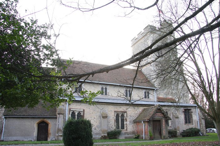
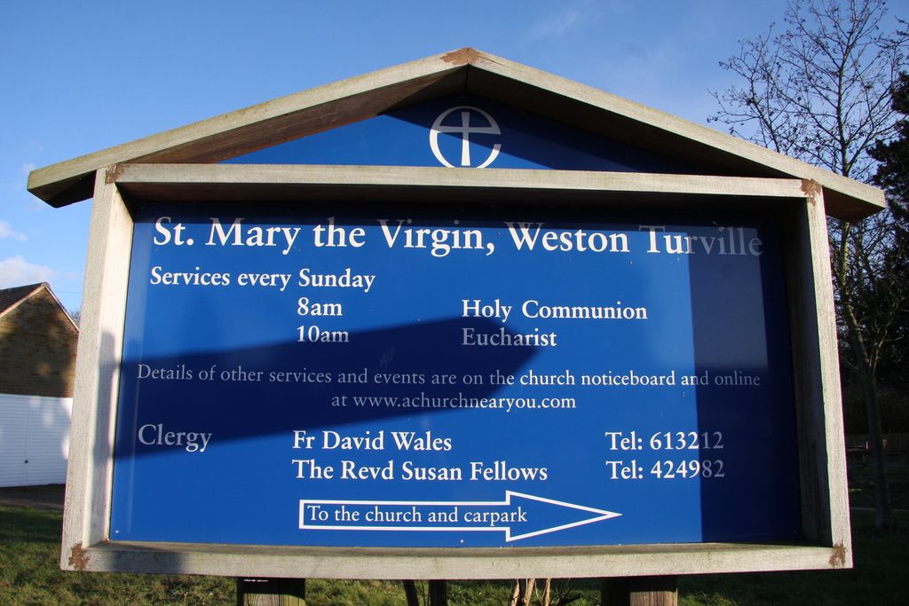
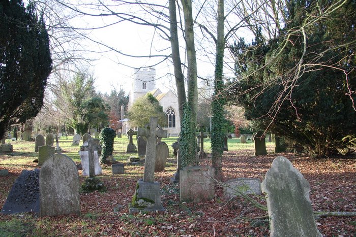
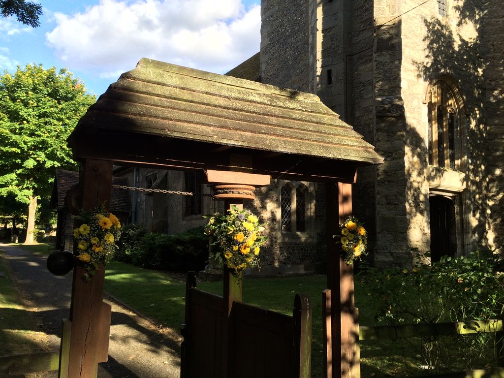
| Description | : | Weston Turville is a village and also a civil parish within Aylesbury Vale district in Buckinghamshire, England. It is located about a mile and a half south east of Aylesbury and the parish is bisected across the top by Akeman Street. St. Mary the Virgin is the Parish church for Weston Turville. A church has existed on the land at the end of Church Walk since the 12th century; however all that remains of the original church is the font and an octagonal shaft built into the south wall of the chancel. added by wertypop |
frequently asked questions (FAQ):
-
Where is St Mary the Virgin Churchyard?
St Mary the Virgin Churchyard is located at Weston Turville, Aylesbury Vale District ,Buckinghamshire ,England.
-
St Mary the Virgin Churchyard cemetery's updated grave count on graveviews.com?
0 memorials
-
Where are the coordinates of the St Mary the Virgin Churchyard?
Latitude: 51.7846280
Longitude: -0.7557710
Nearby Cemetories:
1. St. Michael Churchyard
Halton, Aylesbury Vale District, England
Coordinate: 51.7828900, -0.7341500
2. St. Mary the Virgin Churchyard
Stoke Mandeville, Aylesbury Vale District, England
Coordinate: 51.7861990, -0.7913990
3. St. Michael and All Angels Churchyard
Aston Clinton, Aylesbury Vale District, England
Coordinate: 51.7993580, -0.7261320
4. St Mary Churchyard
Wendover, Aylesbury Vale District, England
Coordinate: 51.7578360, -0.7390050
5. All Saints Churchyard
Buckland, Aylesbury Vale District, England
Coordinate: 51.8037310, -0.7134010
6. Coombe Hill Second Boer War Monument
Wendover, Aylesbury Vale District, England
Coordinate: 51.7530340, -0.7716060
7. Ss. Peter and Paul Churchyard
Ellesborough, Wycombe District, England
Coordinate: 51.7528350, -0.7898410
8. Tring Road Cemetery
Aylesbury, Aylesbury Vale District, England
Coordinate: 51.8149700, -0.7979560
9. St Mary the Virgin Churchyard
Drayton Beauchamp, Aylesbury Vale District, England
Coordinate: 51.7979700, -0.6936800
10. All Saints Churchyard
Little Kimble, Wycombe District, England
Coordinate: 51.7504600, -0.8042100
11. Aylesbury Prison Cemetery
Aylesbury, Aylesbury Vale District, England
Coordinate: 51.8219070, -0.7995920
12. Castle Street Chapel Burial Ground
Aylesbury, Aylesbury Vale District, England
Coordinate: 51.8165570, -0.8157510
13. St. Nicholas Churchyard
Great Kimble, Wycombe District, England
Coordinate: 51.7463600, -0.8053600
14. St. James the Great Churchyard
Bierton-with-Broughton, Aylesbury Vale District, England
Coordinate: 51.8297345, -0.7880557
15. St Mary the Virgin Churchyard
Aylesbury, Aylesbury Vale District, England
Coordinate: 51.8178300, -0.8159800
16. Tring Cemetery
Tring, Dacorum Borough, England
Coordinate: 51.7893700, -0.6754900
17. Bierton Wesleyan Chapel
Bierton-with-Broughton, Aylesbury Vale District, England
Coordinate: 51.8333290, -0.7816600
18. Bierton Strict Baptist Chapel Burial Ground
Bierton-with-Broughton, Aylesbury Vale District, England
Coordinate: 51.8333930, -0.7827580
19. St. Leonard's Churchyard
St Leonards, Chiltern District, England
Coordinate: 51.7547000, -0.6830429
20. Wilstone Cemetery
Wilstone, Dacorum Borough, England
Coordinate: 51.8123300, -0.6773960
21. All Saints Churchyard
Hulcott, Aylesbury Vale District, England
Coordinate: 51.8423500, -0.7632300
22. Akeman Street Baptist Churchyard
Tring, Dacorum Borough, England
Coordinate: 51.7929500, -0.6624700
23. All Saints Churchyard
Long Marston, Dacorum Borough, England
Coordinate: 51.8340100, -0.7029500
24. Aylesbury Vale Crematorium
Aylesbury Vale District, England
Coordinate: 51.8335320, -0.8115783