
| Memorials | : | 1 |
| Location | : | Ellesborough, Wycombe District, England |
| Coordinate | : | 51.7528350, -0.7898410 |
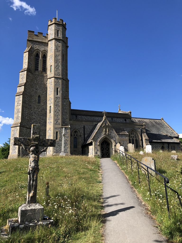
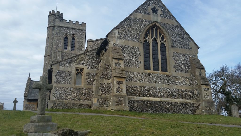
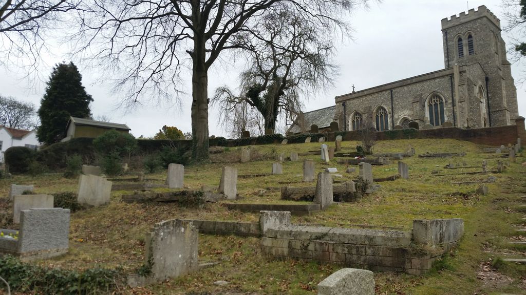
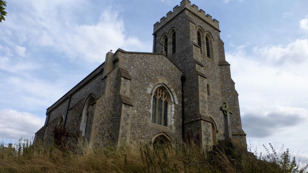
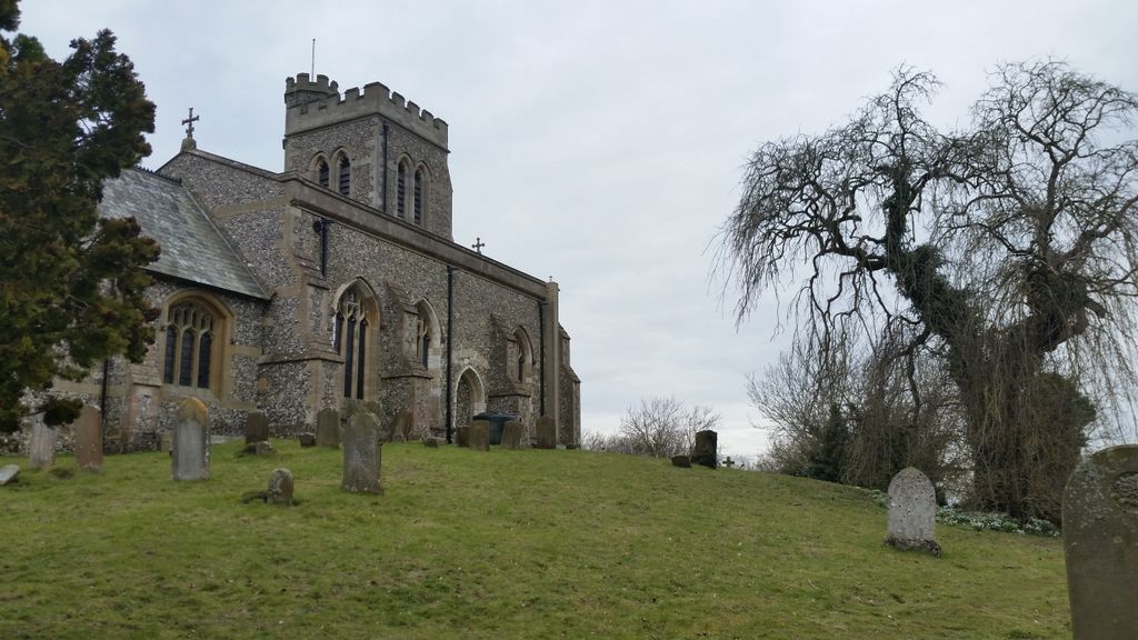
| Description | : | There are no visible traces of any church building before the 15th century although there are records of the names of Rectors from 1324 on a panel inside the church. Over the centuries there were reports of the church being in virtual decay and externally very few traces of the original structure remain as the walls were refaced as part of a 19th century restoration. Internally, however, there is much more remaining from the 15th century. The earliest gravestone in the churchyard is dated 1692 but unfortunately the name of the deceased cannot be read. The nearby Chequers Estate was... Read More |
frequently asked questions (FAQ):
-
Where is Ss. Peter and Paul Churchyard?
Ss. Peter and Paul Churchyard is located at Ellesborough, Wycombe District ,Buckinghamshire ,England.
-
Ss. Peter and Paul Churchyard cemetery's updated grave count on graveviews.com?
1 memorials
-
Where are the coordinates of the Ss. Peter and Paul Churchyard?
Latitude: 51.7528350
Longitude: -0.7898410
Nearby Cemetories:
1. All Saints Churchyard
Little Kimble, Wycombe District, England
Coordinate: 51.7504600, -0.8042100
2. Coombe Hill Second Boer War Monument
Wendover, Aylesbury Vale District, England
Coordinate: 51.7530340, -0.7716060
3. St. Nicholas Churchyard
Great Kimble, Wycombe District, England
Coordinate: 51.7463600, -0.8053600
4. St Dunstan Churchyard
Monks Risborough, Wycombe District, England
Coordinate: 51.7320710, -0.8253050
5. St Mary Churchyard
Wendover, Aylesbury Vale District, England
Coordinate: 51.7578360, -0.7390050
6. Stratton Memorial Gardens
Princes Risborough, Wycombe District, England
Coordinate: 51.7281320, -0.8247490
7. St. Mary the Virgin Churchyard
Stoke Mandeville, Aylesbury Vale District, England
Coordinate: 51.7861990, -0.7913990
8. Little Hampden Churchyard
Little Hampden, Wycombe District, England
Coordinate: 51.7237241, -0.7556049
9. St Mary the Virgin Churchyard
Weston Turville, Aylesbury Vale District, England
Coordinate: 51.7846280, -0.7557710
10. Baptist Church Cemetery
Princes Risborough, Wycombe District, England
Coordinate: 51.7220500, -0.8296700
11. St Mary Churchyard
Princes Risborough, Wycombe District, England
Coordinate: 51.7242980, -0.8340970
12. St Mary Magdalene Churchyard
Great Hampden, Wycombe District, England
Coordinate: 51.7136220, -0.7732700
13. St. Michael Churchyard
Halton, Aylesbury Vale District, England
Coordinate: 51.7828900, -0.7341500
14. St. Michael's and All Angels Churchyard
Horsenden, Wycombe District, England
Coordinate: 51.7193800, -0.8527040
15. Ss. Mary and Nicholas Churchyard
Saunderton, Wycombe District, England
Coordinate: 51.7101051, -0.8499552
16. Loosley Row Cemetery
Losley Row, Wycombe District, England
Coordinate: 51.6974200, -0.8190600
17. Lacey Green Methodist Cemetery
Lacey Green, Wycombe District, England
Coordinate: 51.6962930, -0.8138030
18. St. John The Baptist Churchyard
The Lee, Chiltern District, England
Coordinate: 51.7309539, -0.6998248
19. St. Michael and All Angels Churchyard
Aston Clinton, Aylesbury Vale District, England
Coordinate: 51.7993580, -0.7261320
20. St. Peter's Churchyard
Ilmer, Wycombe District, England
Coordinate: 51.7428914, -0.8873946
21. St John the Evangelist Churchyard
Lacey Green, Wycombe District, England
Coordinate: 51.6916100, -0.8081580
22. Tring Road Cemetery
Aylesbury, Aylesbury Vale District, England
Coordinate: 51.8149700, -0.7979560
23. Speen Baptist Churchyard
Wycombe District, England
Coordinate: 51.6903980, -0.7796780
24. St. Mary's Churchyard
Hartwell, Aylesbury Vale District, England
Coordinate: 51.8052662, -0.8484938