
| Memorials | : | 2 |
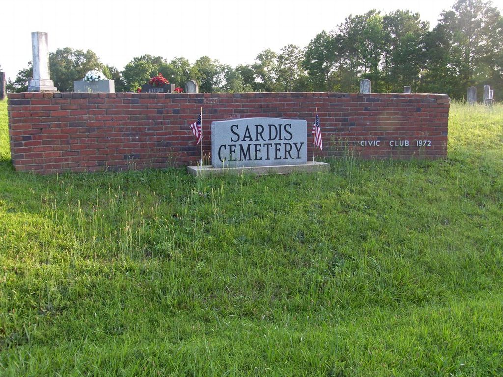
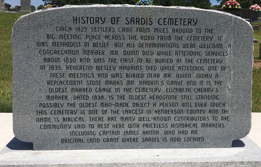
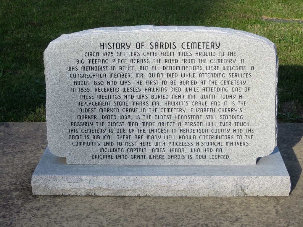
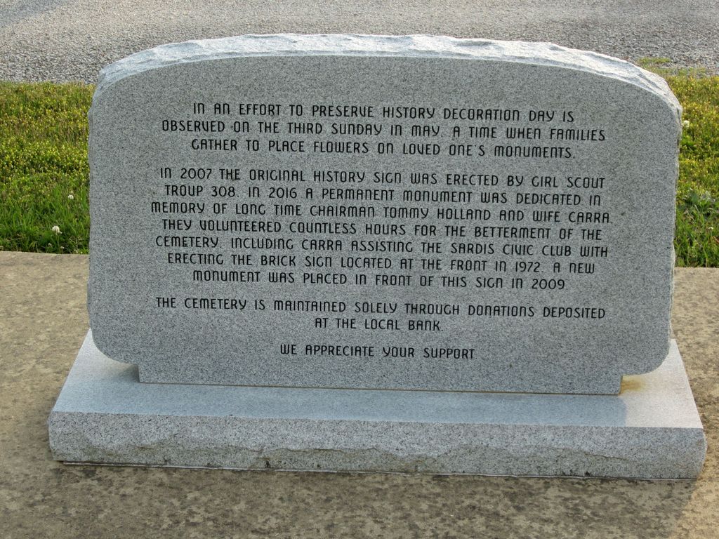
| Location | : | Sardis, Henderson County, USA |
| Coordinate | : | 35.4366020, -88.2833100 |
| Description | : | From the intersection of TN-201 & TN-104 E, in Sardis, travel east on TN-104 for 0.8 mi. to this large cemetery on the south (right) of the highway. |
frequently asked questions (FAQ):
-
Where is Sardis Cemetery?
Sardis Cemetery is located at 35601 TN-104 Sardis, Henderson County ,Tennessee , 38371USA.
-
Sardis Cemetery cemetery's updated grave count on graveviews.com?
2 memorials
-
Where are the coordinates of the Sardis Cemetery?
Latitude: 35.4366020
Longitude: -88.2833100

Nearby Cemetories:
1. McBride Cemetery
Sardis, Henderson County, USA
Coordinate: 35.4406013, -88.3106003
2. Spring Hill Cemetery
Sardis, Henderson County, USA
Coordinate: 35.4277992, -88.3091965
3. Prospect Church Cemetery
Sardis, Henderson County, USA
Coordinate: 35.4584950, -88.2683120
4. Pleasant View Cemetery
Sardis, Henderson County, USA
Coordinate: 35.4639730, -88.3019970
5. Lowery-Doe Creek Cemetery
Decatur County, USA
Coordinate: 35.4483120, -88.2468900
6. Hanna Cemetery
Hinkle, Hardin County, USA
Coordinate: 35.3991600, -88.3006680
7. Hurricane Church Cemetery
Hinkle, Hardin County, USA
Coordinate: 35.4080320, -88.3240380
8. Doe Creek Cemetery
Scotts Hill, Henderson County, USA
Coordinate: 35.4692990, -88.2474350
9. Little Hurricane Cemetery
Sardis, Henderson County, USA
Coordinate: 35.4605060, -88.3302360
10. Cedar Grove Cemetery
Henderson County, USA
Coordinate: 35.4799600, -88.2678900
11. Cedar Grove Pentecostal Cemetery
Sardis, Henderson County, USA
Coordinate: 35.4829530, -88.2698440
12. Liberty Church Cemetery
Scotts Hill, Decatur County, USA
Coordinate: 35.4466050, -88.2146570
13. Brazelton Cemetery
Lebanon, Hardin County, USA
Coordinate: 35.3868220, -88.3217120
14. Granny Austin Cemetery
Scotts Hill, Henderson County, USA
Coordinate: 35.4949850, -88.2734300
15. Marl Bluff Cemetery
Sardis, Henderson County, USA
Coordinate: 35.4570870, -88.3561740
16. Fellowship Church Cemetery
Scotts Hill, Henderson County, USA
Coordinate: 35.4965940, -88.2602540
17. Corinth Church Cemetery
Decatur County, USA
Coordinate: 35.4126020, -88.2056180
18. Lebanon Cemetery
Lebanon, Hardin County, USA
Coordinate: 35.3683014, -88.2941971
19. Patterson Cemetery
Lick Skillet, Decatur County, USA
Coordinate: 35.4383800, -88.1979020
20. Benson Cemetery
Chester County, USA
Coordinate: 35.4453011, -88.3685989
21. Carter Cemetery
Hardin County, USA
Coordinate: 35.3731003, -88.2407990
22. Bethel Cemetery
Scotts Hill, Decatur County, USA
Coordinate: 35.4963690, -88.2320790
23. Edge Cemetery
Reagan, Henderson County, USA
Coordinate: 35.4788830, -88.3620300
24. Scotts Hill Pentecostal Church Cemetery
Scotts Hill, Decatur County, USA
Coordinate: 35.5065610, -88.2336080