
| Memorials | : | 0 |
| Location | : | Derwent and Hope Woodlands, High Peak Borough, England |
| Coordinate | : | 53.3932000, -1.7239000 |
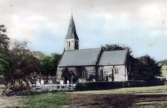
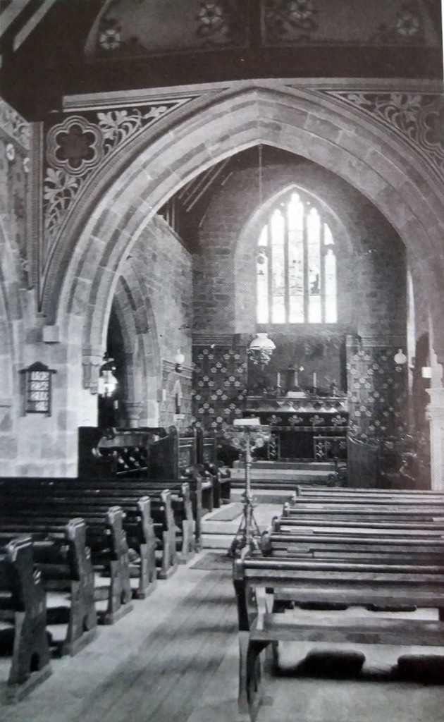
| Description | : | Derwent Woodlands church was lost when Ladybower Reservoir was filled in 1944. |
frequently asked questions (FAQ):
-
Where is Derwent Woodlands Churchyard?
Derwent Woodlands Churchyard is located at Derwent and Hope Woodlands, High Peak Borough ,Derbyshire ,England.
-
Derwent Woodlands Churchyard cemetery's updated grave count on graveviews.com?
0 memorials
-
Where are the coordinates of the Derwent Woodlands Churchyard?
Latitude: 53.3932000
Longitude: -1.7239000
Nearby Cemetories:
1. Hope Cemetery
Hope, High Peak Borough, England
Coordinate: 53.3523100, -1.7418640
2. Our Lady of Sorrows RC Churchyard
Bamford, High Peak Borough, England
Coordinate: 53.3509230, -1.6915140
3. Thornhill Methodist Churchyard
Thornhill, High Peak Borough, England
Coordinate: 53.3481140, -1.7042620
4. St Peter's Churchyard
Hope, High Peak Borough, England
Coordinate: 53.3476570, -1.7424920
5. St. John the Baptist Churchyard
Bamford, High Peak Borough, England
Coordinate: 53.3468590, -1.6896950
6. St. Edmund's Churchyard
Castleton, High Peak Borough, England
Coordinate: 53.3428300, -1.7758600
7. Church of the Holy and Undivided Trinity
Edale, High Peak Borough, England
Coordinate: 53.3688190, -1.8154910
8. Bethlehem Churchyard
Bradwell, Derbyshire Dales District, England
Coordinate: 53.3277120, -1.7417070
9. St Barnabas Churchyard
Bradwell, Derbyshire Dales District, England
Coordinate: 53.3263560, -1.7387040
10. Methodist Chapel Graveyard
Bradwell, Derbyshire Dales District, England
Coordinate: 53.3264690, -1.7417860
11. Edale Methodist Chapel
Edale, High Peak Borough, England
Coordinate: 53.3601000, -1.8315000
12. St Michael and All Angels Churchyard
Hathersage, Derbyshire Dales District, England
Coordinate: 53.3330570, -1.6501020
13. Saint Nicholas Churchyard
High Bradfield, Metropolitan Borough of Sheffield, England
Coordinate: 53.4291200, -1.5991120
14. Hamlet of Bretton
Eyam, Derbyshire Dales District, England
Coordinate: 53.2979962, -1.7008309
15. Methodist Churchyard
Great Hucklow, Derbyshire Dales District, England
Coordinate: 53.2970009, -1.7330000
16. Stannington Unitarian Chapel
Stannington, Metropolitan Borough of Sheffield, England
Coordinate: 53.3941350, -1.5556060
17. Underbank Unitarian Chapel
High Bradfield, Metropolitan Borough of Sheffield, England
Coordinate: 53.3942504, -1.5554100
18. Wesleyan Chapel
Peak Forest, High Peak Borough, England
Coordinate: 53.3116840, -1.8302360
19. Charles King and Martyr Parish Churchyard
Peak Forest, High Peak Borough, England
Coordinate: 53.3095830, -1.8303960
20. Christ Church Churchyard
Stannington, Metropolitan Borough of Sheffield, England
Coordinate: 53.3918830, -1.5469320
21. Stannington Methodist Churchyard
Stannington, Metropolitan Borough of Sheffield, England
Coordinate: 53.3939340, -1.5454460
22. Trot Lane Private Cemetery
Foolow, Derbyshire Dales District, England
Coordinate: 53.2872651, -1.7434660
23. Loxley United Reformed Chapelyard
Sheffield, Metropolitan Borough of Sheffield, England
Coordinate: 53.4074490, -1.5459890
24. Loxley United Reformed Church
Bradfield, Metropolitan Borough of Sheffield, England
Coordinate: 53.4074084, -1.5456459