
| Memorials | : | 0 |
| Location | : | Gaithersburg, Montgomery County, USA |
| Coordinate | : | 39.1325400, -77.1962900 |
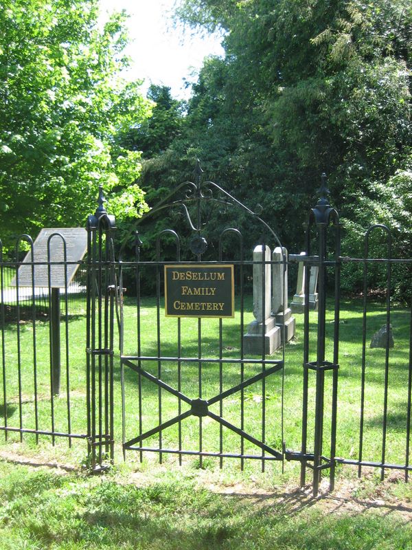
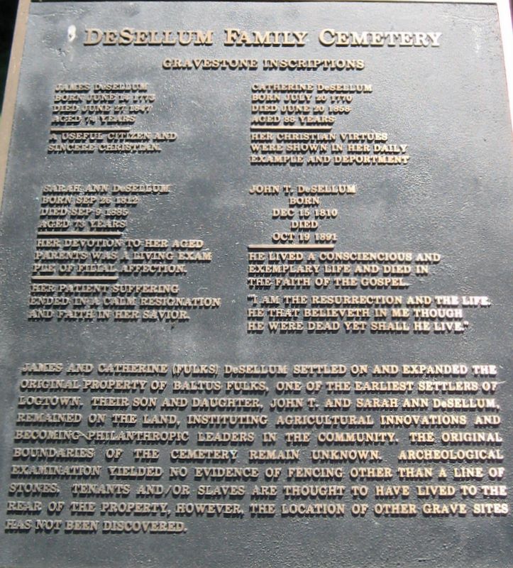
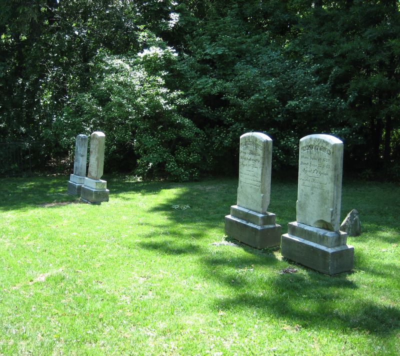
| Description | : | The cemetery is on the grounds of Bohrer Park at Summit Hall Farm. This site was home to the original Logtown Settlement (1769), billeted Confederate forces during the Civil War, and in the 1940s became the country's first commercial turf farm. James and Catharine (Fulks) DeSellum settled on Summit Hall Farm and expanded the original property of Baltus Fulks, one of the earliest settlers of Logtown (now Gaithersburg). Their son and daughter, John T. and Sarah Ann DeSellum, remained on the land, instituting agricultural innovations and becoming philanthropic leaders in the community. |
frequently asked questions (FAQ):
-
Where is DeSellum Family Cemetery?
DeSellum Family Cemetery is located at 506 South Frederick Road Gaithersburg, Montgomery County ,Maryland , 20877USA.
-
DeSellum Family Cemetery cemetery's updated grave count on graveviews.com?
0 memorials
-
Where are the coordinates of the DeSellum Family Cemetery?
Latitude: 39.1325400
Longitude: -77.1962900
Nearby Cemetories:
1. Episcopal Church of the Ascension Columbarium
Gaithersburg, Montgomery County, USA
Coordinate: 39.1364021, -77.1947021
2. Forest Oak Cemetery
Gaithersburg, Montgomery County, USA
Coordinate: 39.1453000, -77.2036000
3. Saffell Family Cemetery
Gaithersburg, Montgomery County, USA
Coordinate: 39.1540140, -77.1850030
4. Emory Grove Cemetery Old
Emory Grove, Montgomery County, USA
Coordinate: 39.1489032, -77.1679060
5. Emory Grove United Methodist Church Cemetery
Gaithersburg, Montgomery County, USA
Coordinate: 39.1537600, -77.1681300
6. Derwood Cemetery
Derwood, Montgomery County, USA
Coordinate: 39.1186400, -77.1580800
7. Crabb Family Cemetery
Derwood, Montgomery County, USA
Coordinate: 39.1151300, -77.1582400
8. Garrett Family Cemetery
Germantown, Montgomery County, USA
Coordinate: 39.1036213, -77.2214028
9. Saint Lukes Lutheran Cemetery
Derwood, Montgomery County, USA
Coordinate: 39.1304800, -77.1494800
10. Flower Hill Church of the Brethren Cemetery
Gaithersburg, Montgomery County, USA
Coordinate: 39.1519200, -77.1522600
11. Saint Rose of Lima Cemetery
Gaithersburg, Montgomery County, USA
Coordinate: 39.1501400, -77.2432700
12. Ward Family Cemetery
Montgomery County, USA
Coordinate: 39.0982285, -77.2239761
13. Mount of Olives Church Cemetery
Gaithersburg, Montgomery County, USA
Coordinate: 39.1140785, -77.2447891
14. Case-Kemp-Fraley Family Cemetery
Redland, Montgomery County, USA
Coordinate: 39.1479170, -77.1455280
15. Cooke Family Cemetery
Derwood, Montgomery County, USA
Coordinate: 39.1568700, -77.1460800
16. Ricketts Family Cemetery
Middlebrook, Montgomery County, USA
Coordinate: 39.1675179, -77.2363281
17. Haiti Cemetery
Rockville, Montgomery County, USA
Coordinate: 39.0931000, -77.1573100
18. Howes Family Cemetery
Germantown, Montgomery County, USA
Coordinate: 39.1803110, -77.2232180
19. Lincoln Park Cemetery
Rockville, Montgomery County, USA
Coordinate: 39.0954300, -77.1452900
20. Martin Family Cemetery
Rockville, Montgomery County, USA
Coordinate: 39.0960100, -77.1428960
21. Rockville Baptist Cemetery
Rockville, Montgomery County, USA
Coordinate: 39.0835400, -77.1562300
22. Rockville United Methodist Church Columbarium
Rockville, Montgomery County, USA
Coordinate: 39.0839060, -77.1554180
23. Musser Cemetery
Germantown, Montgomery County, USA
Coordinate: 39.1572200, -77.2660700
24. Waters Family Cemetery
Laytonsville, Montgomery County, USA
Coordinate: 39.1840262, -77.1573460