
| Memorials | : | 0 |
| Location | : | Montgomery County, USA |
| Coordinate | : | 39.0982285, -77.2239761 |
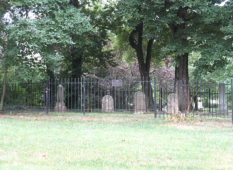
| Description | : | The Ward Family Cemetery is located at the corner of Rolling Green Way and Botany Way in North Potomac, Md. I first ran across this cemetery in the early 1980's when I was walking across the fields of the abandoned Ward farm on Dufief Mill Road. The iron fence had fallen down, the gravestones were either leaning or fallen down, and trees and weeds had overgrown the cemetery. In the late 1980's the Stonebridge subdivsion was built and the developers, with the contributions of Elizabeth Beall Banks, the cemetery was refurbished and now a subdivsion surrounds the Ward... Read More |
frequently asked questions (FAQ):
-
Where is Ward Family Cemetery?
Ward Family Cemetery is located at Montgomery County ,Maryland ,USA.
-
Ward Family Cemetery cemetery's updated grave count on graveviews.com?
0 memorials
-
Where are the coordinates of the Ward Family Cemetery?
Latitude: 39.0982285
Longitude: -77.2239761

Nearby Cemetories:
1. Garrett Family Cemetery
Germantown, Montgomery County, USA
Coordinate: 39.1036213, -77.2214028
2. Mount of Olives Church Cemetery
Gaithersburg, Montgomery County, USA
Coordinate: 39.1140785, -77.2447891
3. DeSellum Family Cemetery
Gaithersburg, Montgomery County, USA
Coordinate: 39.1325400, -77.1962900
4. Episcopal Church of the Ascension Columbarium
Gaithersburg, Montgomery County, USA
Coordinate: 39.1364021, -77.1947021
5. Hunt Ridge Cemetery
Potomac, Montgomery County, USA
Coordinate: 39.0612090, -77.2586880
6. Darnestown Presbyterian Church Cemetery
Darnestown, Montgomery County, USA
Coordinate: 39.1029400, -77.2860400
7. Wesley Union Methodist Church Cemetery
Potomac, Montgomery County, USA
Coordinate: 39.0503260, -77.2329670
8. Forest Oak Cemetery
Gaithersburg, Montgomery County, USA
Coordinate: 39.1453000, -77.2036000
9. Haiti Cemetery
Rockville, Montgomery County, USA
Coordinate: 39.0931000, -77.1573100
10. Darne Family Cemetery (Defunct)
Darnestown, Montgomery County, USA
Coordinate: 39.1033520, -77.2909020
11. Crabb Family Cemetery
Derwood, Montgomery County, USA
Coordinate: 39.1151300, -77.1582400
12. Saint Rose of Lima Cemetery
Gaithersburg, Montgomery County, USA
Coordinate: 39.1501400, -77.2432700
13. Rockville Baptist Cemetery
Rockville, Montgomery County, USA
Coordinate: 39.0835400, -77.1562300
14. Query Family Cemetery
Darnestown, Montgomery County, USA
Coordinate: 39.0771800, -77.2892500
15. Derwood Cemetery
Derwood, Montgomery County, USA
Coordinate: 39.1186400, -77.1580800
16. Rockville United Methodist Church Columbarium
Rockville, Montgomery County, USA
Coordinate: 39.0839060, -77.1554180
17. Christ Episcopal Church Columbarium
Rockville, Montgomery County, USA
Coordinate: 39.0823100, -77.1528500
18. Merry Go Round Farm
Potomac, Montgomery County, USA
Coordinate: 39.0530100, -77.2736300
19. Montgomery County Poor Farm Cemetery
Rockville, Montgomery County, USA
Coordinate: 39.0727400, -77.1540500
20. Lincoln Park Cemetery
Rockville, Montgomery County, USA
Coordinate: 39.0954300, -77.1452900
21. Pleasant Hills Cemetery
Darnestown, Montgomery County, USA
Coordinate: 39.1098340, -77.3033990
22. Martin Family Cemetery
Rockville, Montgomery County, USA
Coordinate: 39.0960100, -77.1428960
23. Old Saint Mary's Catholic Church Cemetery
Rockville, Montgomery County, USA
Coordinate: 39.0819830, -77.1453850
24. Saffell Family Cemetery
Gaithersburg, Montgomery County, USA
Coordinate: 39.1540140, -77.1850030