
| Memorials | : | 114 |
| Location | : | Rockville, Montgomery County, USA |
| Coordinate | : | 39.0931000, -77.1573100 |
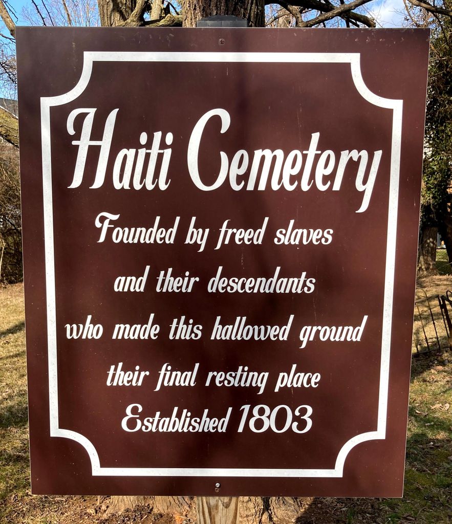
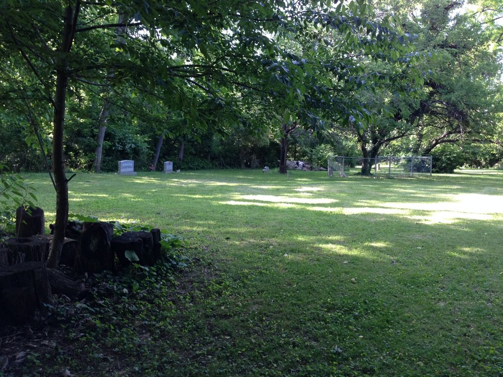
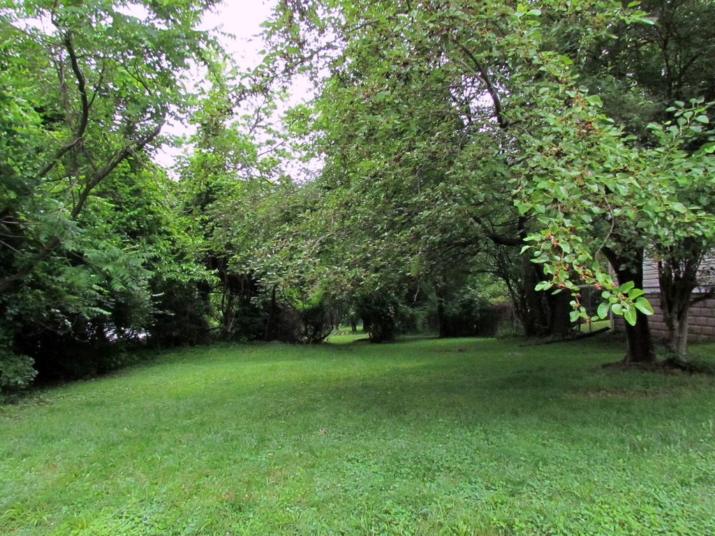
| Description | : | This private cemetery is behind 516 Bickford Avenue in Rockville, Maryland. It is one of the oldest burial grounds in Rockville. Almost all of the individuals buried at Haiti Cemetery are related to one another. Many of the families now living on Martin's Lane just south of the cemetery are direct descendants of those interred. Haiti is still in use as a family burial ground, and with the support of Peerless Rockville, the property owners are seeking historic status for the cemetery. This cemetery consists of about .68 acres. It is the oldest burial place in Rockville that accepted... Read More |
frequently asked questions (FAQ):
-
Where is Haiti Cemetery?
Haiti Cemetery is located at 205 Martins Lane Rockville, Montgomery County ,Maryland ,USA.
-
Haiti Cemetery cemetery's updated grave count on graveviews.com?
114 memorials
-
Where are the coordinates of the Haiti Cemetery?
Latitude: 39.0931000
Longitude: -77.1573100
Nearby Cemetories:
1. Rockville United Methodist Church Columbarium
Rockville, Montgomery County, USA
Coordinate: 39.0839060, -77.1554180
2. Rockville Baptist Cemetery
Rockville, Montgomery County, USA
Coordinate: 39.0835400, -77.1562300
3. Lincoln Park Cemetery
Rockville, Montgomery County, USA
Coordinate: 39.0954300, -77.1452900
4. Christ Episcopal Church Columbarium
Rockville, Montgomery County, USA
Coordinate: 39.0823100, -77.1528500
5. Martin Family Cemetery
Rockville, Montgomery County, USA
Coordinate: 39.0960100, -77.1428960
6. Old Saint Mary's Catholic Church Cemetery
Rockville, Montgomery County, USA
Coordinate: 39.0819830, -77.1453850
7. Montgomery County Poor Farm Cemetery
Rockville, Montgomery County, USA
Coordinate: 39.0727400, -77.1540500
8. Crabb Family Cemetery
Derwood, Montgomery County, USA
Coordinate: 39.1151300, -77.1582400
9. Avery Road Colored Cemetery
Rockville, Montgomery County, USA
Coordinate: 39.0897220, -77.1255560
10. Derwood Cemetery
Derwood, Montgomery County, USA
Coordinate: 39.1186400, -77.1580800
11. New Saint Mary's Catholic Church Cemetery
Rockville, Montgomery County, USA
Coordinate: 39.0830994, -77.1268997
12. Rockville Cemetery
Rockville, Montgomery County, USA
Coordinate: 39.0844002, -77.1260986
13. Rockville United Church Memorial Garden
Rockville, Montgomery County, USA
Coordinate: 39.0783570, -77.1158440
14. Saint Lukes Lutheran Cemetery
Derwood, Montgomery County, USA
Coordinate: 39.1304800, -77.1494800
15. Prather Family Cemetery
Montgomery County, USA
Coordinate: 39.1133330, -77.1147220
16. Faith United Methodist Church Memorial Garden
Rockville, Montgomery County, USA
Coordinate: 39.0536300, -77.1392600
17. Higgins Family Cemetery
Rockville, Montgomery County, USA
Coordinate: 39.0597400, -77.1162300
18. Parklawn Memorial Park and Menorah Gardens
Rockville, Montgomery County, USA
Coordinate: 39.0639000, -77.1091995
19. DeSellum Family Cemetery
Gaithersburg, Montgomery County, USA
Coordinate: 39.1325400, -77.1962900
20. Garrett Family Cemetery
Germantown, Montgomery County, USA
Coordinate: 39.1036213, -77.2214028
21. Ward Family Cemetery
Montgomery County, USA
Coordinate: 39.0982285, -77.2239761
22. Episcopal Church of the Ascension Columbarium
Gaithersburg, Montgomery County, USA
Coordinate: 39.1364021, -77.1947021
23. Case-Kemp-Fraley Family Cemetery
Redland, Montgomery County, USA
Coordinate: 39.1479170, -77.1455280
24. Emory Grove Cemetery Old
Emory Grove, Montgomery County, USA
Coordinate: 39.1489032, -77.1679060