
| Memorials | : | 0 |
| Location | : | Germantown, Montgomery County, USA |
| Coordinate | : | 39.1036213, -77.2214028 |
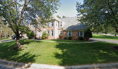
| Description | : | Fenced area between 2 suburban homes. No markers. 1991 plaque on fence says it's Garrett Family Cemetery. Some Garretts were moved to Forest Oak Cemetery, supposedly babies & slaves remain. |
frequently asked questions (FAQ):
-
Where is Garrett Family Cemetery?
Garrett Family Cemetery is located at 111 Englefield Drive Germantown, Montgomery County ,Maryland , 20878USA.
-
Garrett Family Cemetery cemetery's updated grave count on graveviews.com?
0 memorials
-
Where are the coordinates of the Garrett Family Cemetery?
Latitude: 39.1036213
Longitude: -77.2214028
Nearby Cemetories:
1. Ward Family Cemetery
Montgomery County, USA
Coordinate: 39.0982285, -77.2239761
2. Mount of Olives Church Cemetery
Gaithersburg, Montgomery County, USA
Coordinate: 39.1140785, -77.2447891
3. DeSellum Family Cemetery
Gaithersburg, Montgomery County, USA
Coordinate: 39.1325400, -77.1962900
4. Episcopal Church of the Ascension Columbarium
Gaithersburg, Montgomery County, USA
Coordinate: 39.1364021, -77.1947021
5. Forest Oak Cemetery
Gaithersburg, Montgomery County, USA
Coordinate: 39.1453000, -77.2036000
6. Saint Rose of Lima Cemetery
Gaithersburg, Montgomery County, USA
Coordinate: 39.1501400, -77.2432700
7. Darnestown Presbyterian Church Cemetery
Darnestown, Montgomery County, USA
Coordinate: 39.1029400, -77.2860400
8. Crabb Family Cemetery
Derwood, Montgomery County, USA
Coordinate: 39.1151300, -77.1582400
9. Haiti Cemetery
Rockville, Montgomery County, USA
Coordinate: 39.0931000, -77.1573100
10. Hunt Ridge Cemetery
Potomac, Montgomery County, USA
Coordinate: 39.0612090, -77.2586880
11. Derwood Cemetery
Derwood, Montgomery County, USA
Coordinate: 39.1186400, -77.1580800
12. Darne Family Cemetery (Defunct)
Darnestown, Montgomery County, USA
Coordinate: 39.1033520, -77.2909020
13. Wesley Union Methodist Church Cemetery
Potomac, Montgomery County, USA
Coordinate: 39.0503260, -77.2329670
14. Rockville Baptist Cemetery
Rockville, Montgomery County, USA
Coordinate: 39.0835400, -77.1562300
15. Rockville United Methodist Church Columbarium
Rockville, Montgomery County, USA
Coordinate: 39.0839060, -77.1554180
16. Christ Episcopal Church Columbarium
Rockville, Montgomery County, USA
Coordinate: 39.0823100, -77.1528500
17. Saffell Family Cemetery
Gaithersburg, Montgomery County, USA
Coordinate: 39.1540140, -77.1850030
18. Query Family Cemetery
Darnestown, Montgomery County, USA
Coordinate: 39.0771800, -77.2892500
19. Lincoln Park Cemetery
Rockville, Montgomery County, USA
Coordinate: 39.0954300, -77.1452900
20. Montgomery County Poor Farm Cemetery
Rockville, Montgomery County, USA
Coordinate: 39.0727400, -77.1540500
21. Martin Family Cemetery
Rockville, Montgomery County, USA
Coordinate: 39.0960100, -77.1428960
22. Emory Grove Cemetery Old
Emory Grove, Montgomery County, USA
Coordinate: 39.1489032, -77.1679060
23. Saint Lukes Lutheran Cemetery
Derwood, Montgomery County, USA
Coordinate: 39.1304800, -77.1494800
24. Old Saint Mary's Catholic Church Cemetery
Rockville, Montgomery County, USA
Coordinate: 39.0819830, -77.1453850