
| Memorials | : | 0 |
| Location | : | Holloway, Amber Valley Borough, England |
| Coordinate | : | 53.1075100, -1.5183800 |
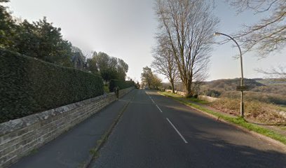
| Description | : | The cemetery is just south of Christ Church, Holloway. |
frequently asked questions (FAQ):
-
Where is Dethick Lea and Holloway Cemetery?
Dethick Lea and Holloway Cemetery is located at Holloway, Amber Valley Borough, England.
-
Dethick Lea and Holloway Cemetery cemetery's updated grave count on graveviews.com?
0 memorials
-
Where are the coordinates of the Dethick Lea and Holloway Cemetery?
Latitude: 53.1075100
Longitude: -1.5183800
Nearby Cemetories:
1. St. Mary's Churchyard
Cromford, Derbyshire Dales District, England
Coordinate: 53.1104260, -1.5538440
2. Holy Trinity Churchyard
Matlock Bath, Derbyshire Dales District, England
Coordinate: 53.1172020, -1.5612230
3. St. Mark's Churchyard
Cromford, Derbyshire Dales District, England
Coordinate: 53.1076550, -1.5647150
4. Holy Trinity Churchyard
Tansley, Derbyshire Dales District, England
Coordinate: 53.1353920, -1.5194670
5. Saint Mary's Churchyard
Crich, Amber Valley Borough, England
Coordinate: 53.0880100, -1.4819100
6. St. Margaret's Chapel
Alderwasley, Amber Valley Borough, England
Coordinate: 53.0769800, -1.5180550
7. Alderwasley cemetery
Alderwasley, Amber Valley Borough, England
Coordinate: 53.0767150, -1.5186900
8. Steeple Arch Cemetery
Wirksworth, Derbyshire Dales District, England
Coordinate: 53.0969820, -1.5688340
9. St. Giles' Churchyard
Matlock, Derbyshire Dales District, England
Coordinate: 53.1343560, -1.5533960
10. Wirksworth Cemetery
Wirksworth, Derbyshire Dales District, England
Coordinate: 53.0856224, -1.5709003
11. Wirksworth Baptist Burial Ground
Wirksworth, Derbyshire Dales District, England
Coordinate: 53.0848778, -1.5709972
12. St. James the Apostle Churchyard
Bonsall, Derbyshire Dales District, England
Coordinate: 53.1196200, -1.5832110
13. St. Mary's Church Vaults
Wirksworth, Derbyshire Dales District, England
Coordinate: 53.0819830, -1.5723380
14. St. Mary's Churchyard
Wirksworth, Derbyshire Dales District, England
Coordinate: 53.0819830, -1.5723380
15. Holy Trinity Churchyard
Middleton by Wirksworth, Derbyshire Dales District, England
Coordinate: 53.0979228, -1.5860175
16. Middleton by Wirksworth Cemetery
Middleton by Wirksworth, Derbyshire Dales District, England
Coordinate: 53.1033860, -1.5919920
17. Holy Trinity Churchyard
Brackenfield, North East Derbyshire District, England
Coordinate: 53.1268949, -1.4443555
18. Wingfield Park
South Wingfield, Amber Valley Borough, England
Coordinate: 53.0800910, -1.4450070
19. All Saints Churchyard
South Wingfield, Amber Valley Borough, England
Coordinate: 53.0977640, -1.4291210
20. All Saints Churchyard
Ashover, North East Derbyshire District, England
Coordinate: 53.1638900, -1.4800330
21. St. Mary the Virgin Churchyard
South Darley, Derbyshire Dales District, England
Coordinate: 53.1498000, -1.6015000
22. St Luke's Heage
Belper, Amber Valley Borough, England
Coordinate: 53.0516040, -1.4501580
23. St Luke Churchyard
Heage, Amber Valley Borough, England
Coordinate: 53.0516130, -1.4500690
24. St. Luke's Churchyard
Heage, Amber Valley Borough, England
Coordinate: 53.0516000, -1.4500700