
| Memorials | : | 0 |
| Location | : | Bonsall, Derbyshire Dales District, England |
| Coordinate | : | 53.1196200, -1.5832110 |
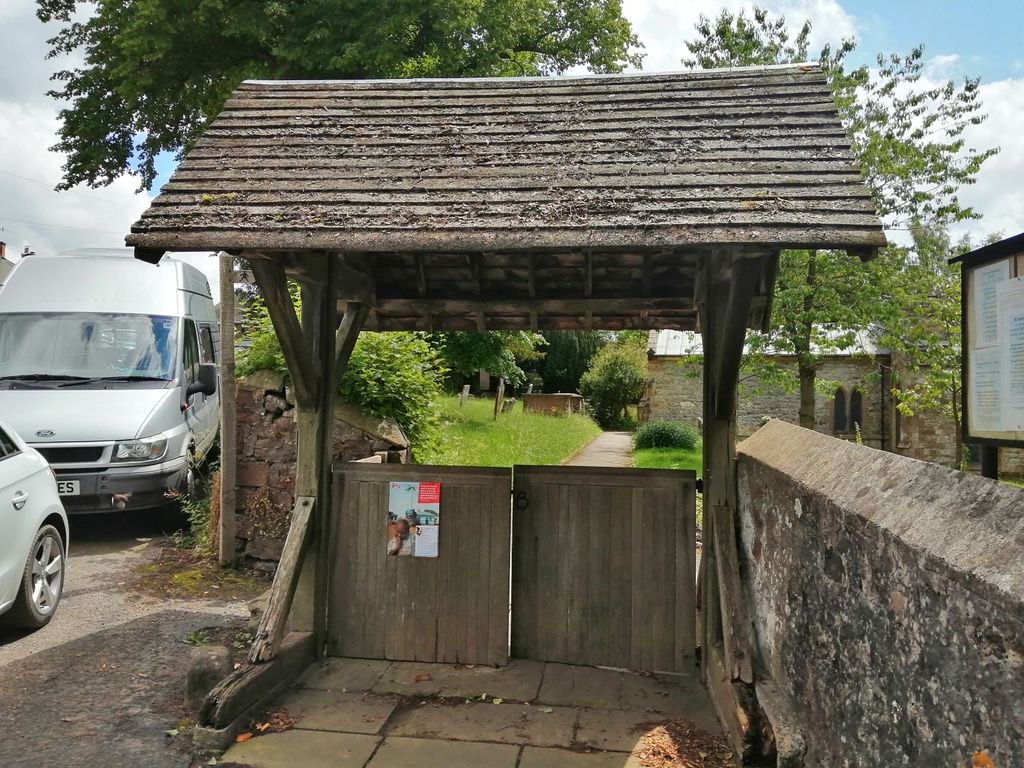
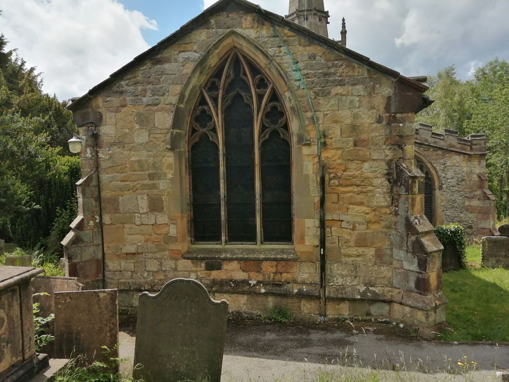
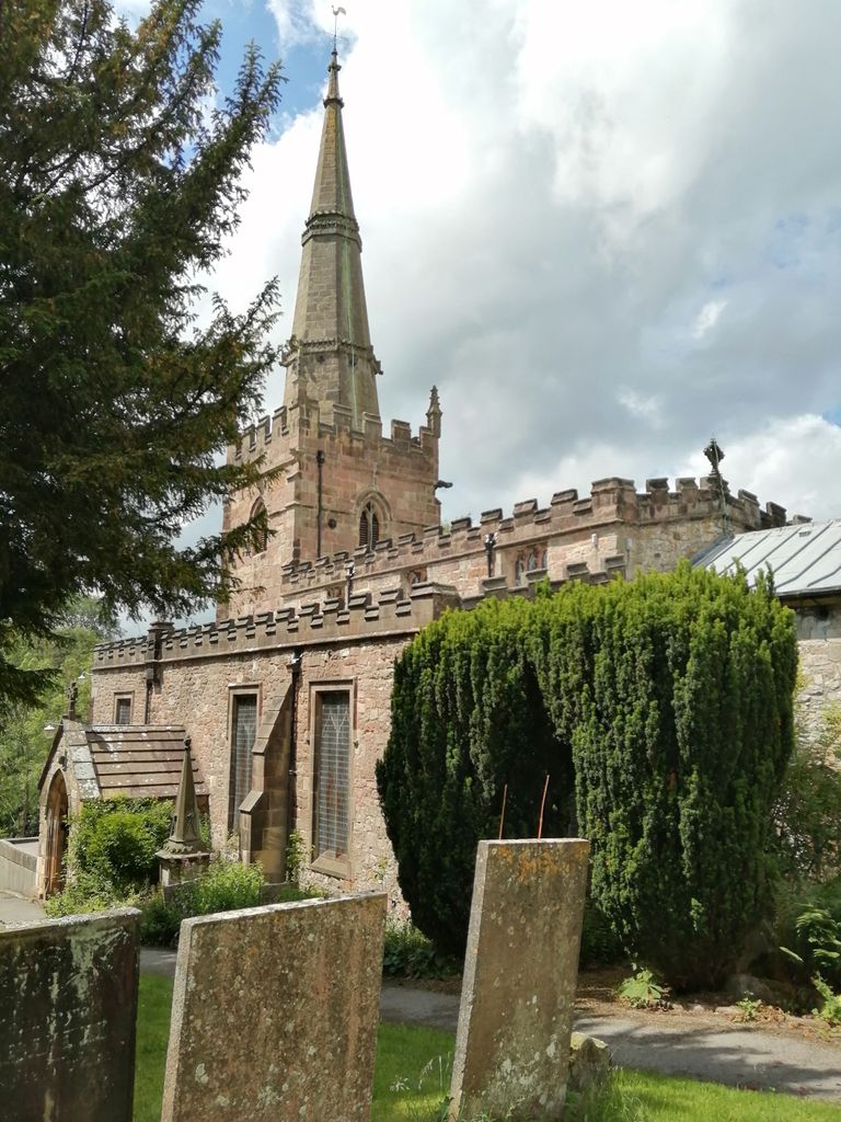
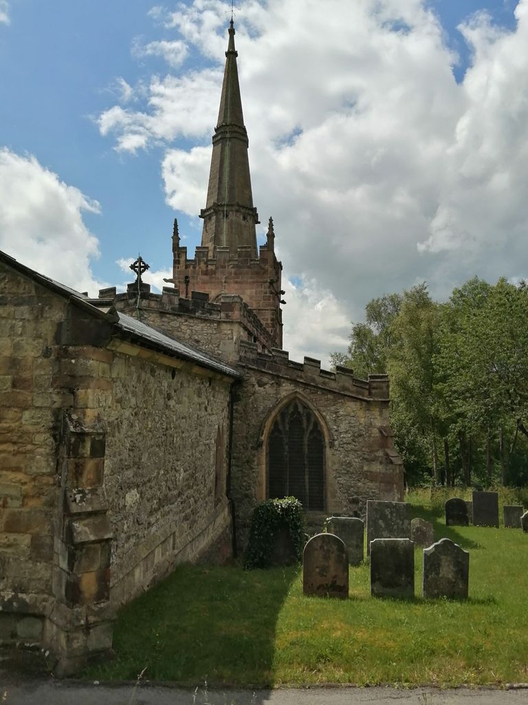
| Description | : | Bonsall is a small hill-village on the high ground west of the Heights of Abraham. With a large church, an ancient market cross and a number of good C17 and C18 houses, it was clearly once a more important place than its present remoteness would suggest; as well as being involved in the lead mining industry general to the area it also became a flourishing centre for framework knitting. The church, of 13th century origin, stands in a prominent position overlooking the village. It has a 15th century tower surrounded by stone crowns and gargoyles and surmounted by a magnificent... Read More |
frequently asked questions (FAQ):
-
Where is St. James the Apostle Churchyard?
St. James the Apostle Churchyard is located at 89 Church St Bonsall, Derbyshire Dales District ,Derbyshire ,England.
-
St. James the Apostle Churchyard cemetery's updated grave count on graveviews.com?
0 memorials
-
Where are the coordinates of the St. James the Apostle Churchyard?
Latitude: 53.1196200
Longitude: -1.5832110


Nearby Cemetories:
1. Holy Trinity Churchyard
Matlock Bath, Derbyshire Dales District, England
Coordinate: 53.1172020, -1.5612230
2. St. Mark's Churchyard
Cromford, Derbyshire Dales District, England
Coordinate: 53.1076550, -1.5647150
3. Middleton by Wirksworth Cemetery
Middleton by Wirksworth, Derbyshire Dales District, England
Coordinate: 53.1033860, -1.5919920
4. St. Mary's Churchyard
Cromford, Derbyshire Dales District, England
Coordinate: 53.1104260, -1.5538440
5. Holy Trinity Churchyard
Middleton by Wirksworth, Derbyshire Dales District, England
Coordinate: 53.0979228, -1.5860175
6. St. Giles' Churchyard
Matlock, Derbyshire Dales District, England
Coordinate: 53.1343560, -1.5533960
7. Steeple Arch Cemetery
Wirksworth, Derbyshire Dales District, England
Coordinate: 53.0969820, -1.5688340
8. St. Mary the Virgin Churchyard
South Darley, Derbyshire Dales District, England
Coordinate: 53.1498000, -1.6015000
9. Wirksworth Cemetery
Wirksworth, Derbyshire Dales District, England
Coordinate: 53.0856224, -1.5709003
10. Wirksworth Baptist Burial Ground
Wirksworth, Derbyshire Dales District, England
Coordinate: 53.0848778, -1.5709972
11. St. Mary's Church Vaults
Wirksworth, Derbyshire Dales District, England
Coordinate: 53.0819830, -1.5723380
12. St. Mary's Churchyard
Wirksworth, Derbyshire Dales District, England
Coordinate: 53.0819830, -1.5723380
13. Dethick Lea and Holloway Cemetery
Holloway, Amber Valley Borough, England
Coordinate: 53.1075100, -1.5183800
14. Holy Trinity Churchyard
Tansley, Derbyshire Dales District, England
Coordinate: 53.1353920, -1.5194670
15. St. John the Baptist Churchyard
Winster, Derbyshire Dales District, England
Coordinate: 53.1418016, -1.6434807
16. Darley Dale Cemetery
Darley Dale, Derbyshire Dales District, England
Coordinate: 53.1635670, -1.5926300
17. St. Helen's Churchyard
Darley Dale, Derbyshire Dales District, England
Coordinate: 53.1634910, -1.6020670
18. St. James' Churchyard
Brassington, Derbyshire Dales District, England
Coordinate: 53.0858300, -1.6565000
19. Alderwasley cemetery
Alderwasley, Amber Valley Borough, England
Coordinate: 53.0767150, -1.5186900
20. St. Margaret's Chapel
Alderwasley, Amber Valley Borough, England
Coordinate: 53.0769800, -1.5180550
21. All Saints Churchyard
Elton, Derbyshire Dales District, England
Coordinate: 53.1455078, -1.6700720
22. Holy Trinity Churchyard
Stanton in Peak, Derbyshire Dales District, England
Coordinate: 53.1750700, -1.6403760
23. Saint Mary's Churchyard
Crich, Amber Valley Borough, England
Coordinate: 53.0880100, -1.4819100
24. Holy Trinity Churchyard
Kirk Ireton, Derbyshire Dales District, England
Coordinate: 53.0485040, -1.6002000