
| Memorials | : | 0 |
| Location | : | Matlock, Derbyshire Dales District, England |
| Coordinate | : | 53.1343560, -1.5533960 |
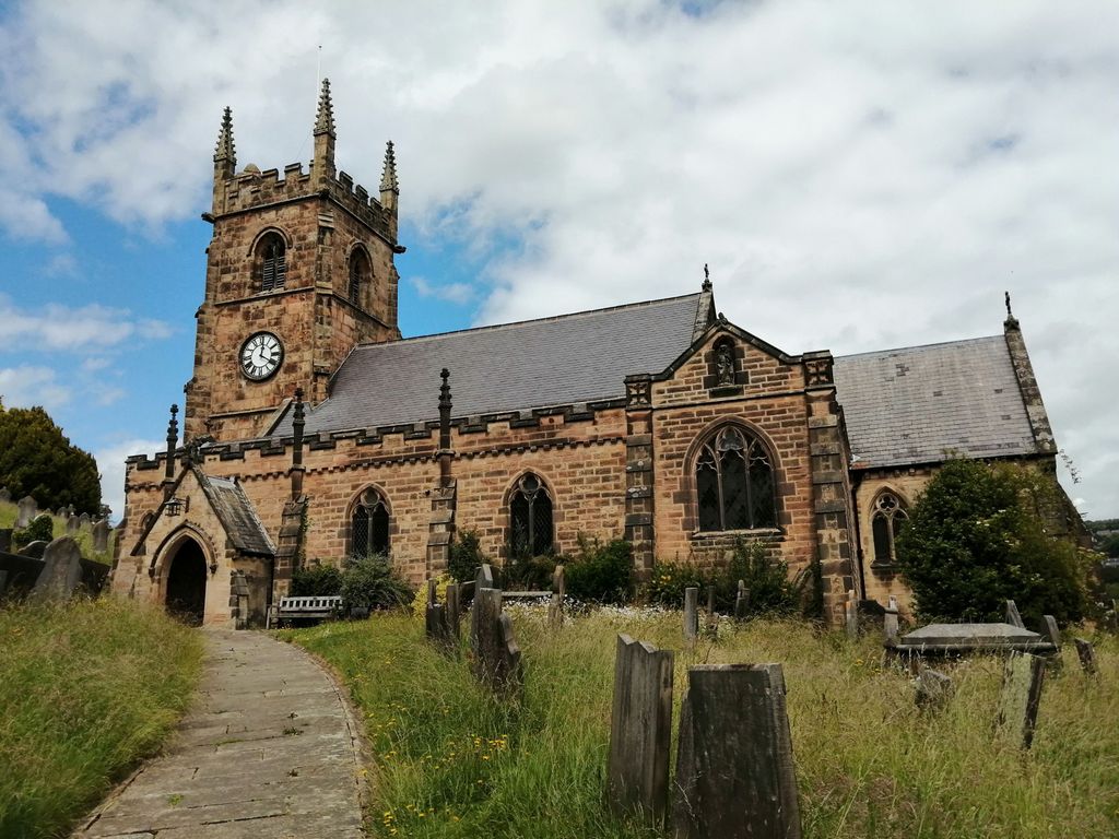
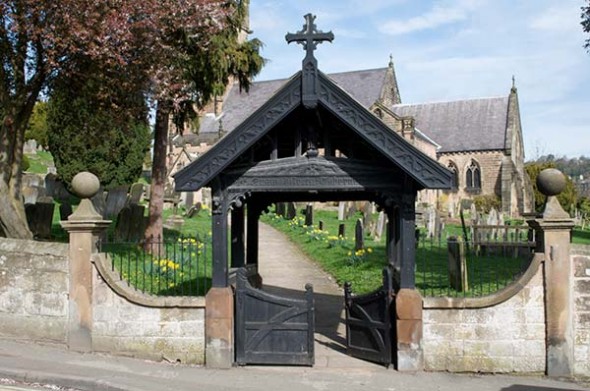
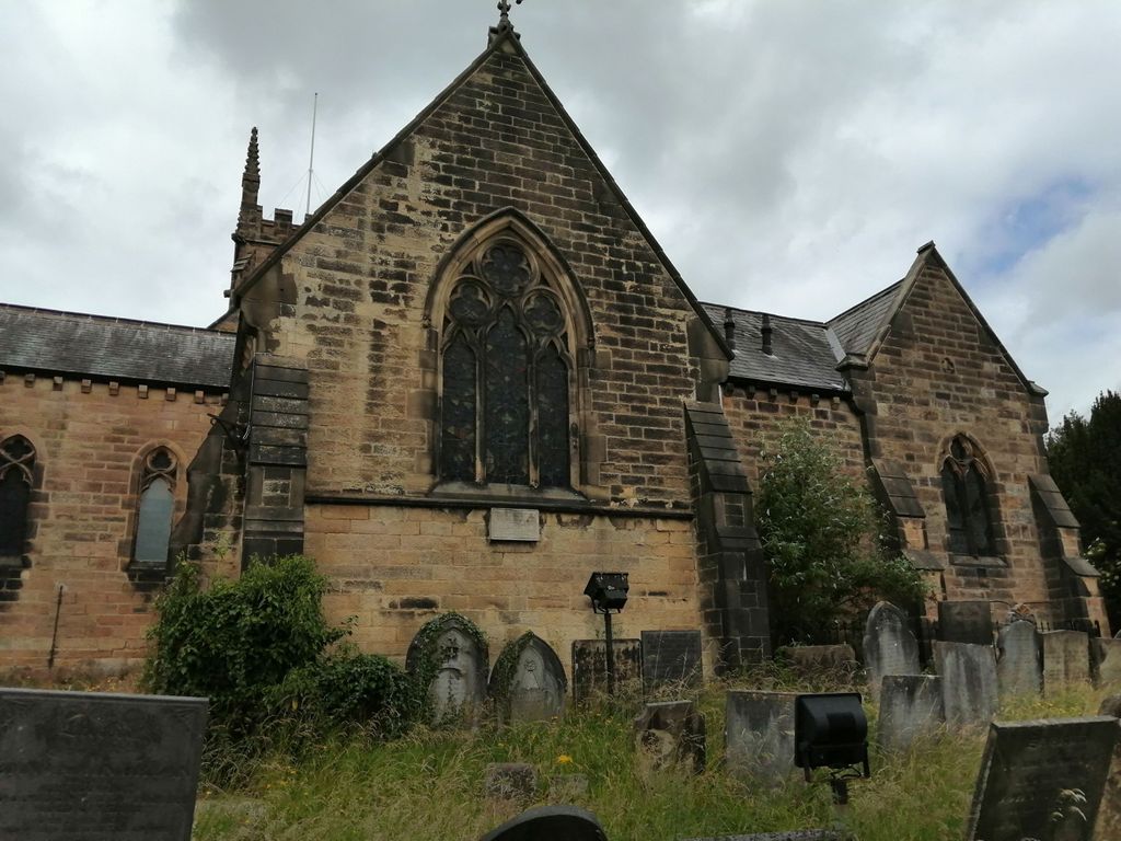
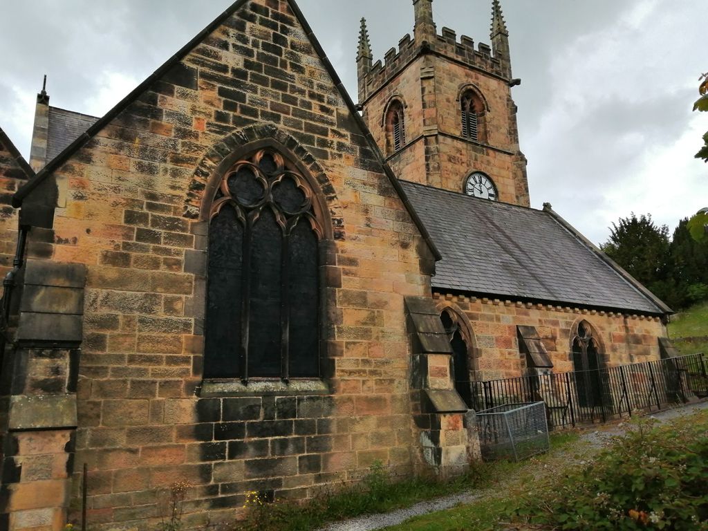
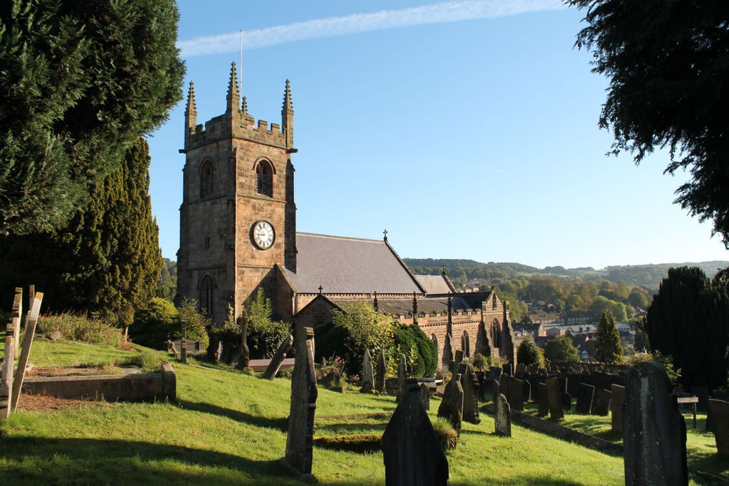
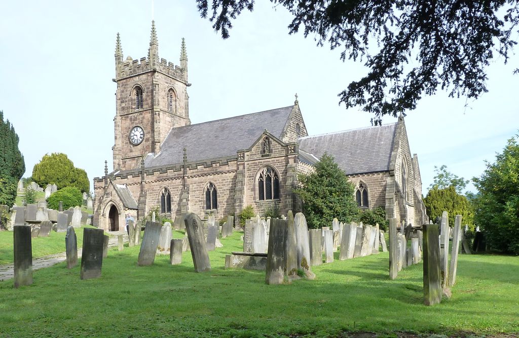
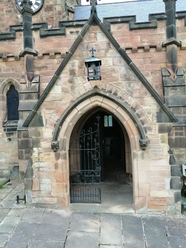
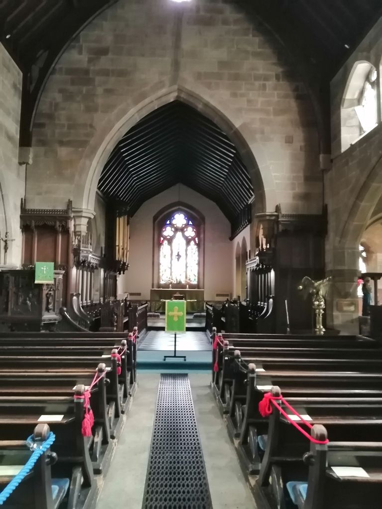
| Description | : | [Note Church Records use the Word Spuriouss, spelled thus, to mean Illegitimate Birth] At its entrance is a neat stone bridge, at a short distance from which; on the verge of a romantic rock, the Church dedicated to St. Giles raises its gray turret, shrouded by trees of luxuriant foliage. The building is an old embattled structure, having an ancient tower with pinnacles whimsically sculptured with grotesque gargoyles. The interior consists of a nave, aisles, and chancel; the roof is arched, and covered with paintings consisting of the four Evangelists and other scriptural and allegorical subjects.The Church contains no ancient... Read More |
frequently asked questions (FAQ):
-
Where is St. Giles' Churchyard?
St. Giles' Churchyard is located at 4 Stoney Way Matlock, Derbyshire Dales District ,Derbyshire , DE4 3BZEngland.
-
St. Giles' Churchyard cemetery's updated grave count on graveviews.com?
0 memorials
-
Where are the coordinates of the St. Giles' Churchyard?
Latitude: 53.1343560
Longitude: -1.5533960
Nearby Cemetories:
1. Holy Trinity Churchyard
Matlock Bath, Derbyshire Dales District, England
Coordinate: 53.1172020, -1.5612230
2. Holy Trinity Churchyard
Tansley, Derbyshire Dales District, England
Coordinate: 53.1353920, -1.5194670
3. St. James the Apostle Churchyard
Bonsall, Derbyshire Dales District, England
Coordinate: 53.1196200, -1.5832110
4. St. Mary's Churchyard
Cromford, Derbyshire Dales District, England
Coordinate: 53.1104260, -1.5538440
5. St. Mark's Churchyard
Cromford, Derbyshire Dales District, England
Coordinate: 53.1076550, -1.5647150
6. St. Mary the Virgin Churchyard
South Darley, Derbyshire Dales District, England
Coordinate: 53.1498000, -1.6015000
7. Dethick Lea and Holloway Cemetery
Holloway, Amber Valley Borough, England
Coordinate: 53.1075100, -1.5183800
8. Darley Dale Cemetery
Darley Dale, Derbyshire Dales District, England
Coordinate: 53.1635670, -1.5926300
9. Steeple Arch Cemetery
Wirksworth, Derbyshire Dales District, England
Coordinate: 53.0969820, -1.5688340
10. Middleton by Wirksworth Cemetery
Middleton by Wirksworth, Derbyshire Dales District, England
Coordinate: 53.1033860, -1.5919920
11. St. Helen's Churchyard
Darley Dale, Derbyshire Dales District, England
Coordinate: 53.1634910, -1.6020670
12. Holy Trinity Churchyard
Middleton by Wirksworth, Derbyshire Dales District, England
Coordinate: 53.0979228, -1.5860175
13. Wirksworth Cemetery
Wirksworth, Derbyshire Dales District, England
Coordinate: 53.0856224, -1.5709003
14. Wirksworth Baptist Burial Ground
Wirksworth, Derbyshire Dales District, England
Coordinate: 53.0848778, -1.5709972
15. All Saints Churchyard
Ashover, North East Derbyshire District, England
Coordinate: 53.1638900, -1.4800330
16. St. Mary's Church Vaults
Wirksworth, Derbyshire Dales District, England
Coordinate: 53.0819830, -1.5723380
17. St. Mary's Churchyard
Wirksworth, Derbyshire Dales District, England
Coordinate: 53.0819830, -1.5723380
18. St. John the Baptist Churchyard
Winster, Derbyshire Dales District, England
Coordinate: 53.1418016, -1.6434807
19. St. Margaret's Chapel
Alderwasley, Amber Valley Borough, England
Coordinate: 53.0769800, -1.5180550
20. Alderwasley cemetery
Alderwasley, Amber Valley Borough, England
Coordinate: 53.0767150, -1.5186900
21. Saint Mary's Churchyard
Crich, Amber Valley Borough, England
Coordinate: 53.0880100, -1.4819100
22. Holy Trinity Churchyard
Brackenfield, North East Derbyshire District, England
Coordinate: 53.1268949, -1.4443555
23. Holy Trinity Churchyard
Stanton in Peak, Derbyshire Dales District, England
Coordinate: 53.1750700, -1.6403760
24. All Saints Churchyard
Elton, Derbyshire Dales District, England
Coordinate: 53.1455078, -1.6700720