
| Memorials | : | 0 |
| Location | : | Driewegen, Borsele Municipality, Netherlands |
| Coordinate | : | 51.4176900, 3.8052200 |
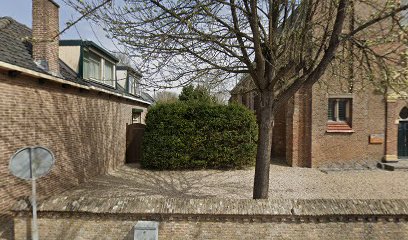
| Description | : | Driewegen is a small village. It is part of the Borsele municipality located in the province of Zeeland, in the south-western Netherlands. The cemetery is in the centre of the village, behind the Protestant church. |
frequently asked questions (FAQ):
-
Where is Driewegen Protestant Cemetery?
Driewegen Protestant Cemetery is located at Driewegen, Borsele Municipality ,Zeeland ,Netherlands.
-
Driewegen Protestant Cemetery cemetery's updated grave count on graveviews.com?
0 memorials
-
Where are the coordinates of the Driewegen Protestant Cemetery?
Latitude: 51.4176900
Longitude: 3.8052200
Nearby Cemetories:
1. Ovezande Bloemenstraat Cemetery
Ovezande, Borsele Municipality, Netherlands
Coordinate: 51.4274400, 3.8208500
2. Ellewoutsdijk Begraafplaats
Ellewoutsdijk, Borsele Municipality, Netherlands
Coordinate: 51.3922900, 3.8175300
3. Oudelande Algemene Begraafplaats
Oudelande, Borsele Municipality, Netherlands
Coordinate: 51.4095600, 3.8564700
4. R.K. Begraafplaats
's-Heerenhoek, Borsele Municipality, Netherlands
Coordinate: 51.4542131, 3.7715854
5. Borssele Algemene Begraafplaats
Borssele, Borsele Municipality, Netherlands
Coordinate: 51.4229700, 3.7374900
6. Algemene Begraafplaats
Nisse, Borsele Municipality, Netherlands
Coordinate: 51.4584900, 3.8467600
7. 's-Heerenhoek Old Cemetery
's-Heerenhoek, Borsele Municipality, Netherlands
Coordinate: 51.4634500, 3.7642900
8. Heinkenszand Kerklaan Cemetery
Heinkenszand, Borsele Municipality, Netherlands
Coordinate: 51.4717900, 3.8139200
9. Baarland Steenweg Cemetery
Baarland, Borsele Municipality, Netherlands
Coordinate: 51.4072879, 3.8944024
10. Hoedekenskerke Old Churchyard
Hoedekenskerke, Borsele Municipality, Netherlands
Coordinate: 51.4235320, 3.9121413
11. Hoedekenskerke Waardweg Cemetery
Hoedekenskerke, Borsele Municipality, Netherlands
Coordinate: 51.4224100, 3.9129400
12. Nieuwdorp Algemene Begraafplaats
Nieuwdorp, Borsele Municipality, Netherlands
Coordinate: 51.4775300, 3.7466800
13. 's-Gravenpolder Algemene Begraafplaats
's-Gravenpolder, Borsele Municipality, Netherlands
Coordinate: 51.4556100, 3.9003500
14. Nieuwdorp Dutch Reformed Cemetery
Nieuwdorp, Borsele Municipality, Netherlands
Coordinate: 51.4768900, 3.7438300
15. Lenshoekdijk Old
's-Gravenpolder, Borsele Municipality, Netherlands
Coordinate: 51.4554900, 3.9012800
16. Lewedorp Kerkhof
Lewedorp, Borsele Municipality, Netherlands
Coordinate: 51.4940600, 3.7502800
17. Crematorium en uitvaartcentrum Het Zeeuwse Land
Goes Municipality, Netherlands
Coordinate: 51.4810570, 3.8994665
18. 's-Heer-Hendrikskinderen Algemene Begraafplaats
's-Heer Hendrikskinderen, Goes Municipality, Netherlands
Coordinate: 51.5012100, 3.8463800
19. Hoofdplaat Roman Catholic Cemetery
Hoofdplaat, Sluis Municipality, Netherlands
Coordinate: 51.3691587, 3.6648077
20. Begraafplaats Begoniastraat
Hoek, Terneuzen Municipality, Netherlands
Coordinate: 51.3119844, 3.7793691
21. Goes Algemene Begraafplaats
Goes, Goes Municipality, Netherlands
Coordinate: 51.5120600, 3.8866100
22. Kloetinge General Cemetery
Kloetinge, Goes Municipality, Netherlands
Coordinate: 51.4971500, 3.9232100
23. Wolphaartsdijk Algemene Begraafplaats
Wolphaartsdijk, Goes Municipality, Netherlands
Coordinate: 51.5271200, 3.8191400
24. Alg. Begraafplaats Molendreef
Hoek, Terneuzen Municipality, Netherlands
Coordinate: 51.3075086, 3.7741648