
| Memorials | : | 0 |
| Location | : | Eynsham, West Oxfordshire District, England |
| Coordinate | : | 51.7786110, -1.3738890 |
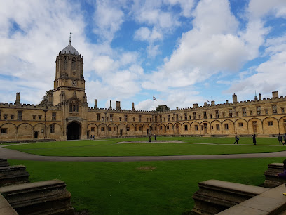
| Description | : | Eynsham Abbey was a Benedictine monastery in Eynsham, Oxfordshire, in England. King Æthelred allowed Æthelmar to found the abbey in 1005. After the Norman Conquest the abbey was reopened in 1086. The abbey flourished until the Dissolution of the Monasteries in 1538. Anthony Kitchin was the last abbot. Some of the buildings were wrecked to hinder the return of the monks. The Earl of Derby acquired the abbey buildings, the stones of which were subsequently used to build houses in the village. From Wikipedia |
frequently asked questions (FAQ):
-
Where is Eynsham Abbey?
Eynsham Abbey is located at Eynsham, West Oxfordshire District ,Oxfordshire ,England.
-
Eynsham Abbey cemetery's updated grave count on graveviews.com?
0 memorials
-
Where are the coordinates of the Eynsham Abbey?
Latitude: 51.7786110
Longitude: -1.3738890
Nearby Cemetories:
1. St Leonard Churchyard
Eynsham, West Oxfordshire District, England
Coordinate: 51.7799470, -1.3738080
2. Eynsham War Memorial
Eynsham, West Oxfordshire District, England
Coordinate: 51.7801562, -1.3736687
3. St Peter's Churchyard
Cassington, West Oxfordshire District, England
Coordinate: 51.7923610, -1.3423160
4. St Michael's Churchyard
Stanton Harcourt, West Oxfordshire District, England
Coordinate: 51.7480000, -1.3977000
5. Ss. Peter & Paul Churchyard
Church Hanborough, West Oxfordshire District, England
Coordinate: 51.8125750, -1.3838000
6. St. James the Great Churchyard
South Leigh, West Oxfordshire District, England
Coordinate: 51.7781050, -1.4298950
7. St Mary the Virgin Churchyard
Freeland, West Oxfordshire District, England
Coordinate: 51.8116300, -1.4004700
8. Wytham Churchyard
Wytham, Vale of White Horse District, England
Coordinate: 51.7736230, -1.3131610
9. Yarnton Cemetery
Yarnton, Cherwell District, England
Coordinate: 51.8004080, -1.3103260
10. Godstow Abbey Ruins
Oxford, City of Oxford, England
Coordinate: 51.7784060, -1.2998170
11. St. Bartholomew's Churchyard
Yarnton, Cherwell District, England
Coordinate: 51.8016610, -1.3087620
12. Christ Churchyard
Long Hanborough, West Oxfordshire District, England
Coordinate: 51.8247400, -1.3955000
13. Saint Margaret of Antioch
City of Oxford, England
Coordinate: 51.7690340, -1.2975900
14. St Michael Churchyard
Cumnor, Vale of White Horse District, England
Coordinate: 51.7340384, -1.3331002
15. St. Martin's Churchyard
Bladon, West Oxfordshire District, England
Coordinate: 51.8304596, -1.3495430
16. St. Michael's Churchyard
Begbroke, Cherwell District, England
Coordinate: 51.8221520, -1.3218069
17. St. Denys' Churchyard
Northmoor, West Oxfordshire District, England
Coordinate: 51.7230000, -1.3918000
18. Botley Cemetery
Botley, Vale of White Horse District, England
Coordinate: 51.7518050, -1.2930000
19. St. Peter Churchyard
Wolvercote, City of Oxford, England
Coordinate: 51.7848300, -1.2811100
20. St Mary Churchyard
North Leigh, West Oxfordshire District, England
Coordinate: 51.8201820, -1.4396170
21. St. Giles' Churchyard
Standlake, West Oxfordshire District, England
Coordinate: 51.7299550, -1.4262300
22. Blenheim Palace
Woodstock, West Oxfordshire District, England
Coordinate: 51.8414993, -1.3611000
23. St. Lawrence's Churchyard
North Hinksey, Vale of White Horse District, England
Coordinate: 51.7457590, -1.2848020
24. Wolvercote Cemetery
Oxford, City of Oxford, England
Coordinate: 51.7913666, -1.2721500