
| Memorials | : | 0 |
| Location | : | Hendersonville, Henderson County, USA |
| Coordinate | : | 35.3151530, -82.4841940 |
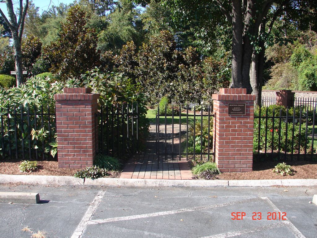
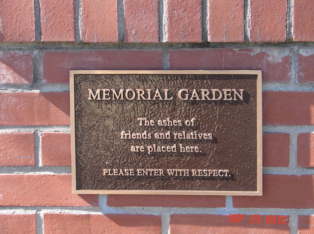
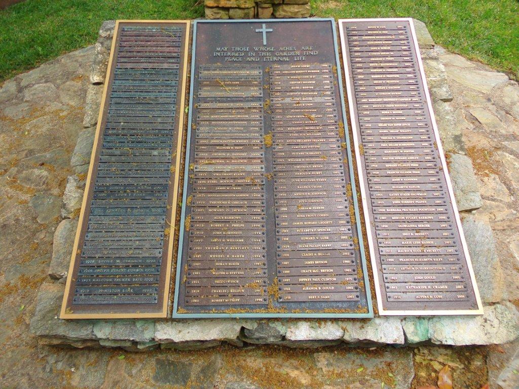
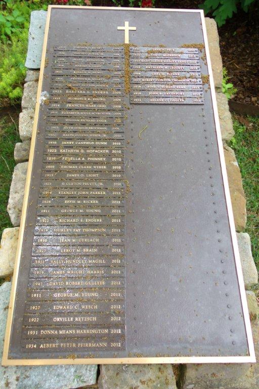
| Description | : | This lovely small garden on the church grounds provides a place to scatter the ashes of loved ones. A plaque in the garden records their names and dates. |
frequently asked questions (FAQ):
-
Where is First Congregational Church Memorial Garden?
First Congregational Church Memorial Garden is located at 1735 5th Avenue W Hendersonville, Henderson County ,North Carolina , 28739USA.
-
First Congregational Church Memorial Garden cemetery's updated grave count on graveviews.com?
0 memorials
-
Where are the coordinates of the First Congregational Church Memorial Garden?
Latitude: 35.3151530
Longitude: -82.4841940
Nearby Cemetories:
1. Grace Lutheran Church Memorial Garden
Hendersonville, Henderson County, USA
Coordinate: 35.3212100, -82.4786900
2. Oakdale Cemetery
Hendersonville, Henderson County, USA
Coordinate: 35.3191986, -82.4753036
3. Shaws Creek Baptist Church Cemetery
Horse Shoe, Henderson County, USA
Coordinate: 35.3231010, -82.4983978
4. Saint James Episcopal Church Cemetery
Hendersonville, Henderson County, USA
Coordinate: 35.3198874, -82.4610627
5. McCrary Family Cemetery
Henderson County, USA
Coordinate: 35.3366776, -82.4810562
6. McCarson Cemetery
Henderson County, USA
Coordinate: 35.3442001, -82.5021973
7. Mud Creek Baptist Church Cemetery
Flat Rock, Henderson County, USA
Coordinate: 35.2905998, -82.4536972
8. Cantrell Family Cemetery
Henderson County, USA
Coordinate: 35.2869119, -82.5096819
9. Forest Lawn Memorial Park
Henderson County, USA
Coordinate: 35.3225403, -82.4362411
10. Henderson County Home Cemetery
Henderson County, USA
Coordinate: 35.3535480, -82.4986540
11. Pleasant Hill Cemetery
Valley Hill, Henderson County, USA
Coordinate: 35.2750015, -82.4993973
12. Saint John In the Wilderness Cemetery
Flat Rock, Henderson County, USA
Coordinate: 35.2821170, -82.4435670
13. Pinecrest Presbyterian Church Memorial Garden
Flat Rock, Henderson County, USA
Coordinate: 35.2822100, -82.4426360
14. Shaws Creek Methodist Campground Cemetery
Horse Shoe, Henderson County, USA
Coordinate: 35.3437996, -82.5345001
15. Saint Matthews Cemetery
Hillgirt, Henderson County, USA
Coordinate: 35.3683014, -82.4792023
16. Oakland Cemetery
East Flat Rock, Henderson County, USA
Coordinate: 35.2835999, -82.4302979
17. Moores Grove Methodist Cemetery
Henderson County, USA
Coordinate: 35.3488007, -82.4318008
18. Ebenezer Baptist Church Cemetery
Hendersonville, Henderson County, USA
Coordinate: 35.3498001, -82.4326019
19. Brown Family Cemetery
Henderson County, USA
Coordinate: 35.2779600, -82.5336300
20. Hill Mausoleum
Flat Rock, Henderson County, USA
Coordinate: 35.2630638, -82.4577080
21. Saint Francis Chapel Memorial Garden
Henderson County, USA
Coordinate: 35.2641670, -82.5200440
22. Berea Baptist Church Cemetery
Flat Rock, Henderson County, USA
Coordinate: 35.2564011, -82.4875031
23. Seagle Cemetery
Henderson County, USA
Coordinate: 35.3553009, -82.4300003
24. Fair Haven Baptist Church Cemetery
Hendersonville, Henderson County, USA
Coordinate: 35.3447800, -82.4203100