
| Memorials | : | 0 |
| Location | : | East Flat Rock, Henderson County, USA |
| Coordinate | : | 35.2835999, -82.4302979 |
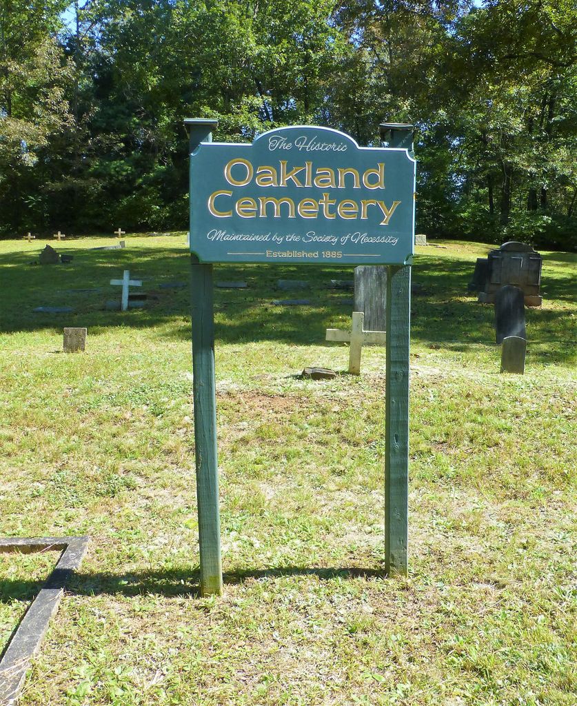
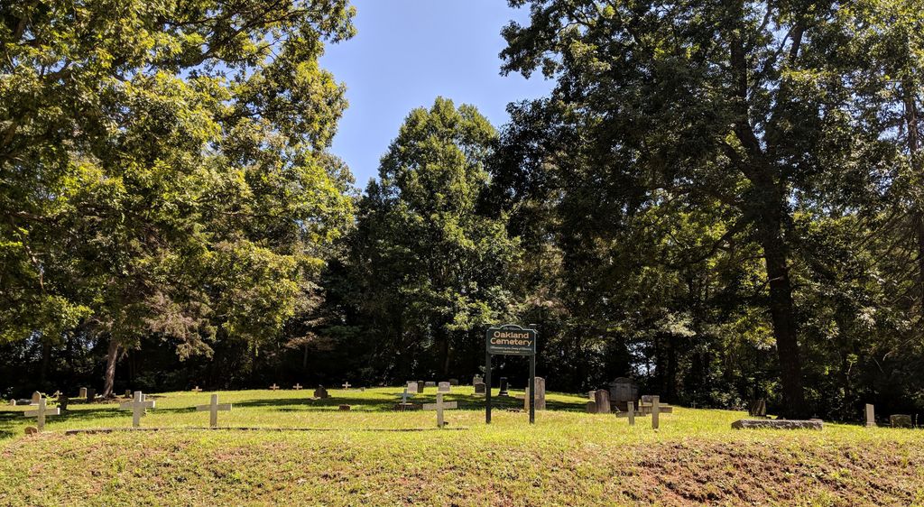
| Description | : | Cemetery is just off Highland Park Road about 1/4 mile from N. Highland Lake Rd on the left. There is a small pull off for parking. Update from the Flat Rock Village Historical Society: The cemetery in East Flat Rock, Oakland, was established c1873 by African-American servants etc., brought to Flat Rock by the Charlestonians - those who preferred the Baptist faith rather than worship at the Episcopal Church of St. John in the Wilderness. With emancipation, they purchased land on Mine Gap Road in East Flat Rock and built Mud Creek Baptist Church (the same name as the much larger... Read More |
frequently asked questions (FAQ):
-
Where is Oakland Cemetery?
Oakland Cemetery is located at East Flat Rock, Henderson County ,North Carolina ,USA.
-
Oakland Cemetery cemetery's updated grave count on graveviews.com?
0 memorials
-
Where are the coordinates of the Oakland Cemetery?
Latitude: 35.2835999
Longitude: -82.4302979
Nearby Cemetories:
1. Pinecrest Presbyterian Church Memorial Garden
Flat Rock, Henderson County, USA
Coordinate: 35.2822100, -82.4426360
2. Saint John In the Wilderness Cemetery
Flat Rock, Henderson County, USA
Coordinate: 35.2821170, -82.4435670
3. Mud Creek Baptist Church Cemetery
Flat Rock, Henderson County, USA
Coordinate: 35.2905998, -82.4536972
4. Oak Grove Baptist Church Cemetery
East Flat Rock, Henderson County, USA
Coordinate: 35.2729000, -82.4031580
5. Anders Cemetery
East Flat Rock, Henderson County, USA
Coordinate: 35.2654700, -82.4064300
6. Hill Mausoleum
Flat Rock, Henderson County, USA
Coordinate: 35.2630638, -82.4577080
7. Gilbert-Justus Family Cemetery
Upward, Henderson County, USA
Coordinate: 35.2861000, -82.3894380
8. Bethel Wesleyan Church Cemetery
Henderson County, USA
Coordinate: 35.3157234, -82.4103165
9. Tracy Grove Baptist Church
Henderson County, USA
Coordinate: 35.3142014, -82.4045029
10. Forest Lawn Memorial Park
Henderson County, USA
Coordinate: 35.3225403, -82.4362411
11. Jones Family Cemetery at Upward
Upward, Henderson County, USA
Coordinate: 35.3022003, -82.3855972
12. Hammett Family Cemetery
Upward, Henderson County, USA
Coordinate: 35.3090400, -82.3868630
13. Saint James Episcopal Church Cemetery
Hendersonville, Henderson County, USA
Coordinate: 35.3198874, -82.4610627
14. Fortune-Kuykendall Cemetery
Zirconia, Henderson County, USA
Coordinate: 35.2424000, -82.4032000
15. Mountain View Baptist Church Cemetery
Tuxedo, Henderson County, USA
Coordinate: 35.2325000, -82.4285000
16. Oakdale Cemetery
Hendersonville, Henderson County, USA
Coordinate: 35.3191986, -82.4753036
17. Tuxedo First Baptist Church Cemetery
Zirconia, Henderson County, USA
Coordinate: 35.2299000, -82.4285000
18. Berea Baptist Church Cemetery
Flat Rock, Henderson County, USA
Coordinate: 35.2564011, -82.4875031
19. First Congregational Church Memorial Garden
Hendersonville, Henderson County, USA
Coordinate: 35.3151530, -82.4841940
20. Grace Lutheran Church Memorial Garden
Hendersonville, Henderson County, USA
Coordinate: 35.3212100, -82.4786900
21. Crossroads Baptist Church Cemetery
Zirconia, Henderson County, USA
Coordinate: 35.2287090, -82.4154320
22. Ward Family Cemetery
Henderson County, USA
Coordinate: 35.2308780, -82.4049850
23. Pleasant Hill Cemetery
Valley Hill, Henderson County, USA
Coordinate: 35.2750015, -82.4993973
24. Mount Olivet Baptist Church Cemetery
Zirconia, Henderson County, USA
Coordinate: 35.2366900, -82.4749000