
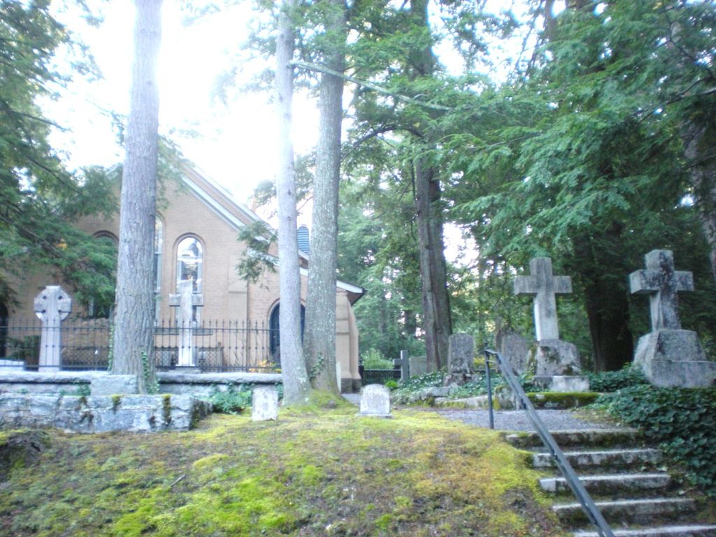
| Memorials | : | 11 |
| Location | : | Flat Rock, Henderson County, USA |
| Phone | : | 828-9783 |
| Coordinate | : | 35.2821170, -82.4435670 |
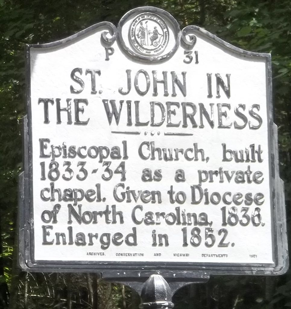
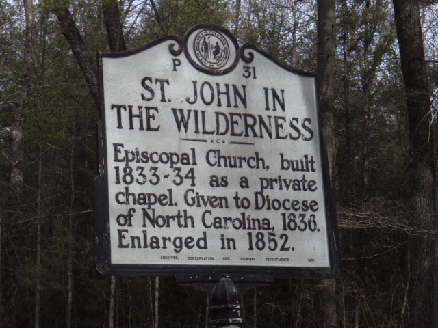
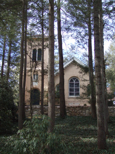
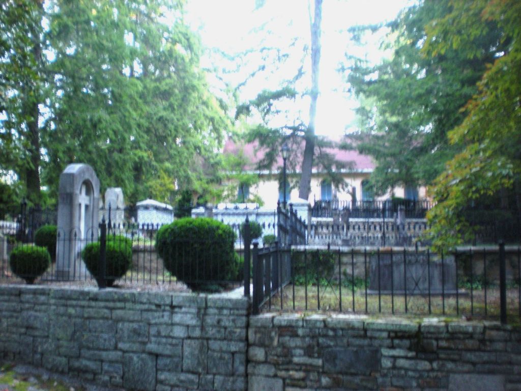
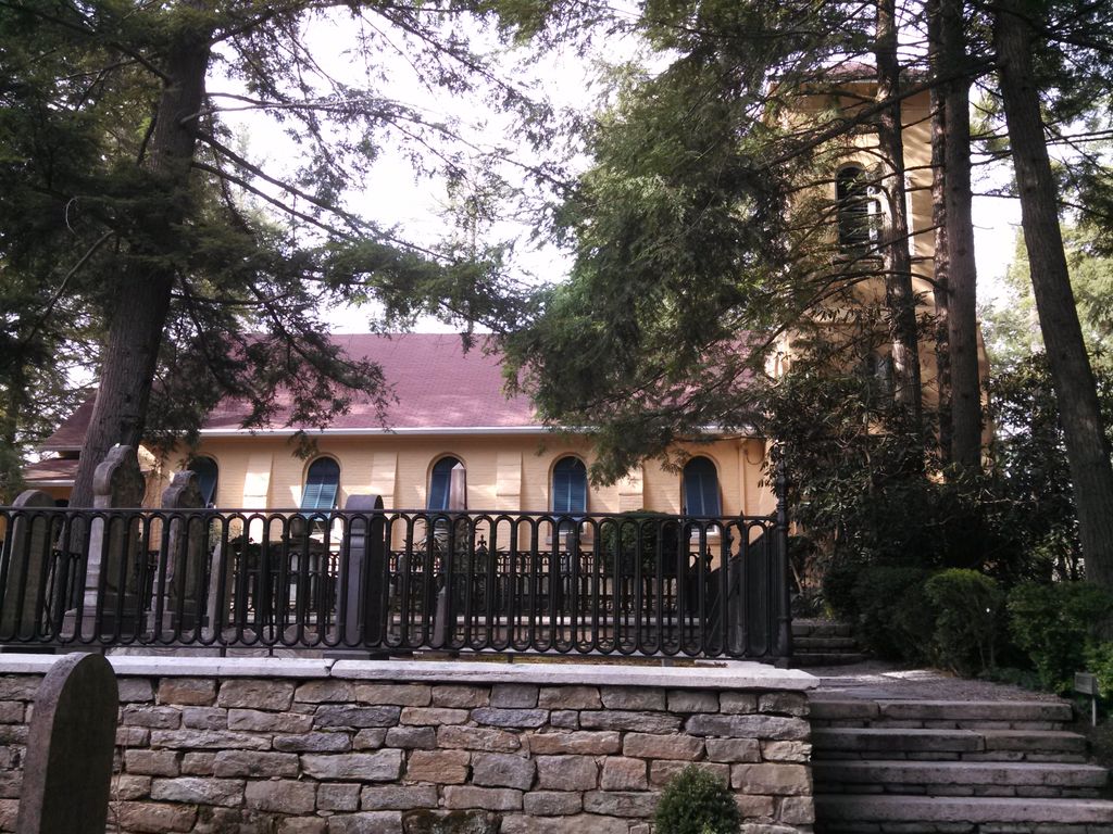
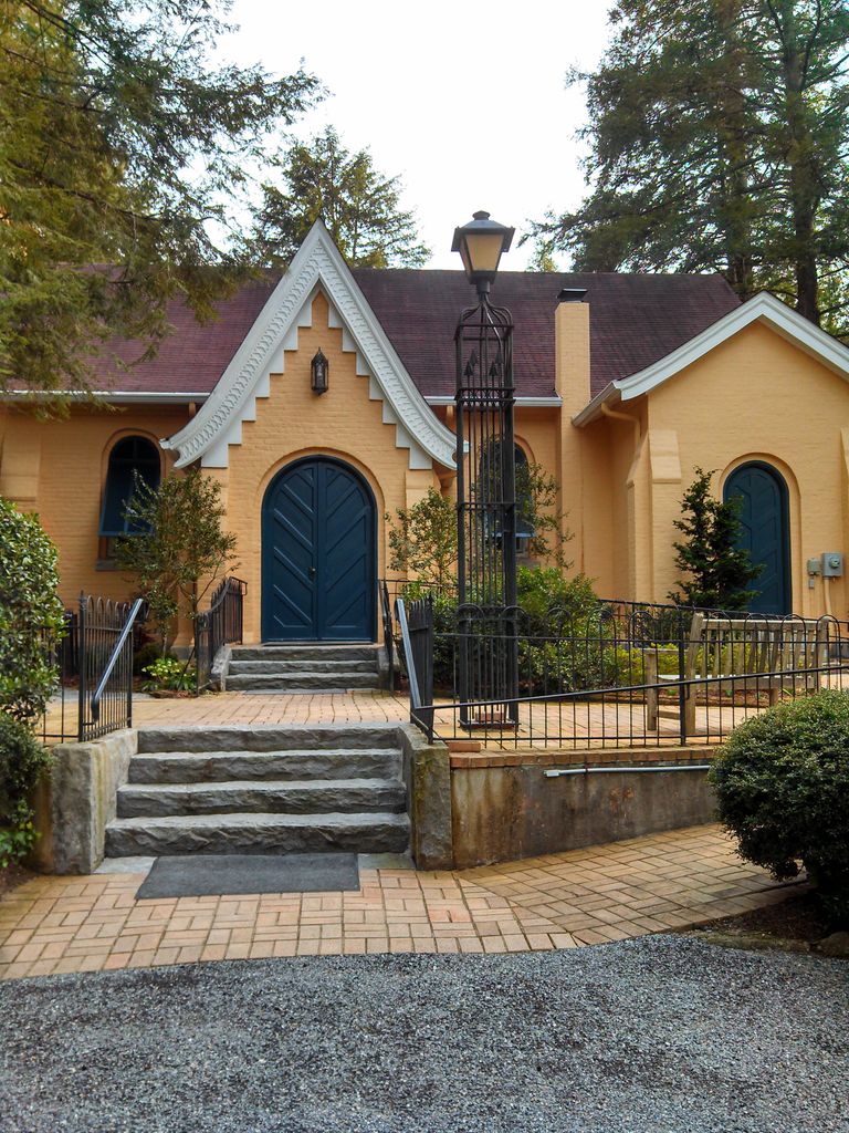
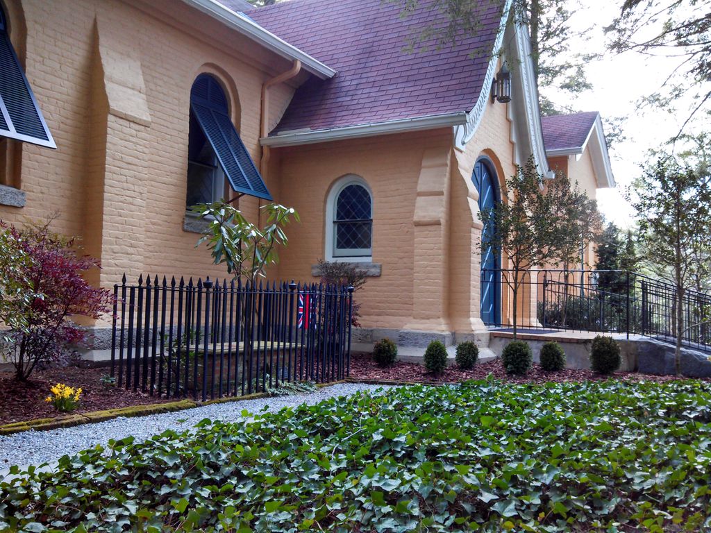
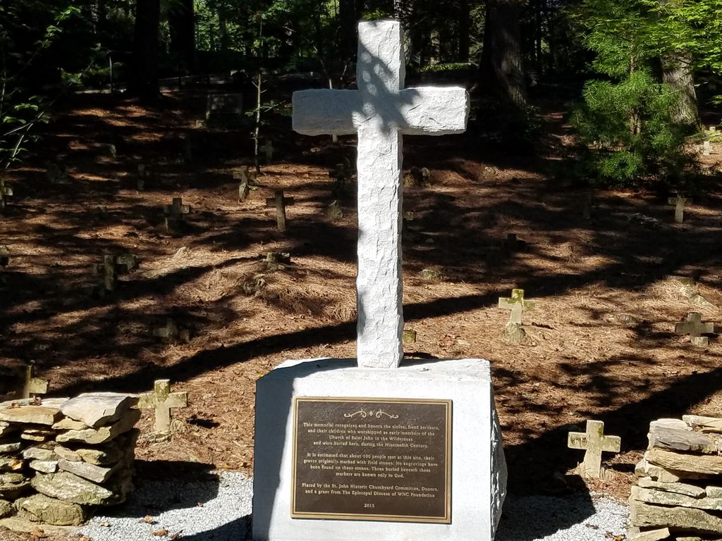
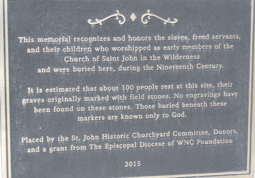
| Description | : | From Interstate 26 exit onto upward road and turn toward Flat Rock. Follow this road till it dead ends. Turn Left. Cemetery will be on the Right. This is the oldest Episcopal Church in Western North Carolina and was begun by Charleston Plantation owners who escaped the malaria on the coast to summer in the mountains. |
frequently asked questions (FAQ):
-
Where is Saint John In the Wilderness Cemetery?
Saint John In the Wilderness Cemetery is located at 1905 Greenville Hwy. Flat Rock, Henderson County ,North Carolina , 28726USA.
-
Saint John In the Wilderness Cemetery cemetery's updated grave count on graveviews.com?
10 memorials
-
Where are the coordinates of the Saint John In the Wilderness Cemetery?
Latitude: 35.2821170
Longitude: -82.4435670

Nearby Cemetories:
1. Pinecrest Presbyterian Church Memorial Garden
Flat Rock, Henderson County, USA
Coordinate: 35.2822100, -82.4426360
2. Oakland Cemetery
East Flat Rock, Henderson County, USA
Coordinate: 35.2835999, -82.4302979
3. Mud Creek Baptist Church Cemetery
Flat Rock, Henderson County, USA
Coordinate: 35.2905998, -82.4536972
4. Hill Mausoleum
Flat Rock, Henderson County, USA
Coordinate: 35.2630638, -82.4577080
5. Oak Grove Baptist Church Cemetery
East Flat Rock, Henderson County, USA
Coordinate: 35.2729000, -82.4031580
6. Anders Cemetery
East Flat Rock, Henderson County, USA
Coordinate: 35.2654700, -82.4064300
7. Saint James Episcopal Church Cemetery
Hendersonville, Henderson County, USA
Coordinate: 35.3198874, -82.4610627
8. Forest Lawn Memorial Park
Henderson County, USA
Coordinate: 35.3225403, -82.4362411
9. Bethel Wesleyan Church Cemetery
Henderson County, USA
Coordinate: 35.3157234, -82.4103165
10. Berea Baptist Church Cemetery
Flat Rock, Henderson County, USA
Coordinate: 35.2564011, -82.4875031
11. Gilbert-Justus Family Cemetery
Upward, Henderson County, USA
Coordinate: 35.2861000, -82.3894380
12. Tracy Grove Baptist Church
Henderson County, USA
Coordinate: 35.3142014, -82.4045029
13. Oakdale Cemetery
Hendersonville, Henderson County, USA
Coordinate: 35.3191986, -82.4753036
14. Pleasant Hill Cemetery
Valley Hill, Henderson County, USA
Coordinate: 35.2750015, -82.4993973
15. First Congregational Church Memorial Garden
Hendersonville, Henderson County, USA
Coordinate: 35.3151530, -82.4841940
16. Grace Lutheran Church Memorial Garden
Hendersonville, Henderson County, USA
Coordinate: 35.3212100, -82.4786900
17. Mountain View Baptist Church Cemetery
Tuxedo, Henderson County, USA
Coordinate: 35.2325000, -82.4285000
18. Jones Family Cemetery at Upward
Upward, Henderson County, USA
Coordinate: 35.3022003, -82.3855972
19. Fortune-Kuykendall Cemetery
Zirconia, Henderson County, USA
Coordinate: 35.2424000, -82.4032000
20. Mount Olivet Baptist Church Cemetery
Zirconia, Henderson County, USA
Coordinate: 35.2366900, -82.4749000
21. Hammett Family Cemetery
Upward, Henderson County, USA
Coordinate: 35.3090400, -82.3868630
22. Tuxedo First Baptist Church Cemetery
Zirconia, Henderson County, USA
Coordinate: 35.2299000, -82.4285000
23. Cantrell Family Cemetery
Henderson County, USA
Coordinate: 35.2869119, -82.5096819
24. Crossroads Baptist Church Cemetery
Zirconia, Henderson County, USA
Coordinate: 35.2287090, -82.4154320