| Memorials | : | 0 |
| Location | : | Spring Creek, Madison County, USA |
| Coordinate | : | 35.7412000, -88.6406000 |
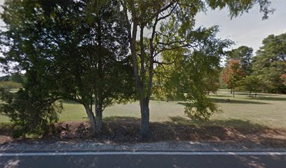
| Description | : | Located 1.8 miles north from Interstate 40, via Law Road and Tennessee Highway 152. Situated .1 mile west of Tennessee Highway 152 on the Parnell Landers place. Whites, Asa H. Gaston (1819-1881) and D. H. Grant and families buried here. Beyond the old fenced-in burial area of these families, to the east and slightly to the northeast appear evidences of several graves. |
frequently asked questions (FAQ):
-
Where is Grant-Gaston Cemeteryʌ?
Grant-Gaston Cemeteryʌ is located at Spring Creek Law Road Spring Creek, Madison County ,Tennessee , 38305USA.
-
Grant-Gaston Cemeteryʌ cemetery's updated grave count on graveviews.com?
0 memorials
-
Where are the coordinates of the Grant-Gaston Cemeteryʌ?
Latitude: 35.7412000
Longitude: -88.6406000
Nearby Cemetories:
1. Williams Family Cemetery
Jackson, Madison County, USA
Coordinate: 35.7306000, -88.6325000
2. Fly Cemetery
Spring Creek, Madison County, USA
Coordinate: 35.7523870, -88.6484160
3. Wards Grove Baptist Church Cemetery
Spring Creek, Madison County, USA
Coordinate: 35.7450900, -88.6235510
4. Askew Haughton Cemetery
Madison County, USA
Coordinate: 35.7541670, -88.6655290
5. New Carmel Cemetery
Madison County, USA
Coordinate: 35.7578290, -88.6644070
6. Oakley Cemetery
Jackson, Madison County, USA
Coordinate: 35.7467730, -88.6094490
7. Oak Grove Cemetery
Madison County, USA
Coordinate: 35.7581000, -88.6139000
8. Pearson Family Graveyard
Claybrook, Madison County, USA
Coordinate: 35.7083100, -88.6441600
9. Claybrook-Berry Zion Cemetery
Beech Bluff, Madison County, USA
Coordinate: 35.7072720, -88.6249050
10. Donnell Cemetery
Spring Creek, Madison County, USA
Coordinate: 35.7750000, -88.6570000
11. Key Cemetery
Spring Creek, Madison County, USA
Coordinate: 35.7036680, -88.6538450
12. Cool Springs Cemetery
Independence, Henderson County, USA
Coordinate: 35.7494490, -88.5923100
13. Colonel Taylor's Cemetery
Jackson, Madison County, USA
Coordinate: 35.7732000, -88.6777800
14. Independence Cemetery
Poplar Springs, Henderson County, USA
Coordinate: 35.7280998, -88.5860977
15. Gaskins Cemetery
Claybrook, Madison County, USA
Coordinate: 35.7176590, -88.6917720
16. Lebanon Methodist Church Cemetery
Jackson, Madison County, USA
Coordinate: 35.7883540, -88.6222740
17. Spring Creek Church Cemetery
Spring Creek, Madison County, USA
Coordinate: 35.7696870, -88.6906290
18. Hilliard Cemetery
Spring Creek, Madison County, USA
Coordinate: 35.7708200, -88.6906400
19. May Family Cemetery
Spring Creek, Madison County, USA
Coordinate: 35.7216000, -88.6985000
20. Jonas Clark Family Cemetery
Jackson, Madison County, USA
Coordinate: 35.6946270, -88.6758830
21. Manley Cemetery
Blue Goose, Henderson County, USA
Coordinate: 35.7069600, -88.5837520
22. Gaston Cemetery
Spring Creek, Madison County, USA
Coordinate: 35.7738150, -88.6991500
23. Hilliard Cemetery
Madison County, USA
Coordinate: 35.7555000, -88.7111000
24. Fellowship Cemetery
Madison County, USA
Coordinate: 35.7477640, -88.7147910

