
| Memorials | : | 0 |
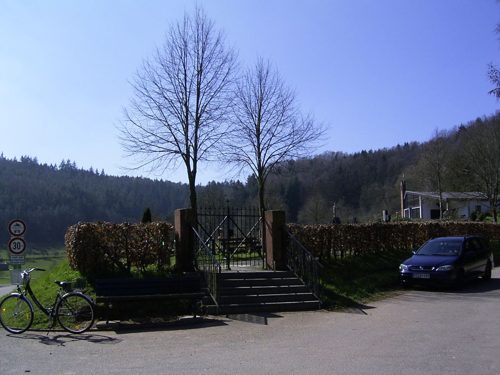
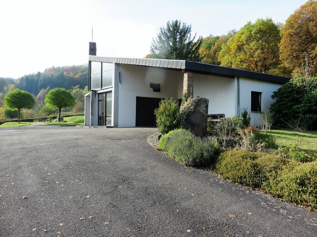
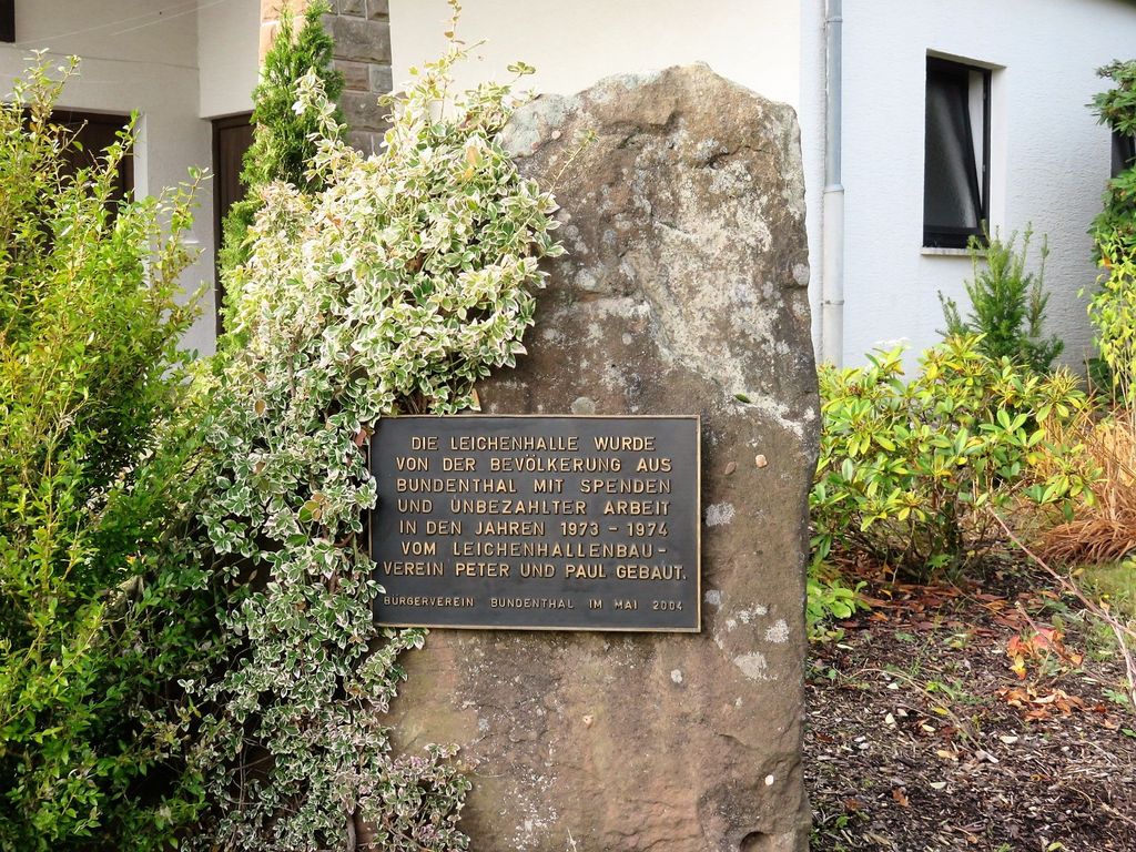
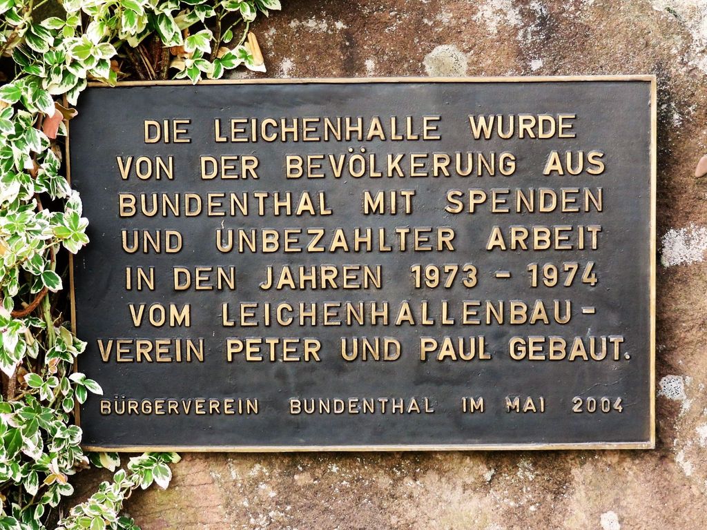
| Location | : | Bundenthal, Landkreis Südwestpfalz, Germany |
| Coordinate | : | 49.0918000, 7.8114500 |
| Description | : | Bundenthal ist eine Ortsgemeinde im Landkreis Südwestpfalz in Rheinland-Pfalz. Sie gehört der Verbandsgemeinde Dahner Felsenland an, die ihren Verwaltungssitz in der Stadt Dahn hat. Im Jahre 2015 hatte Bundenthal 1.121 Einwohner. Bundenthal liegt nordwestlich von Karlsruhe, etwa eine Stunde mit dem Auto. Die größte Stadt in der Nähe von Bundenthal ist Bad Bergzabern. Die meisten Grabsteine wurden im Jahr 2004 von Andreas Drieß fotografiert. Fotos ab 2016 stammen von Reiner Peter. --------------------------------------------- Bundenthal is a municipality in the Südwestpfalz administrative district in the German state of Rhineland-Palatinate. In 2015 its population was 1,121. Bundenthal is located northwest of Karlsruhe, approx. 1 hour by... Read More |
frequently asked questions (FAQ):
-
Where is Friedhof Bundenthal?
Friedhof Bundenthal is located at Friedhofstraße Bundenthal, Landkreis Südwestpfalz ,Rheinland-Pfalz , 76891Germany.
-
Friedhof Bundenthal cemetery's updated grave count on graveviews.com?
0 memorials
-
Where are the coordinates of the Friedhof Bundenthal?
Latitude: 49.0918000
Longitude: 7.8114500
Nearby Cemetories:
1. Neuer Friedhof Bruchweiler-Bärenbach
Bruchweiler-Bärenbach, Landkreis Südwestpfalz, Germany
Coordinate: 49.1099200, 7.8122200
2. Friedhof Rumbach
Rumbach, Landkreis Südwestpfalz, Germany
Coordinate: 49.0961000, 7.7835600
3. Friedhof Nothweiler
Nothweiler, Landkreis Südwestpfalz, Germany
Coordinate: 49.0702600, 7.8026500
4. Alter Friedhof Bruchweiler-Bärenbach
Bruchweiler-Bärenbach, Landkreis Südwestpfalz, Germany
Coordinate: 49.1152000, 7.8025100
5. Friedhof Niederschlettenbach
Niederschlettenbach, Landkreis Südwestpfalz, Germany
Coordinate: 49.0838800, 7.8504800
6. Jüdischer Friedhof Busenberg
Busenberg, Landkreis Südwestpfalz, Germany
Coordinate: 49.1262340, 7.8389840
7. Friedhof Bobenthal
Bobenthal, Landkreis Südwestpfalz, Germany
Coordinate: 49.0643900, 7.8576300
8. Friedhof Busenberg
Busenberg, Landkreis Südwestpfalz, Germany
Coordinate: 49.1311060, 7.8288170
9. Friedhof Erlenbach bei Dahn
Erlenbach bei Dahn, Landkreis Südwestpfalz, Germany
Coordinate: 49.1146900, 7.8646200
10. Gemeindefriedhof Schönau
Schönau, Landkreis Südwestpfalz, Germany
Coordinate: 49.0602500, 7.7496600
11. Friedhof Sankt Nikolaus
Schönau, Landkreis Südwestpfalz, Germany
Coordinate: 49.0595310, 7.7501690
12. Friedhof Schindhard
Schindhard, Landkreis Südwestpfalz, Germany
Coordinate: 49.1469200, 7.8198700
13. Ehrenfriedhof Dahn
Dahn, Landkreis Südwestpfalz, Germany
Coordinate: 49.1458330, 7.7869440
14. Friedhof Vorderweidenthal
Vorderweidenthal, Landkreis Südliche Weinstraße, Germany
Coordinate: 49.1284760, 7.8830630
15. Friedhof Fischbach bei Dahn
Fischbach bei Dahn, Landkreis Südwestpfalz, Germany
Coordinate: 49.0824400, 7.7142100
16. Friedhof Dahn
Dahn, Landkreis Südwestpfalz, Germany
Coordinate: 49.1531000, 7.7799200
17. Friedhof Lauterschwan
Lauterschwan, Landkreis Südwestpfalz, Germany
Coordinate: 49.1142400, 7.9052800
18. Friedhof Erfweiler
Erfweiler, Landkreis Südwestpfalz, Germany
Coordinate: 49.1575300, 7.8085500
19. Friedhof Oberschlettenbach
Oberschlettenbach, Landkreis Südliche Weinstraße, Germany
Coordinate: 49.1455900, 7.8753200
20. Friedhof Birkenhördt
Birkenhördt, Landkreis Südliche Weinstraße, Germany
Coordinate: 49.1150600, 7.9242400
21. Église Saint Philippe et Saint Jacques
Climbach, Departement du Bas-Rhin, France
Coordinate: 49.0164030, 7.8511920
22. Friedhof Darstein
Darstein, Landkreis Südwestpfalz, Germany
Coordinate: 49.1596200, 7.8823000
23. Friedhof Böllenborn
Böllenborn, Landkreis Südliche Weinstraße, Germany
Coordinate: 49.0995300, 7.9368800
24. Friedhof Schwanheim
Schwanheim, Landkreis Südwestpfalz, Germany
Coordinate: 49.1655200, 7.8786300