| Memorials | : | 0 |
| Location | : | Lauterschwan, Landkreis Südwestpfalz, Germany |
| Coordinate | : | 49.1142400, 7.9052800 |
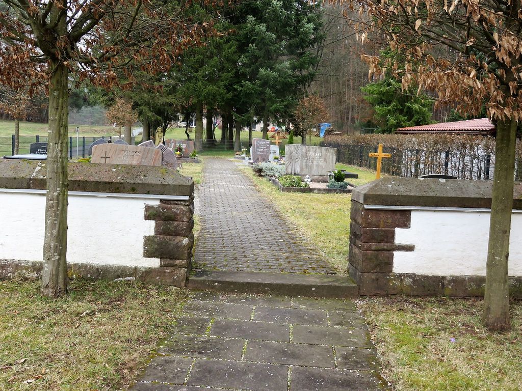
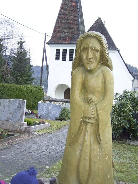
| Description | : | Lauterschwan war einst ein kleines, eigenständiges Dorf (heute Teil des Dorfes Erlenbach bei Dahn) im Bundesland Rheinland-Pfalz und nordwestlich von Karlsruhe, max. 1 Stunde mit dem Auto. Die größte Stadt, die Lauterschwan am nächsten liegt, ist Bad Bergzabern. Der Friedhof ist gut erhalten und in sehr gutem Zustand. Das älteste Grab des Friedhofs stammt aus dem Jahr 1929. Die Informationen enthalten alle visuellen Bestattungen aus Grabsteininschriften. Die meisten Grabsteine wurden im Jahr 2004 von Andreas Drieß fotografiert. Grabsteine ab 2005 wurden im Jahr 2017 von Reiner Peter fotografiert. ------------------------------------------- Lauterschwan was once a small village (today it is part of the village of... Read More |
frequently asked questions (FAQ):
-
Where is Friedhof Lauterschwan?
Friedhof Lauterschwan is located at Kirchstraße Lauterschwan, Landkreis Südwestpfalz ,Rheinland-Pfalz , 76891Germany.
-
Friedhof Lauterschwan cemetery's updated grave count on graveviews.com?
0 memorials
-
Where are the coordinates of the Friedhof Lauterschwan?
Latitude: 49.1142400
Longitude: 7.9052800
Nearby Cemetories:
1. Friedhof Birkenhördt
Birkenhördt, Landkreis Südliche Weinstraße, Germany
Coordinate: 49.1150600, 7.9242400
2. Friedhof Vorderweidenthal
Vorderweidenthal, Landkreis Südliche Weinstraße, Germany
Coordinate: 49.1284760, 7.8830630
3. Friedhof Böllenborn
Böllenborn, Landkreis Südliche Weinstraße, Germany
Coordinate: 49.0995300, 7.9368800
4. Friedhof Erlenbach bei Dahn
Erlenbach bei Dahn, Landkreis Südwestpfalz, Germany
Coordinate: 49.1146900, 7.8646200
5. Friedhof Blankenborn
Blankenborn, Landkreis Südliche Weinstraße, Germany
Coordinate: 49.1293300, 7.9564800
6. Friedhof Oberschlettenbach
Oberschlettenbach, Landkreis Südliche Weinstraße, Germany
Coordinate: 49.1455900, 7.8753200
7. Friedhof Silz
Silz, Landkreis Südliche Weinstraße, Germany
Coordinate: 49.1460700, 7.9431900
8. Friedhof Dörrenbach
Dörrenbach, Landkreis Südliche Weinstraße, Germany
Coordinate: 49.0904200, 7.9611490
9. Jüdischer Friedhof Busenberg
Busenberg, Landkreis Südwestpfalz, Germany
Coordinate: 49.1262340, 7.8389840
10. Friedhof Stein
Gossersweiler-Stein, Landkreis Südliche Weinstraße, Germany
Coordinate: 49.1564600, 7.9338400
11. Friedhof Gossersweiler
Gossersweiler-Stein, Landkreis Südliche Weinstraße, Germany
Coordinate: 49.1589200, 7.9275400
12. Friedhof Niederschlettenbach
Niederschlettenbach, Landkreis Südwestpfalz, Germany
Coordinate: 49.0838800, 7.8504800
13. Friedhof Darstein
Darstein, Landkreis Südwestpfalz, Germany
Coordinate: 49.1596200, 7.8823000
14. Friedhof Münchweiler am Klingbach
Münchweiler am Klingbach, Landkreis Südliche Weinstraße, Germany
Coordinate: 49.1488400, 7.9645800
15. Friedhof Busenberg
Busenberg, Landkreis Südwestpfalz, Germany
Coordinate: 49.1311060, 7.8288170
16. Friedhof Dimbach
Dimbach, Landkreis Südwestpfalz, Germany
Coordinate: 49.1676900, 7.8951850
17. Friedhof Schwanheim
Schwanheim, Landkreis Südwestpfalz, Germany
Coordinate: 49.1655200, 7.8786300
18. Friedhof Völkersweiler
Völkersweiler, Landkreis Südliche Weinstraße, Germany
Coordinate: 49.1677600, 7.9336300
19. Friedhof Bobenthal
Bobenthal, Landkreis Südwestpfalz, Germany
Coordinate: 49.0643900, 7.8576300
20. Neuer Friedhof Bruchweiler-Bärenbach
Bruchweiler-Bärenbach, Landkreis Südwestpfalz, Germany
Coordinate: 49.1099200, 7.8122200
21. Friedhof Oberotterbach
Oberotterbach, Landkreis Südliche Weinstraße, Germany
Coordinate: 49.0731920, 7.9752540
22. Friedhof Schindhard
Schindhard, Landkreis Südwestpfalz, Germany
Coordinate: 49.1469200, 7.8198700
23. Friedhof Bad Bergzabern
Bad Bergzabern, Landkreis Südliche Weinstraße, Germany
Coordinate: 49.1012300, 8.0022100
24. Friedhof Bundenthal
Bundenthal, Landkreis Südwestpfalz, Germany
Coordinate: 49.0918000, 7.8114500


