
| Memorials | : | 0 |
| Location | : | Carperby, Richmondshire District, England |
| Coordinate | : | 54.3031720, -1.9925670 |
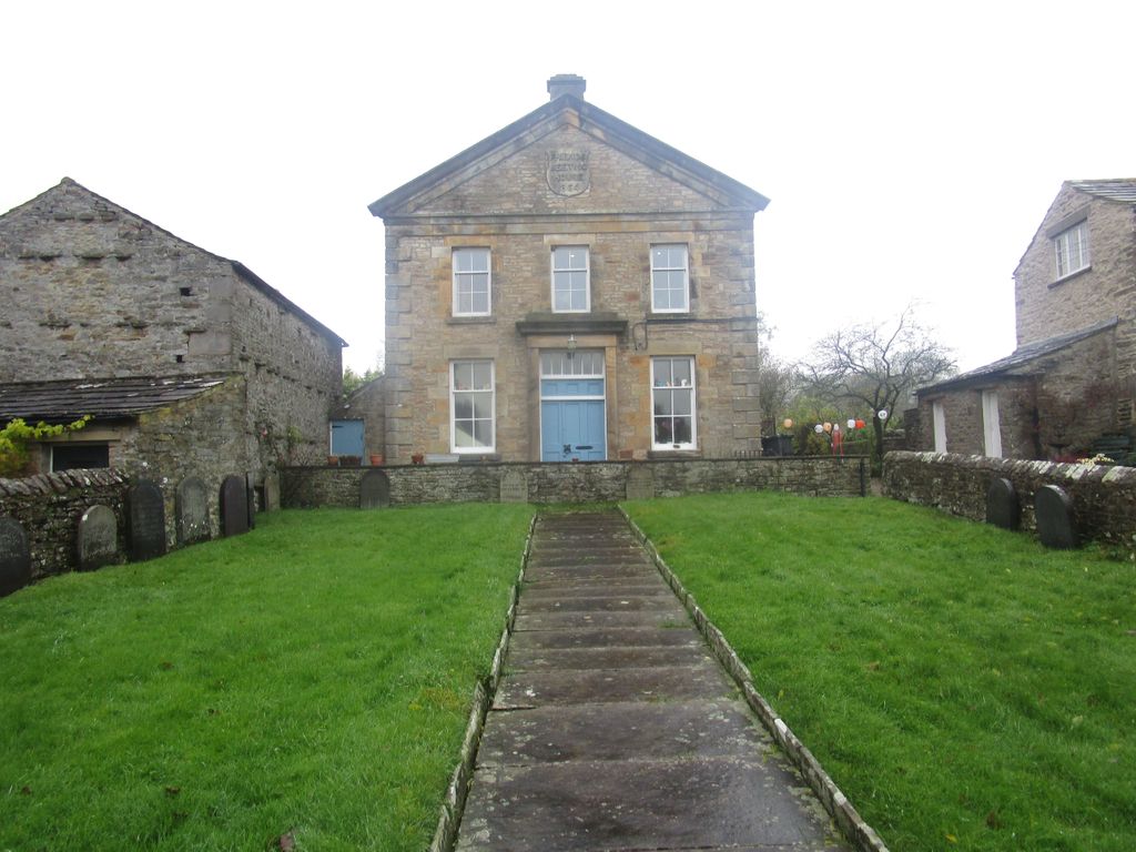
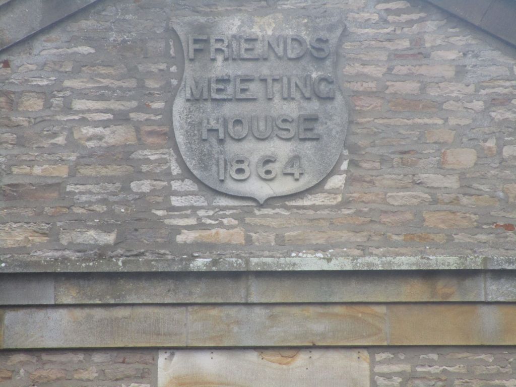
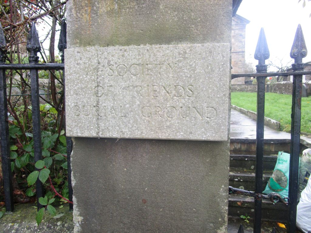
| Description | : | The gravestones can be found in the front of the former Quaker Meeting house which is now a private residence. |
frequently asked questions (FAQ):
-
Where is Friends Meeting House Burial Ground?
Friends Meeting House Burial Ground is located at Carperby, Richmondshire District ,North Yorkshire ,England.
-
Friends Meeting House Burial Ground cemetery's updated grave count on graveviews.com?
0 memorials
-
Where are the coordinates of the Friends Meeting House Burial Ground?
Latitude: 54.3031720
Longitude: -1.9925670
Nearby Cemetories:
1. St. Andrew Churchyard
Aysgarth, Richmondshire District, England
Coordinate: 54.2922340, -1.9833760
2. St Mary Churchyard
Redmire, Richmondshire District, England
Coordinate: 54.3126200, -1.9227400
3. St Bartholomew Churchyard
West Witton, Richmondshire District, England
Coordinate: 54.2920100, -1.9073200
4. St. Oswald Churchyard
Askrigg, Richmondshire District, England
Coordinate: 54.3147100, -2.0817500
5. Preston Under Scar Cemetery
Preston-under-Scar, Richmondshire District, England
Coordinate: 54.3133800, -1.8964000
6. Askrigg Cemetery
Askrigg, Richmondshire District, England
Coordinate: 54.3141230, -2.0915060
7. Bainbridge Cemetery
Bainbridge, Richmondshire District, England
Coordinate: 54.3054000, -2.0994100
8. Friends Burial Ground
Bainbridge, Richmondshire District, England
Coordinate: 54.3093330, -2.1023380
9. Low Row United Reformed Chapelyard
Low Row, Richmondshire District, England
Coordinate: 54.3755880, -2.0317420
10. Holy Trinity Churchyard
Wensley, Richmondshire District, England
Coordinate: 54.3014000, -1.8600000
11. Low Row Methodist Cemetery
Low Row, Richmondshire District, England
Coordinate: 54.3798050, -2.0259320
12. Wensley Cemetery
Wensley, Richmondshire District, England
Coordinate: 54.3013320, -1.8568169
13. Holy Trinity Churchyard
Low Row, Richmondshire District, England
Coordinate: 54.3812800, -2.0223090
14. St Botolph Churchyard
Horsehouse, Richmondshire District, England
Coordinate: 54.2269100, -1.9292300
15. St. Andrew's Churchyard
Grinton, Richmondshire District, England
Coordinate: 54.3812610, -1.9305740
16. St Matthew Old Churchyard
Stalling Busk, Richmondshire District, England
Coordinate: 54.2695500, -2.1289300
17. Reeth and Grinton Cemetery
Grinton, Richmondshire District, England
Coordinate: 54.3800400, -1.9246700
18. St Matthew Churchyard
Stalling Busk, Richmondshire District, England
Coordinate: 54.2686220, -2.1302030
19. Reeth Congregational Chapelyard
Reeth, Richmondshire District, England
Coordinate: 54.3878600, -1.9422700
20. Gunnerside Wesleyan Methodist Chapelyard
Gunnerside, Richmondshire District, England
Coordinate: 54.3783950, -2.0778320
21. Marrick Priory Churchyard
Marrick, Richmondshire District, England
Coordinate: 54.3758830, -1.8977990
22. Leyburn Cemetery
Leyburn, Richmondshire District, England
Coordinate: 54.3093030, -1.8348630
23. Holy Trinity Churchyard
Coverham, Richmondshire District, England
Coordinate: 54.2727230, -1.8429440
24. Coverham Abbey
Coverham, Richmondshire District, England
Coordinate: 54.2728510, -1.8392460