
| Memorials | : | 15 |
| Location | : | Stalling Busk, Richmondshire District, England |
| Coordinate | : | 54.2695500, -2.1289300 |
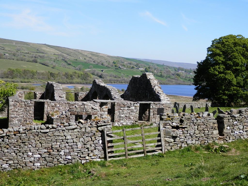
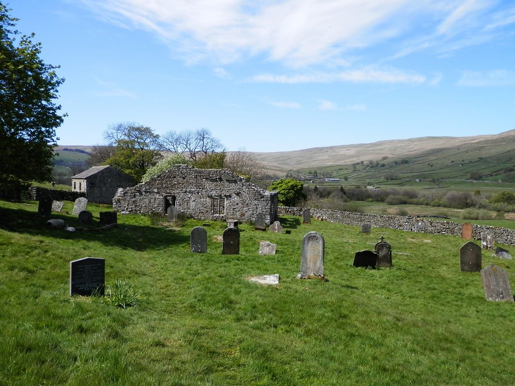
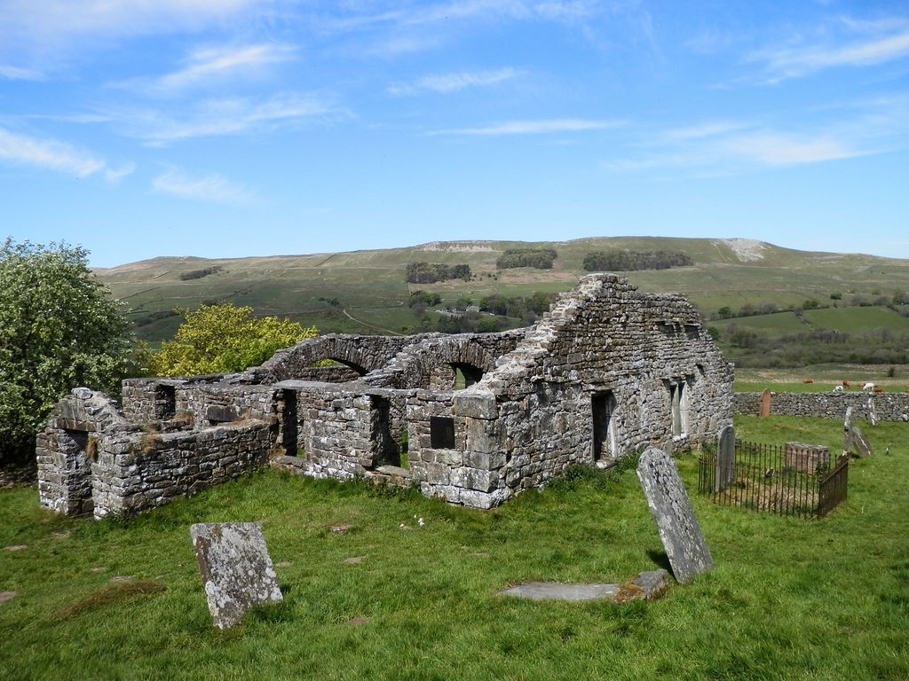
| Description | : | Stalling Busk is one of 3 settlements (the others being Countersett and Marsett) around Semer Water in the Richmondshire district of North Yorkshire in the small dale of Raydale just off from Wensleydale, England. The hamlet lies to the immediate south of the lake. It is about 3½ miles SW of Bainbridge. The original church of St Matthew (about ½ mile from the village and new church of Stalling Busk) is in ruins. It dates from around 1722, although some of the structure incorporates stones from an earlier church from around 1600. The old church was still in use in the... Read More |
frequently asked questions (FAQ):
-
Where is St Matthew Old Churchyard?
St Matthew Old Churchyard is located at Stalling Busk, Richmondshire District ,North Yorkshire ,England.
-
St Matthew Old Churchyard cemetery's updated grave count on graveviews.com?
15 memorials
-
Where are the coordinates of the St Matthew Old Churchyard?
Latitude: 54.2695500
Longitude: -2.1289300
Nearby Cemetories:
1. St Matthew Churchyard
Stalling Busk, Richmondshire District, England
Coordinate: 54.2686220, -2.1302030
2. Bainbridge Cemetery
Bainbridge, Richmondshire District, England
Coordinate: 54.3054000, -2.0994100
3. Friends Burial Ground
Bainbridge, Richmondshire District, England
Coordinate: 54.3093330, -2.1023380
4. Askrigg Cemetery
Askrigg, Richmondshire District, England
Coordinate: 54.3141230, -2.0915060
5. Sandemanian Chapel Burial Ground
Hawes, Richmondshire District, England
Coordinate: 54.2992110, -2.1982010
6. Friends Burial Ground
Hawes, Richmondshire District, England
Coordinate: 54.3039790, -2.1937940
7. St. Margaret's Churchyard
Hawes, Richmondshire District, England
Coordinate: 54.3032300, -2.1969700
8. St. Oswald Churchyard
Askrigg, Richmondshire District, England
Coordinate: 54.3147100, -2.0817500
9. St. Mary and St. John Churchyard
Hardraw, Richmondshire District, England
Coordinate: 54.3169800, -2.2052700
10. St. Michael and All Angels Churchyard
Hubberholme, Craven District, England
Coordinate: 54.2001100, -2.1147330
11. Friends Meeting House Burial Ground
Carperby, Richmondshire District, England
Coordinate: 54.3031720, -1.9925670
12. St. Andrew Churchyard
Aysgarth, Richmondshire District, England
Coordinate: 54.2922340, -1.9833760
13. St. Mary's Churchyard
Muker, Richmondshire District, England
Coordinate: 54.3763690, -2.1392860
14. Gunnerside Wesleyan Methodist Chapelyard
Gunnerside, Richmondshire District, England
Coordinate: 54.3783950, -2.0778320
15. Low Row United Reformed Chapelyard
Low Row, Richmondshire District, England
Coordinate: 54.3755880, -2.0317420
16. St Botolph Churchyard
Horsehouse, Richmondshire District, England
Coordinate: 54.2269100, -1.9292300
17. Low Row Methodist Cemetery
Low Row, Richmondshire District, England
Coordinate: 54.3798050, -2.0259320
18. St Oswald Churchyard
Arncliffe, Craven District, England
Coordinate: 54.1434970, -2.1038940
19. St Mary Churchyard
Redmire, Richmondshire District, England
Coordinate: 54.3126200, -1.9227400
20. Holy Trinity Churchyard
Low Row, Richmondshire District, England
Coordinate: 54.3812800, -2.0223090
21. St Bartholomew Churchyard
West Witton, Richmondshire District, England
Coordinate: 54.2920100, -1.9073200
22. St Mary Churchyard
Kettlewell, Craven District, England
Coordinate: 54.1459650, -2.0454120
23. Keld United Reform Chapelyard
Keld, Richmondshire District, England
Coordinate: 54.4055920, -2.1660210
24. Preston Under Scar Cemetery
Preston-under-Scar, Richmondshire District, England
Coordinate: 54.3133800, -1.8964000