
| Memorials | : | 1 |
| Location | : | Marrick, Richmondshire District, England |
| Coordinate | : | 54.3758830, -1.8977990 |
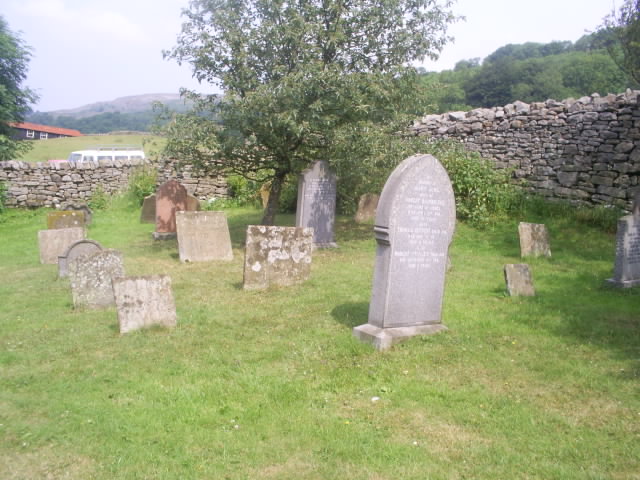
| Description | : | Established as Benedictine nunnery between 1140-1160 by Roger de Aske, Marrick Priory was dissolved in 1549 as part of King Henry VIII reforms. It was served by the parish church of the Virgin Mary and St. Andrew. After dissolution of the priory, the church continued to be used as a place of worship until 1948. It was then used as a farm building, and in 1970 restored and converted into an outdoor education and residential centre. Marrick parish records, including a burial register dating 1687-1951 are held at the North Yorkshire County Record Office in Northallerton. |
frequently asked questions (FAQ):
-
Where is Marrick Priory Churchyard?
Marrick Priory Churchyard is located at Marrick, Richmondshire District ,North Yorkshire , DL11 7LDEngland.
-
Marrick Priory Churchyard cemetery's updated grave count on graveviews.com?
1 memorials
-
Where are the coordinates of the Marrick Priory Churchyard?
Latitude: 54.3758830
Longitude: -1.8977990
Nearby Cemetories:
1. Reeth and Grinton Cemetery
Grinton, Richmondshire District, England
Coordinate: 54.3800400, -1.9246700
2. St. Andrew's Churchyard
Grinton, Richmondshire District, England
Coordinate: 54.3812610, -1.9305740
3. Reeth Congregational Chapelyard
Reeth, Richmondshire District, England
Coordinate: 54.3878600, -1.9422700
4. St Michael and All Angels Churchyard
Downholme, Richmondshire District, England
Coordinate: 54.3799700, -1.8313400
5. St Edmund the Martyr Churchyard
Marske, Richmondshire District, England
Coordinate: 54.3997500, -1.8403700
6. Preston Under Scar Cemetery
Preston-under-Scar, Richmondshire District, England
Coordinate: 54.3133800, -1.8964000
7. St John the Evangelist Churchyard
Bellerby, Richmondshire District, England
Coordinate: 54.3303200, -1.8239000
8. St Mary Churchyard
Redmire, Richmondshire District, England
Coordinate: 54.3126200, -1.9227400
9. St Michael and All Angels Churchyard
Hudswell, Richmondshire District, England
Coordinate: 54.3990300, -1.7846500
10. Langthwaite Wesleyan Methodist Chapelyard
Langthwaite, Richmondshire District, England
Coordinate: 54.4181000, -1.9958500
11. St. Mary the Virgin Churchyard
Langthwaite, Richmondshire District, England
Coordinate: 54.4195260, -1.9967580
12. Holy Trinity Churchyard
Low Row, Richmondshire District, England
Coordinate: 54.3812800, -2.0223090
13. Low Row Methodist Cemetery
Low Row, Richmondshire District, England
Coordinate: 54.3798050, -2.0259320
14. Leyburn Cemetery
Leyburn, Richmondshire District, England
Coordinate: 54.3093030, -1.8348630
15. Church of Saint Mary the Virgin Graveyard
Arkengarthdale, Richmondshire District, England
Coordinate: 54.4225063, -2.0013365
16. Holy Trinity Churchyard
Wensley, Richmondshire District, England
Coordinate: 54.3014000, -1.8600000
17. Low Row United Reformed Chapelyard
Low Row, Richmondshire District, England
Coordinate: 54.3755880, -2.0317420
18. Wensley Cemetery
Wensley, Richmondshire District, England
Coordinate: 54.3013320, -1.8568169
19. St Bartholomew Churchyard
West Witton, Richmondshire District, England
Coordinate: 54.2920100, -1.9073200
20. Richmond Cemetery
Richmond, Richmondshire District, England
Coordinate: 54.4053750, -1.7572010
21. Friends Meeting House Burial Ground
Carperby, Richmondshire District, England
Coordinate: 54.3031720, -1.9925670
22. Spennithorne & Harmby Cemetery
Harmby, Richmondshire District, England
Coordinate: 54.3002500, -1.7989900
23. St. Andrew Churchyard
Aysgarth, Richmondshire District, England
Coordinate: 54.2922340, -1.9833760
24. St Mary the Virgin Churchyard
Richmond, Richmondshire District, England
Coordinate: 54.4046600, -1.7333700