
| Memorials | : | 4 |
| Location | : | Preston, City of Preston, England |
| Coordinate | : | 53.7610250, -2.7030380 |
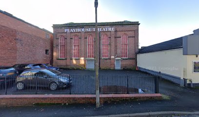
| Description | : | Quakers have a long history in Preston; James Jameson registered his dwelling in Preston as a meeting house in 1689. A building near Spring Gardens in Preston was acquired in 1730 for use as a meeting house. Towards the end of the eighteenth century new premises were sought once more, and a field on the north-west side of Preston off Friargate was bought for the purpose in 1779. A meeting house was erected there and opened in 1782. It was rebuilt on the same site in 1847 and a separate school building was later added. In 1925 the site was... Read More |
frequently asked questions (FAQ):
-
Where is Friends Meeting House Burial Ground (Defunct)?
Friends Meeting House Burial Ground (Defunct) is located at Market Street West Preston, City of Preston ,Lancashire , PR1 2HBEngland.
-
Friends Meeting House Burial Ground (Defunct) cemetery's updated grave count on graveviews.com?
0 memorials
-
Where are the coordinates of the Friends Meeting House Burial Ground (Defunct)?
Latitude: 53.7610250
Longitude: -2.7030380
Nearby Cemetories:
1. Holy Trinity
Preston, City of Preston, England
Coordinate: 53.7613030, -2.7030580
2. St. George the Martyr
Preston, City of Preston, England
Coordinate: 53.7591220, -2.7025660
3. St. Wilfrid's Catholic Cemetery
Preston, City of Preston, England
Coordinate: 53.7581670, -2.7044930
4. Grey Friars' Church
Preston, City of Preston, England
Coordinate: 53.7601480, -2.7084600
5. Saint Peter Churchyard
Preston, City of Preston, England
Coordinate: 53.7634100, -2.7080700
6. St. Ignatius RC Churchyard
Preston, City of Preston, England
Coordinate: 53.7635270, -2.6965870
7. St John Churchyard
Preston, City of Preston, England
Coordinate: 53.7582080, -2.6959750
8. St. Paul Churchyard
Preston, City of Preston, England
Coordinate: 53.7625360, -2.6947080
9. Christ Church Churchyard
Preston, City of Preston, England
Coordinate: 53.7573210, -2.7103080
10. St. James' Churchyard
Preston, City of Preston, England
Coordinate: 53.7566010, -2.6941110
11. St Walburge's RC Church
Preston, City of Preston, England
Coordinate: 53.7629690, -2.7149620
12. St Augustine of Canterbury
Preston, City of Preston, England
Coordinate: 53.7560420, -2.6912650
13. St Mary Churchyard
Penwortham, South Ribble Borough, England
Coordinate: 53.7551800, -2.7234210
14. Christ Church Churchyard
Fulwood, City of Preston, England
Coordinate: 53.7771920, -2.7028700
15. Penwortham Cemetery
Penwortham, South Ribble Borough, England
Coordinate: 53.7452590, -2.7209190
16. St. Andrew's Churchyard
Ashton-on-Ribble, City of Preston, England
Coordinate: 53.7687030, -2.7359180
17. Preston Old Cemetery
Ribbleton, City of Preston, England
Coordinate: 53.7686352, -2.6623154
18. St Leonard Churchyard
Walton-le-Dale, South Ribble Borough, England
Coordinate: 53.7476530, -2.6666950
19. Preston New Cemetery
Ribbleton, City of Preston, England
Coordinate: 53.7717400, -2.6620900
20. Our Lady and Saint Gerards Churchyard
Lostock Hall, South Ribble Borough, England
Coordinate: 53.7279090, -2.6921460
21. St Mary's Churchyard Brownedge
Bamber Bridge, South Ribble Borough, England
Coordinate: 53.7305472, -2.6669416
22. St Paul Churchyard
Farington, South Ribble Borough, England
Coordinate: 53.7199900, -2.7017200
23. All Saints Churchyard
Walton-le-Dale, South Ribble Borough, England
Coordinate: 53.7407250, -2.6408280
24. Our Lady and St Patrick's Church
Walton-le-Dale, South Ribble Borough, England
Coordinate: 53.7407250, -2.6408280