
| Memorials | : | 134 |
| Location | : | Ribbleton, City of Preston, England |
| Website | : | www.parksandgardens.org/places/preston-cemetery |
| Coordinate | : | 53.7686352, -2.6623154 |
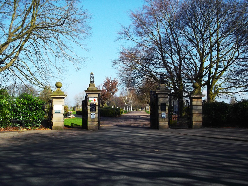
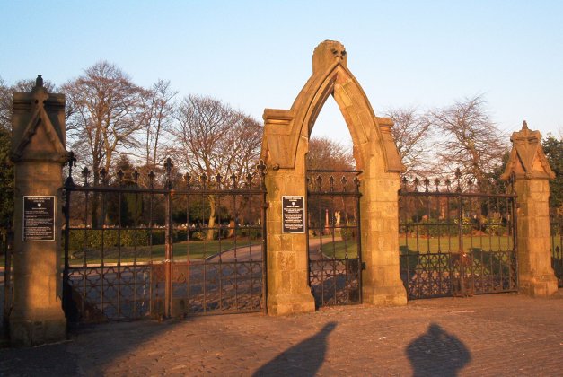
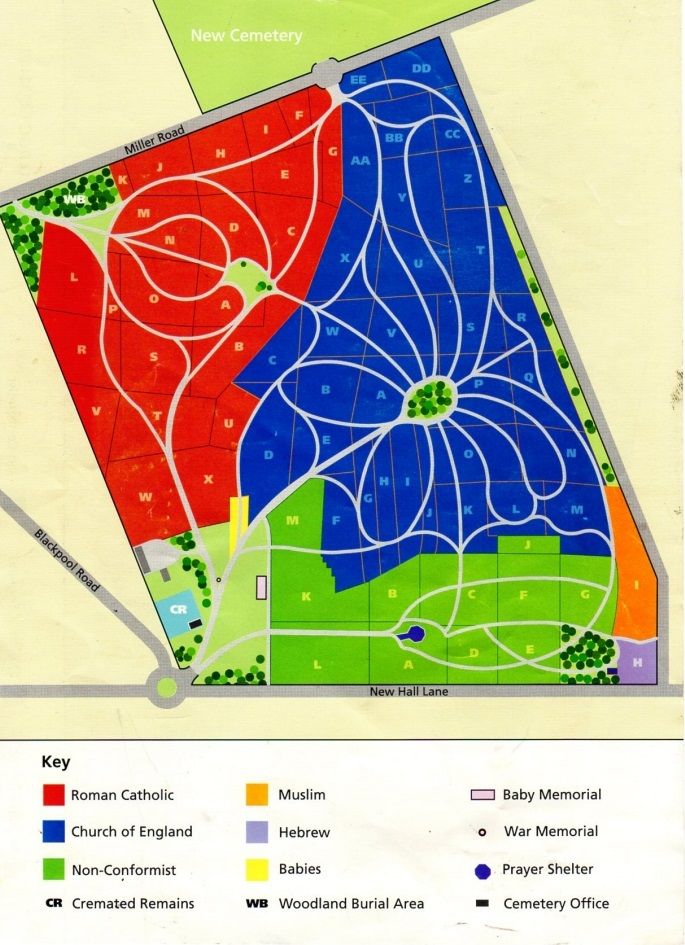
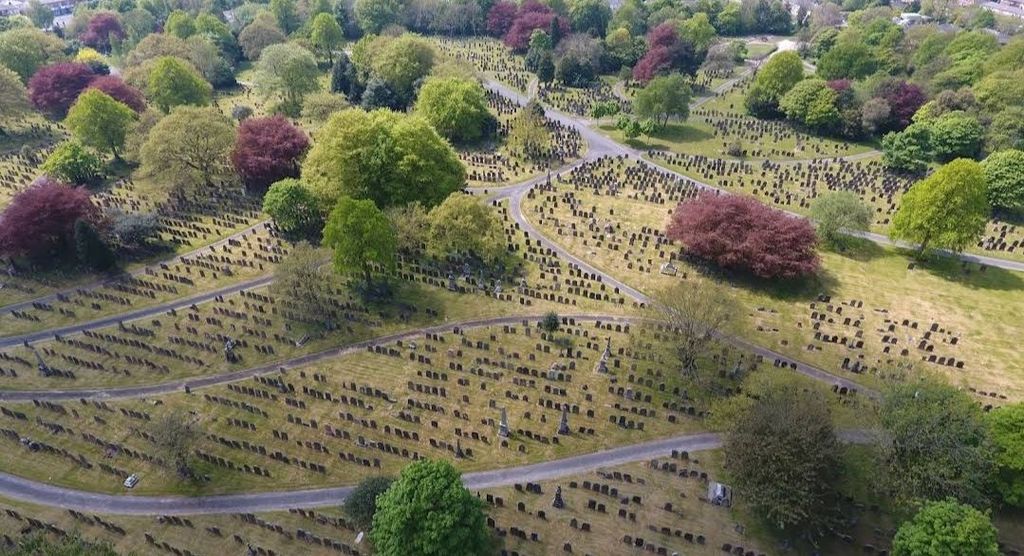
| Description | : | Preston Cemetery is in two parts. The earlier part was opened in 1855 by Preston Burial Board, the later part in the mid-1920s. The original site covered some 18 hectares, for which the original design and some planting remains. The chapels and lodges, however, have been demolished. Remaining features include entrances and a war memorial. |
frequently asked questions (FAQ):
-
Where is Preston Old Cemetery?
Preston Old Cemetery is located at New Hall Lane Ribbleton, City of Preston ,Lancashire ,England.
-
Preston Old Cemetery cemetery's updated grave count on graveviews.com?
119 memorials
-
Where are the coordinates of the Preston Old Cemetery?
Latitude: 53.7686352
Longitude: -2.6623154
Nearby Cemetories:
1. Preston New Cemetery
Ribbleton, City of Preston, England
Coordinate: 53.7717400, -2.6620900
2. St. Paul Churchyard
Preston, City of Preston, England
Coordinate: 53.7625360, -2.6947080
3. St. Ignatius RC Churchyard
Preston, City of Preston, England
Coordinate: 53.7635270, -2.6965870
4. St Leonard Churchyard
Walton-le-Dale, South Ribble Borough, England
Coordinate: 53.7476530, -2.6666950
5. St Augustine of Canterbury
Preston, City of Preston, England
Coordinate: 53.7560420, -2.6912650
6. St. James' Churchyard
Preston, City of Preston, England
Coordinate: 53.7566010, -2.6941110
7. St John Churchyard
Preston, City of Preston, England
Coordinate: 53.7582080, -2.6959750
8. St. Leonard the Less Churchyard
Samlesbury, South Ribble Borough, England
Coordinate: 53.7680000, -2.6237000
9. Preston Crematorium
Preston, City of Preston, England
Coordinate: 53.7863750, -2.6340170
10. Holy Trinity
Preston, City of Preston, England
Coordinate: 53.7613030, -2.7030580
11. Friends Meeting House Burial Ground (Defunct)
Preston, City of Preston, England
Coordinate: 53.7610250, -2.7030380
12. Christ Church Churchyard
Fulwood, City of Preston, England
Coordinate: 53.7771920, -2.7028700
13. St. George the Martyr
Preston, City of Preston, England
Coordinate: 53.7591220, -2.7025660
14. St. Mary's and St. John RC Churchyard, Southworth
Samlesbury, South Ribble Borough, England
Coordinate: 53.7676690, -2.6183400
15. St. Wilfrid's Catholic Cemetery
Preston, City of Preston, England
Coordinate: 53.7581670, -2.7044930
16. Saint Peter Churchyard
Preston, City of Preston, England
Coordinate: 53.7634100, -2.7080700
17. Grey Friars' Church
Preston, City of Preston, England
Coordinate: 53.7601480, -2.7084600
18. Christ Church Churchyard
Preston, City of Preston, England
Coordinate: 53.7573210, -2.7103080
19. All Saints Churchyard
Walton-le-Dale, South Ribble Borough, England
Coordinate: 53.7407250, -2.6408280
20. Our Lady and St Patrick's Church
Walton-le-Dale, South Ribble Borough, England
Coordinate: 53.7407250, -2.6408280
21. St Walburge's RC Church
Preston, City of Preston, England
Coordinate: 53.7629690, -2.7149620
22. St. Mary's Churchyard
Preston, City of Preston, England
Coordinate: 53.8010830, -2.6779600
23. St. Michael's Churchyard
Grimsargh, City of Preston, England
Coordinate: 53.7990710, -2.6352530
24. St Mary's Churchyard Brownedge
Bamber Bridge, South Ribble Borough, England
Coordinate: 53.7305472, -2.6669416